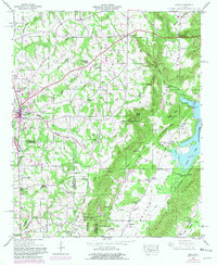
1948 Map of Arab
USGS Topo · Published 1981About this map
The Tennessee Valley Divide snakes through the center of this terrain, marking a distinct watershed boundary between the rugged uplands and the fertile drainage basins of the south. High on this ridge, Arab serves as a central hub, surrounded by a network of rural settlements like New Canaan and Scant City. The landscape is deeply carved by numerous waterways, including Shoal Creek and Mink Creek, which flow toward the expansive Guntersville Lake in the northeast corner.
Find a feature on this map
64 named features on this map. Tap any name to fly to it.
Don’t see what you’re looking for? This feature index may not catch every label — zoom into the map to look around manually.
Map Details
Editions of this 1948 Arab Map
3 editions found
Other maps of this area

1885 · Gadsden
USGS Topo · 1:125,000

1888 · Cullman
USGS Topo · 1:125,000

1888 · Gadsden
USGS Topo · 1:125,000

1892 · Cullman
USGS Topo · 1:125,000

1892 · Gadsden
USGS Topo · 1:125,000

1895 · Gadsden
USGS Topo · 1:125,000

1903 · Gadsden
USGS Topo · 1:125,000

1936 · Guntersville
USGS Topo · 1:24,000

1936 · Guntersville Dam
USGS Topo · 1:24,000

1936 · Hulaco
USGS Topo · 1:24,000