1900s (20th Century) Maps of Rosa, Alabama
Explore 19 historic maps of Rosa from the 1900s (20th Century). These maps offer a rare glimpse into what life looked like during the 1900s — showing old roads, neighborhoods, homes, and landmarks that have changed or disappeared over time.
Whether you're researching your family's past, planning a metal detecting trip, or studying how Rosa's landscape evolved across the 1900s, these high-resolution maps are a powerful tool for exploring the history of this region.
- Focus on a specific era: All maps on this page are from the 1900s, giving you a focused view of this time period.
- See what’s changed: Compare century-old streets, trails, and buildings to today's modern landscape using overlays and satellite layers.
- Research with precision: Use these maps for genealogy, historical research, land use analysis, or educational projects.
- View, download, or print: Maps are fully viewable online in high resolution, and can be downloaded or printed for your own records.
Start exploring Rosa's history through authentic maps from the 1900s. This is your window into the past.
Rosa, AL maps
(19)- 1903 Map of Gadsden
 1903 Gadsden1903 Print · USGSNorthern Alabama in the late nineteenth century centers on the busy Tennessee River corridor and its surrounding ridges. Trace old family sites and transport hubs like Hillian Store, Lovelace Landing, and the Mt Zion church.4 unique versions available
 - 1907 Map of Birmingham
 1907 Birmingham1907 Print · USGSJefferson and Blount counties are shown in the early twentieth century as the industrial heart of Alabama was taking shape. Genealogists can trace family roots through named landmarks like Box Schoolhouse, Watson PO, and the coal works at Watts Mines.5 unique versions available
 - 1953 Map of Birmingham, 1964 Print
 1953 Birmingham1964 Print · USGSCentral Alabama at mid-century shows a landscape defined by industrial expansion and the iron-rich ridges surrounding Birmingham. Researchers can trace the extensive rail networks of the L & N RR or locate historic federal sites like the Anniston Ordnance Depot.4 unique versions available
 - 1956 Map of Birmingham
 1956 Birmingham1956 Print · USGSCentral Alabama in the mid-fifties exhibits a landscape of growing cities and deep-rooted industrial corridors. Genealogists and historians can trace the development of suburban Mountain Brook or locate regional hubs like Sylacauga and Jasper.
 - 1956 Map of Gadsden, 1966 Print
 1956 Gadsden1966 Print · USGSNorth Alabama in the mid-1950s shows a region transformed by river engineering and federal industry. Genealogists and local historians can trace the development of the Tennessee Valley through the growth of Huntsville, the sprawling Redstone Arsenal, and the expansive Guntersville Lake.3 unique versions available
 - 1957 Map of Birmingham
 1957 Birmingham1957 Print · USGSNorth-Central Alabama in the mid-fifties is an industrial powerhouse centered on the steel valleys and sprawling iron ridges. Genealogists and historians can trace the rail-linked growth of Birmingham and Tuscaloosa, or locate rural landmarks like Talladega College and the Anniston Ordnance Depot.
 - 1958 Map of Gadsden
 1958 Gadsden1958 Print · USGSNorth Alabama comes alive in the late 1950s as the Tennessee Valley Authority’s massive river projects and the rise of the space industry reshaped the landscape. Researchers can trace the mid-century footprints of Huntsville, Redstone Arsenal, and the riverside rail networks of the Southern railroad.
 - 1958 Map of Susan Moore, 1960 Print
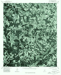
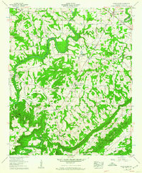 1958 Susan Moore1960 Print · USGSBlount County in the late fifties shows a rural Alabama landscape defined by the winding Locust Fork. Researchers can trace old family sites near Snead Crossroads, locate the Royal Sch, or find ancestral plots at Mt Moriah Cem and Brown Cem.3 unique versions available
 - 1958 Map of Oneonta, 1960 Print
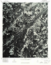
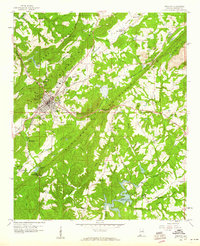 1958 Oneonta1960 Print · USGSOneonta and the surrounding Murphree Valley are captured in the late fifties as the regional rail and road networks shaped Blount County. Genealogists and local historians can trace rural landmarks from Chepultepec to Highland Lake, including Liberty Cem and Mountain Chapel.3 unique versions available
 - 1958 Map of Cleveland, 1961 Print
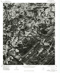
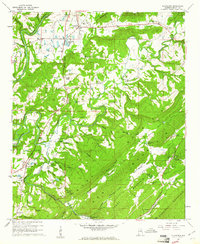 1958 Cleveland1961 Print · USGSThe Blount County landscape in the late fifties is defined by the winding Locust Fork and the ridges of Sand Mountain. Genealogists can trace family roots at Chitwood Cem, Daileys Chapel, and the old Hendrick Mill.3 unique versions available
 - 1960 Map of Gadsden
 1960 Gadsden1960 Print · USGSNorthern Alabama in the mid-1950s is defined by the mighty Tennessee River and its massive reservoirs. Trace the development of Huntsville and Redstone Arsenal or explore the vast William B Bankhead National Forest.2 unique versions available
 - 1963 Map of Gadsden
 1963 Gadsden1963 Print · USGSNorthern Alabama underwent a dramatic mid-century transformation as the Tennessee Valley became a hub for defense and industry. Researchers can trace the development of the Redstone Arsenal, the route of the Natchez Trace Parkway, and long-standing rail lines like the Southern Railway.
 - 1969 Map of Blountsville, 1972 Print
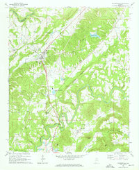 1969 Blountsville1972 Print · USGSBlount County in the late sixties is documented here as a landscape of winding river bends and highland ridges. Researchers can locate several rural landmarks including Antioch Ch, Blackwood Bend on the Locust Fork, and the historic Huntsville Meridian passing through Blountsville.4 unique versions available
 - 1975 Map of Susan Moore, 1977 Print
 1975 Susan Moore1977 Print · USGSBlount County land patterns are captured in detail in the mid-1970s, showing the transition between family farms and woodland. Researchers can pinpoint specific homesteads and road networks around Susan Moore, Snead Crossroads, and Hendrix.2 unique versions available
 - 1975 Map of Oneonta, 1977 Print
 1975 Oneonta1977 Print · USGSOneonta and the surrounding Blount County landscape are captured in this mid-seventies aerial survey. Genealogists and local historians can study the town layout and land-use patterns centered on the community of Oneonta.
 - 1975 Map of Cleveland, 1977 Print
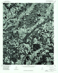
 1975 Cleveland1977 Print · USGSMid-1970s Blount County comes into sharp focus in this aerial orthophotomap, showing the rural landscape around Cleveland as it appeared before modern development. Trace the winding Locust Fork and the settlement patterns near Allgood.
 - 1975 Map of Blountsville, 1977 Print
 1975 Blountsville1977 Print · USGSBlountsville and its surrounding Alabama hill country are seen in clear aerial detail during the mid-seventies. Local historians can trace land use patterns and rural homesteads near Blountsville and the smaller community of Royal.2 unique versions available
 - 1984 Map of Guntersville, 1985 Print
 1984 Guntersville1985 Print · USGSNorthern Alabama at the start of the eighties shows a landscape shaped by massive TVA impoundments and a robust rail network. Genealogists and historians can trace family land across Brindley Mountain or near old rail stops on the Louisville and Nashville RR and Southern Ry.2 unique versions available
 - 1984 Map of Birmingham North, 1985 Print
 1984 Birmingham North1985 Print · USGSNorth Alabama in the mid-eighties shows the bustling intersection of the Appalachian foothills and the Deep South's industrial heart. Genealogists and historians can trace the paths of the Southern Railway and Seaboard System Railroad through towns like Oneonta, Leeds, and Springville.2 unique versions available
End of results
Showing maps 1-19 of 19
Top cities near Rosa
- Oneonta historical maps
- Odenville historical maps
- Springville historical maps
- Hanceville historical maps
- Ashville historical maps
- Blountsville historical maps
See more
Frequently asked questions
- What are the different types of historical maps available for Rosa?
- What is the oldest map of Rosa?
- Where can I purchase historical maps of Rosa for my home or office?
- Where can I download high-res historical maps of Rosa?
- Are there historical topographic maps available for Rosa?
- Is there historical aerial imagery available for Rosa?
- Where are historical maps of Rosa sourced from?