Old Maps of Rosa, Alabama for Academic Research
Study the evolution of Rosa with 54 high-resolution historic maps. Whether you're teaching, researching, or modeling changes in land use, these maps provide essential visual documentation of urban, environmental, and geographic change.
- Analyze long-term change: Track patterns in development, transportation, and natural features.
- Ideal for environmental or urban studies: Support academic projects with primary historical map data.
- Use in the classroom or lab: Educators and researchers rely on these maps to bring historical context to life.
These maps are a powerful tool for teaching, research, and visualizing how Rosa has changed over the decades.
Rosa, AL maps
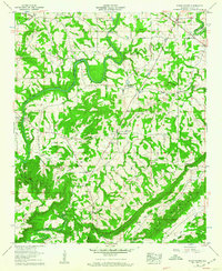
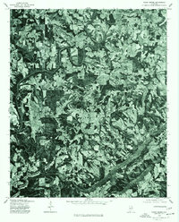
(54)- 1885 Map of Gadsden
 1885 Gadsden1885 Print · USGSNortheast Alabama in the mid-1880s was a landscape of river-side landings and emerging rail towns. Genealogists and historians can trace the early foundations of Guntersville and Gadsden while locating rural landmarks like Hillian Store, Cottonville, and Law Landing.
 - 1888 Map of Cullman
 1888 Cullman1888 Print · USGSCullman and Morgan counties are shown in the late 1880s as the railroad fueled growth across the Sand Mountain region. Genealogists can trace early homesteads and commerce at Sobotka's Mill, Fort Bluff, and the riverside town of Blountsville.
 - 1888 Map of Gadsden
 1888 Gadsden1888 Print · USGSNorth Alabama's river valleys and plateau lands are captured here in the late nineteenth century as the region transitioned from river landings to rail transport. Researchers can locate early post offices and commerce centers like Hillian's Store, Guntersville, and the ferry at Ft Deposit.
 - 1889 Map of Springville
 1889 Springville1889 Print · USGSSt. Clair County and its neighbors are mapped here during the late Victorian era as railroads began to transform the old plantation and river economy. Genealogists can locate family landmarks like Henry's Mill, trace the path of Jackson's Trace, or find the location of old river crossings at Colman's Ferry.
 - 1889 Map of Birmingham
 1889 Birmingham1889 Print · USGSIn the late nineteenth century, the Iron City was a growing urban core surrounded by intensive extraction sites and river crossings. Trace early industrial footprints at the Pratt Mines, Sloss Quarry, and the Old Irondale Furnace.
 - 1892 Map of Cullman
 1892 Cullman1892 Print · USGSNorth-central Alabama's development is centered on the railroad corridor and rugged plateau country in the late nineteenth century. Genealogists can trace family footprints at Sobotka's Mill, along the historic Stout's Road, or near the remote Newsome Sinks.4 unique versions available
 - 1892 Map of Birmingham
 1892 Birmingham1892 Print · USGSBirmingham and the surrounding iron district emerge in the late nineteenth century as a hub of heavy industry and rail expansion. Trace the early footprints of the Sloss Mine, locate river crossings like Doss Ferry, and find family-named landmarks like Hanby Mill.
 - 1892 Map of Springville
 1892 Springville1892 Print · USGSNortheast Alabama at the end of the nineteenth century is a landscape of river crossings and expanding rail lines. Genealogists can trace family footprints at St. Clair Springs, Greensport, and numerous river crossings like Colman's Ferry or Goodwin's Mill.7 unique versions available
 - 1892 Map of Gadsden
 1892 Gadsden1892 Print · USGSNorth Alabama's river-and-rail economy is captured here in the late nineteenth century as Guntersville and Gadsden emerge as regional hubs. Genealogists and historians can trace the routes of the Birmingham Mineral R. R. or locate old community centers like Cottonville and Mt Zion.
 - 1895 Map of Gadsden
 1895 Gadsden1895 Print · USGSNortheast Alabama at the close of the century was a landscape of river landings and mountain gaps where the Tennessee River met growing rail hubs. Genealogists can trace family holdings near Hillian Store, Cottonville, and the remote heights of Lookout Mountain.
 - 1895 Map of Birmingham
 1895 Birmingham1895 Print · USGSBirmingham at the peak of its industrial boom is captured here as the city’s rail and mining networks spread through the surrounding valleys. Researchers can trace early iron production at Old Irondale Furnace or locate family roots at Doss Ferry and Pratt Mines.2 unique versions available
 - 1903 Map of Gadsden
 1903 Gadsden1903 Print · USGSNorthern Alabama in the late nineteenth century centers on the busy Tennessee River corridor and its surrounding ridges. Trace old family sites and transport hubs like Hillian Store, Lovelace Landing, and the Mt Zion church.4 unique versions available
 - 1907 Map of Birmingham
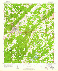
 1907 Birmingham1907 Print · USGSJefferson and Blount counties are shown in the early twentieth century as the industrial heart of Alabama was taking shape. Genealogists can trace family roots through named landmarks like Box Schoolhouse, Watson PO, and the coal works at Watts Mines.5 unique versions available
 - 1953 Map of Birmingham, 1964 Print
 1953 Birmingham1964 Print · USGSCentral Alabama at mid-century shows a landscape defined by industrial expansion and the iron-rich ridges surrounding Birmingham. Researchers can trace the extensive rail networks of the L & N RR or locate historic federal sites like the Anniston Ordnance Depot.4 unique versions available
 - 1956 Map of Birmingham
 1956 Birmingham1956 Print · USGSCentral Alabama in the mid-fifties exhibits a landscape of growing cities and deep-rooted industrial corridors. Genealogists and historians can trace the development of suburban Mountain Brook or locate regional hubs like Sylacauga and Jasper.
 - 1956 Map of Gadsden, 1966 Print
 1956 Gadsden1966 Print · USGSNorth Alabama in the mid-1950s shows a region transformed by river engineering and federal industry. Genealogists and local historians can trace the development of the Tennessee Valley through the growth of Huntsville, the sprawling Redstone Arsenal, and the expansive Guntersville Lake.3 unique versions available
 - 1957 Map of Birmingham
 1957 Birmingham1957 Print · USGSNorth-Central Alabama in the mid-fifties is an industrial powerhouse centered on the steel valleys and sprawling iron ridges. Genealogists and historians can trace the rail-linked growth of Birmingham and Tuscaloosa, or locate rural landmarks like Talladega College and the Anniston Ordnance Depot.
 - 1958 Map of Gadsden
 1958 Gadsden1958 Print · USGSNorth Alabama comes alive in the late 1950s as the Tennessee Valley Authority’s massive river projects and the rise of the space industry reshaped the landscape. Researchers can trace the mid-century footprints of Huntsville, Redstone Arsenal, and the riverside rail networks of the Southern railroad.
 - 1958 Map of Susan Moore, 1960 Print
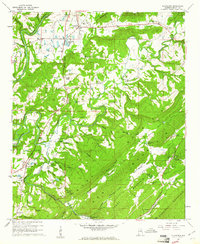
 1958 Susan Moore1960 Print · USGSBlount County in the late fifties shows a rural Alabama landscape defined by the winding Locust Fork. Researchers can trace old family sites near Snead Crossroads, locate the Royal Sch, or find ancestral plots at Mt Moriah Cem and Brown Cem.3 unique versions available
 - 1958 Map of Oneonta, 1960 Print
 1958 Oneonta1960 Print · USGSOneonta and the surrounding Murphree Valley are captured in the late fifties as the regional rail and road networks shaped Blount County. Genealogists and local historians can trace rural landmarks from Chepultepec to Highland Lake, including Liberty Cem and Mountain Chapel.3 unique versions available
 - 1958 Map of Cleveland, 1961 Print
 1958 Cleveland1961 Print · USGSThe Blount County landscape in the late fifties is defined by the winding Locust Fork and the ridges of Sand Mountain. Genealogists can trace family roots at Chitwood Cem, Daileys Chapel, and the old Hendrick Mill.3 unique versions available
 - 1960 Map of Gadsden
 1960 Gadsden1960 Print · USGSNorthern Alabama in the mid-1950s is defined by the mighty Tennessee River and its massive reservoirs. Trace the development of Huntsville and Redstone Arsenal or explore the vast William B Bankhead National Forest.2 unique versions available
 - 1963 Map of Gadsden
 1963 Gadsden1963 Print · USGSNorthern Alabama underwent a dramatic mid-century transformation as the Tennessee Valley became a hub for defense and industry. Researchers can trace the development of the Redstone Arsenal, the route of the Natchez Trace Parkway, and long-standing rail lines like the Southern Railway.
 - 1969 Map of Blountsville, 1972 Print
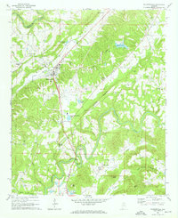 1969 Blountsville1972 Print · USGSBlount County in the late sixties is documented here as a landscape of winding river bends and highland ridges. Researchers can locate several rural landmarks including Antioch Ch, Blackwood Bend on the Locust Fork, and the historic Huntsville Meridian passing through Blountsville.4 unique versions available
 - 1975 Map of Susan Moore, 1977 Print
 1975 Susan Moore1977 Print · USGSBlount County land patterns are captured in detail in the mid-1970s, showing the transition between family farms and woodland. Researchers can pinpoint specific homesteads and road networks around Susan Moore, Snead Crossroads, and Hendrix.2 unique versions available
Showing maps 1-25 of 54
Top cities near Rosa
- Oneonta historical maps
- Odenville historical maps
- Springville historical maps
- Hanceville historical maps
- Ashville historical maps
- Blountsville historical maps
See more
Frequently asked questions
- What are the different types of historical maps available for Rosa?
- What is the oldest map of Rosa?
- Where can I purchase historical maps of Rosa for my home or office?
- Where can I download high-res historical maps of Rosa?
- Are there historical topographic maps available for Rosa?
- Is there historical aerial imagery available for Rosa?
- Where are historical maps of Rosa sourced from?