1980s Maps of Blackman, Alabama
Explore 2 historic maps of Blackman from the 1980s. These maps offer a rare glimpse into what life looked like during the 1980s — showing old roads, neighborhoods, homes, and landmarks that have changed or disappeared over time.
Whether you're researching your family's past, planning a metal detecting trip, or studying how Blackman's landscape evolved across the 1980s, these high-resolution maps are a powerful tool for exploring the history of this region.
- Focus on a specific era: All maps on this page are from the 1980s, giving you a focused view of this time period.
- See what’s changed: Compare century-old streets, trails, and buildings to today's modern landscape using overlays and satellite layers.
- Research with precision: Use these maps for genealogy, historical research, land use analysis, or educational projects.
- View, download, or print: Maps are fully viewable online in high resolution, and can be downloaded or printed for your own records.
Start exploring Blackman's history through authentic maps from the 1980s. This is your window into the past.
Blackman, AL maps
(2)- 1981 Map of Camp Hill SE
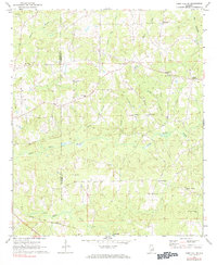 1981 Camp Hill SE1981 Print · USGSChambers County and eastern Tallapoosa County appear here in the early 1970s, showing a landscape of rural crossroads and historic congregations. Trace family roots at Mt Sinai Ch, New Harmony, or along the Central of Georgia rail line.
 - 1981 Map of Opelika, 1982 Print
 1981 Opelika1982 Print · USGSEast Alabama and West Georgia appear in the early 1980s as a region defined by massive river reservoirs and the storied textile corridor. Genealogists can trace family roots through the valley towns of Lanett and Fairfax or locate sites near Horseshoe Bend National Military Park.
End of results
Showing maps 1-2 of 2
Top cities near Blackman
- Auburn historical maps
- Opelika historical maps
- Dadeville historical maps
- LaFayette historical maps
- Camp Hill historical maps
- New Site historical maps
See more
Frequently asked questions
- What are the different types of historical maps available for Blackman?
- What is the oldest map of Blackman?
- Where can I purchase historical maps of Blackman for my home or office?
- Where can I download high-res historical maps of Blackman?
- Are there historical topographic maps available for Blackman?
- Is there historical aerial imagery available for Blackman?
- Where are historical maps of Blackman sourced from?