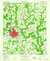
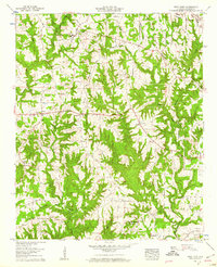
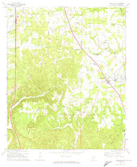
1900s (20th Century) Maps of Good Hope, Alabama
Explore 9 historic maps of Good Hope from the 1900s (20th Century). These maps offer a rare glimpse into what life looked like during the 1900s — showing old roads, neighborhoods, homes, and landmarks that have changed or disappeared over time.
Whether you're researching your family's past, planning a metal detecting trip, or studying how Good Hope's landscape evolved across the 1900s, these high-resolution maps are a powerful tool for exploring the history of this region.
- Focus on a specific era: All maps on this page are from the 1900s, giving you a focused view of this time period.
- See what’s changed: Compare century-old streets, trails, and buildings to today's modern landscape using overlays and satellite layers.
- Research with precision: Use these maps for genealogy, historical research, land use analysis, or educational projects.
- View, download, or print: Maps are fully viewable online in high resolution, and can be downloaded or printed for your own records.
Start exploring Good Hope's history through authentic maps from the 1900s. This is your window into the past.
Good Hope, AL maps
(9)- 1956 Map of Gadsden, 1966 Print
 1956 Gadsden1966 Print · USGSNorth Alabama in the mid-1950s shows a region transformed by river engineering and federal industry. Genealogists and local historians can trace the development of the Tennessee Valley through the growth of Huntsville, the sprawling Redstone Arsenal, and the expansive Guntersville Lake.3 unique versions available
 - 1957 Map of Cullman, 1960 Print
 1957 Cullman1960 Print · USGSCullman and the surrounding plateaus of Brindley Mountain are shown here in the late fifties as the city expanded along its historic rail and highway corridors. Genealogists and local historians can locate St Bernard College, the Ave Maria Grotto, and numerous family-named landmarks like Pfal Cem and Kelly Sch.5 unique versions available
 - 1958 Map of Gadsden
 1958 Gadsden1958 Print · USGSNorth Alabama comes alive in the late 1950s as the Tennessee Valley Authority’s massive river projects and the rise of the space industry reshaped the landscape. Researchers can trace the mid-century footprints of Huntsville, Redstone Arsenal, and the riverside rail networks of the Southern railroad.
 - 1958 Map of West Point, 1960 Print
 1958 West Point1960 Print · USGSWest Point and the surrounding Cullman County uplands are captured here in the late fifties, showing a landscape of small farms and ridge-top roads. Researchers can trace family roots through numerous sites like Bethel Ch, Mt Nebo Cem, and the Grandview Lookout Tower.3 unique versions available
 - 1960 Map of Gadsden
 1960 Gadsden1960 Print · USGSNorthern Alabama in the mid-1950s is defined by the mighty Tennessee River and its massive reservoirs. Trace the development of Huntsville and Redstone Arsenal or explore the vast William B Bankhead National Forest.2 unique versions available
 - 1963 Map of Gadsden
 1963 Gadsden1963 Print · USGSNorthern Alabama underwent a dramatic mid-century transformation as the Tennessee Valley became a hub for defense and industry. Researchers can trace the development of the Redstone Arsenal, the route of the Natchez Trace Parkway, and long-standing rail lines like the Southern Railway.
 - 1969 Map of Hanceville
 1969 Hanceville1969 Print · USGSCullman County during the late 1960s shows a transition from rural crossroads to more established communities along the rail line. Researchers can trace family sites at Good Hope Cem, Johnsons Crossing, and the Stout Mtn Ch.4 unique versions available
 - 1969 Map of Trimble, 1973 Print
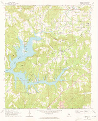 1969 Trimble1973 Print · USGSCullman County's landscape appears in the late sixties as the rising waters of Lewis Smith Lake redefined the local geography. Researchers can trace ancestral roots through sites like Sharon Grove Cem, Shedd Cem, and the community of Trimble.4 unique versions available
 - 1984 Map of Guntersville, 1985 Print
 1984 Guntersville1985 Print · USGSNorthern Alabama at the start of the eighties shows a landscape shaped by massive TVA impoundments and a robust rail network. Genealogists and historians can trace family land across Brindley Mountain or near old rail stops on the Louisville and Nashville RR and Southern Ry.2 unique versions available
End of results
Showing maps 1-9 of 9
Top cities near Good Hope
- Cullman historical maps
- Hanceville historical maps
- Hayden historical maps
- Locust Fork historical maps
- Holly Pond historical maps
- Eva historical maps
See more
Frequently asked questions
- What are the different types of historical maps available for Good Hope?
- What is the oldest map of Good Hope?
- Where can I purchase historical maps of Good Hope for my home or office?
- Where can I download high-res historical maps of Good Hope?
- Are there historical topographic maps available for Good Hope?
- Is there historical aerial imagery available for Good Hope?
- Where are historical maps of Good Hope sourced from?