Old Maps of Belknap, Alabama for Genealogy
Trace your family roots with 12 historic maps of Belknap. These high-res maps reveal old neighborhoods, homesites, landmarks, and streets — helping you uncover where your ancestors lived and how the area evolved over time.
- Explore historic neighborhoods: Identify where your relatives may have lived in the 1800s or 1900s.
- Compare maps over time: Trace the changes in streets, buildings, and landmarks for multi-generational research.
- Perfect for genealogy & ancestry research: Used by family historians and researchers to map out lineage and migration.
These maps are an incredible resource for exploring your personal connection to Belknap's past.
Belknap, AL maps
(12)- 1953 Map of Montgomery, 1964 Print
 1953 Montgomery1964 Print · USGSCentral Alabama's river-and-rail corridor is mapped here in the mid-fifties, showing the vital connections between the capital and the Black Belt. Genealogists and historians can trace rail depots and crossroads from Marion Junction to Wetumpka, alongside landmarks like Craig AFB.4 unique versions available
 - 1956 Map of Montgomery
 1956 Montgomery1956 Print · USGSCentral Alabama in the mid-1950s shows a landscape defined by its great river systems and a booming military aviation presence. Genealogists and historians can trace the rail corridors of the Southern Railway and locate tactical bases like Maxwell AFB and Craig AFB.
 - 1957 Map of Montgomery
 1957 Montgomery1957 Print · USGSCentral Alabama in the mid-fifties is defined by the winding Alabama River and a strategic network of military bases and rail lines. Trace family roots in Montgomery and Selma, or locate landmarks like Craig AFB and the State Capitol before the interstate era.
 - 1957 Map of Carlowville, 1958 Print
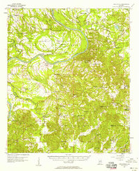 1957 Carlowville1958 Print · USGSThe Alabama River dominates this mid-century landscape of Dallas and Wilcox Counties, where rural life centered on the river's bends and the region's fertile soils. Genealogists can trace family roots through numerous landmarks like Snow Hill Institute, Boykin Cem, and the old settlement at Portland.2 unique versions available
 - 1975 Map of Carlowville NE, 1977 Print
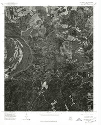 1975 Carlowville NE1977 Print · USGSThe Alabama riverfront in Dallas County appears in sharp photographic detail in the mid-1970s. Trace the dramatic oxbows of the Alabama River and examine the interplay of timber tracts and agricultural clearings along its fertile banks.
 - 1986 Map of Selma
 1986 Selma1986 Print · USGSCentral Alabama's river and rail networks are preserved here in the mid-eighties, showing the transition from river travel to modern infrastructure. Researchers can trace the layout of Selma, the historic capital at Cahaba, and the Millers Ferry Lock and Dam.2 unique versions available
 - 1987 Map of Elm Bluff
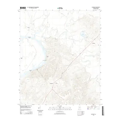
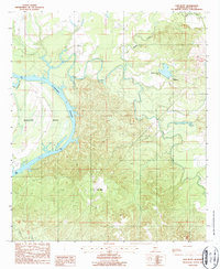 1987 Elm Bluff1987 Print · USGSThe Alabama River dominates this Dallas County landscape in the early 1980s, revealing a region defined by its winding waterways and bottomlands. Local historians and researchers can trace the course of the Alabama River near Belknap and the tributary waters of Mush Creek.
 - 2011 Map of Elm Bluff, 2011 Print
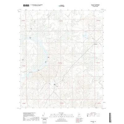
 2011 Elm Bluff2011 Print · USGSCovers Belknap, including Elm Bluff, Dallas County, and other nearby areas
 - 2014 Map of Elm Bluff, 2014 Print
 2014 Elm Bluff2014 Print · USGSCovers Belknap, including Elm Bluff, Dallas County, and other nearby areas
 - 2018 Map of Elm Bluff, 2018 Print
 2018 Elm Bluff2018 Print · USGSCovers Belknap, including Elm Bluff, Dallas County, and other nearby areas
 - 2020 Map of Elm Bluff, 2020 Print
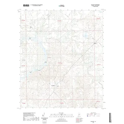 2020 Elm Bluff2020 Print · USGSCovers Belknap, including Elm Bluff, Dallas County, and other nearby areas
 - 2024 Map of Elm Bluff, 2024 Print
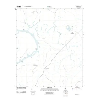
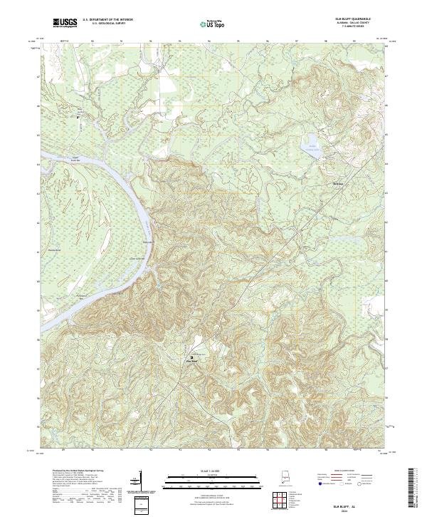 2024 Elm Bluff2024 Print · USGSThe Alabama River corridor in Dallas County remains a landscape of shifting bars and high bluffs in this recent survey. Researchers can locate family landmarks like Mount Leveton Cem and Center Ridge Cem or trace the river's path past Molette Bend and Elm Bluff.
End of results
Showing maps 1-12 of 12
Top cities near Belknap
Frequently asked questions
- What are the different types of historical maps available for Belknap?
- What is the oldest map of Belknap?
- Where can I purchase historical maps of Belknap for my home or office?
- Where can I download high-res historical maps of Belknap?
- Are there historical topographic maps available for Belknap?
- Is there historical aerial imagery available for Belknap?
- Where are historical maps of Belknap sourced from?