Old Maps of Dallas County, Alabama
Explore 187 old maps of Dallas County, spanning from 1891 to today. These high-resolution historic maps reveal how streets, neighborhoods, landmarks, and natural features evolved over time — perfect for genealogy, metal detecting, research, and local history exploration.
What you can do with these maps:
- See how Dallas County changed over time: Compare historical maps to modern-day views to trace roads, homesites, rail lines & more.
- View detailed metadata: Each map includes creators, publishers, year, scale, and archive source.
- Overlay maps with satellite & LiDAR: Visualize the past alongside modern tools to explore terrain & human change.
- Trusted historical sources: Maps sourced from the USGS, Library of Congress, and other archives.
- Access maps your way: View online, download high-res files, or order prints for personal or research use.
Start exploring old maps of Dallas County to uncover forgotten places, hidden landmarks, and the deep history beneath your feet.
Dallas County, AL maps
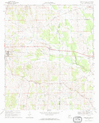
(187)- 1891 Map of Clanton
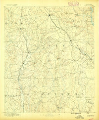 1891 Clanton1891 Print · USGSChilton and Autauga counties are shown here in the 1890s, when the river-and-rail economy defined Central Alabama. Genealogists and historians can trace the foundations of Clanton and rural landmarks like Big Spring Church, Adam's Ferry, and Ousley Store.5 unique versions available
 - 1953 Map of Montgomery, 1964 Print
 1953 Montgomery1964 Print · USGSCentral Alabama's river-and-rail corridor is mapped here in the mid-fifties, showing the vital connections between the capital and the Black Belt. Genealogists and historians can trace rail depots and crossroads from Marion Junction to Wetumpka, alongside landmarks like Craig AFB.4 unique versions available
 - 1956 Map of Montgomery
 1956 Montgomery1956 Print · USGSCentral Alabama in the mid-1950s shows a landscape defined by its great river systems and a booming military aviation presence. Genealogists and historians can trace the rail corridors of the Southern Railway and locate tactical bases like Maxwell AFB and Craig AFB.
 - 1957 Map of Montgomery
 1957 Montgomery1957 Print · USGSCentral Alabama in the mid-fifties is defined by the winding Alabama River and a strategic network of military bases and rail lines. Trace family roots in Montgomery and Selma, or locate landmarks like Craig AFB and the State Capitol before the interstate era.
 - 1957 Map of Carlowville, 1958 Print
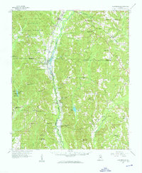
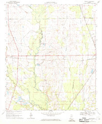
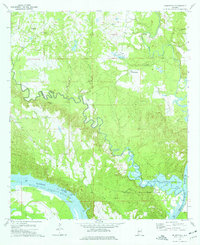
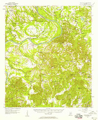 1957 Carlowville1958 Print · USGSThe Alabama River dominates this mid-century landscape of Dallas and Wilcox Counties, where rural life centered on the river's bends and the region's fertile soils. Genealogists can trace family roots through numerous landmarks like Snow Hill Institute, Boykin Cem, and the old settlement at Portland.2 unique versions available
 - 1957 Map of Benton, 1958 Print
 1957 Benton1958 Print · USGSThe river country along the Alabama-Lowndes border in the late fifties is defined by the deep oxbows of the Alabama River. Genealogists and researchers can trace rural life through a network of landmarks like Pine Flat Ch, the Dulaney Sch, and the rail stops at Benton and Tyler.2 unique versions available
 - 1957 Map of Braggs, 1958 Print
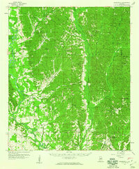
 1957 Braggs1958 Print · USGSSouthern Alabama in the late fifties was a region of tight-knit rural communities and family farmsteads. Genealogists and historians can trace the exact locations of local landmarks like the Berlin Normal Sch, Mt Moriah Ch, and the Louisville and Nashville rail stop at Minter (Minters Sta).2 unique versions available
 - 1958 Map of Selma, 1959 Print
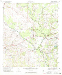
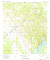
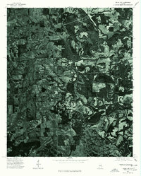
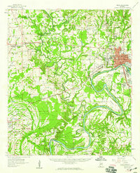 1958 Selma1959 Print · USGSDallas County in the late 1950s centers on the bustling river city of Selma and the critical aviation operations at Craig Air Force Base. Genealogists can trace local roots through numerous rural landmarks like Selma University, Marion Junction, and Childers Chapel Cemetery.3 unique versions available
 - 1958 Map of Selma, 1959 Print
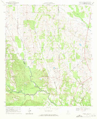
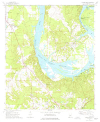
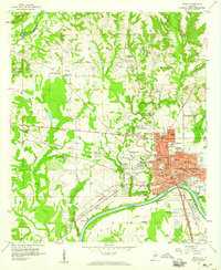 1958 Selma1959 Print · USGSMid-century Selma and its riverfront come to life just as the city’s residential and educational infrastructure was peaking. Genealogists and historians can trace family roots through dozens of local landmarks, including New Live Oak Cem, Parrish High Sch, and Harper Chapel.3 unique versions available
 - 1959 Map of Plantersville
 1959 Plantersville1959 Print · USGSDuring the late fifties, the rural communities of central Alabama thrived along the Southern and Mobile and Ohio rail lines. Researchers can trace the heritage of vanished landmarks and family churches like Little Zion Ch, Vine Hill, and the Evergreen Lookout Tower.2 unique versions available
 - 1959 Map of Summerfield, 1960 Print
 1959 Summerfield1960 Print · USGSPerry and Dallas counties appear here in the late fifties, showcasing a landscape of timber stands and river-bottom settlements. Researchers can trace the locations of family landmarks and rural centers like Cleveland Mills, Lovelady Cem, and Suttle Sch.2 unique versions available
 - 1968 Map of Uniontown East, 1971 Print
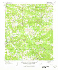
 1968 Uniontown East1971 Print · USGSThe rural borderlands of Perry and Dallas Counties come into focus in the late 1960s as a landscape of rail-side settlements and aviation history. Researchers can trace the Southern railroad through Uniontown and Tayloe or locate community centers like White Hill Sch and Trinity Ch.
 - 1968 Map of Browns, 1971 Print
 1968 Browns1971 Print · USGSThe rural landscape of Dallas and Perry Counties is captured here in the late sixties, where small rail-stop settlements like Browns and Massillon anchor the community. Researchers can trace local heritage through numerous landmarks, including St Marks Cem, Caldwell Ch, and Lake Walnutta.
 - 1968 Map of Safford, 1971 Print
 1968 Safford1971 Print · USGSDallas County in the late sixties is captured here as a network of rail-side settlements and country parishes. Genealogists can locate family-named landmarks like Martin Station Sch, Salem Ch, and the numerous flowing wells near Orrville.2 unique versions available
 - 1968 Map of Central Mills, 1971 Print
 1968 Central Mills1971 Print · USGSDallas and Perry counties are shown here in the late sixties, where the timber and rail economy shaped rural life. Genealogists can trace family landmarks and community centers like Central Mills, Shady Grove Ch, and the small settlement of Blalock.3 unique versions available
 - 1974 Map of Crumptonia, 1977 Print
 1974 Crumptonia1977 Print · USGSThe Alabama River lowlands in the mid-1970s show a landscape shaped by the William "Bill" Dannelly Reservoir and rural creek valleys. Genealogists can locate family landmarks such as Hardy Young Cem, Aimwell Ch, and the settlement of Crumptonia.
 - 1974 Map of Catherine, 1977 Print
 1974 Catherine1977 Print · USGSWilcox and Dallas County communities thrive along the Southern rail corridor in the mid-1970s. Genealogists can trace family names through numerous sites like Catherine Academy, Prairie Bluff Cem, and the old settlement of Rehoboth.
 - 1974 Map of Camden North, 1977 Print
 1974 Camden North1977 Print · USGSWilcox County life in the mid-seventies is centered on the wide waters of the Alabama River and the tight-knit communities of Gees Bend. Genealogists and historians can locate numerous rural burial sites and landmarks like Old St Francis Cem, Boykin, and the Lower Coastal Plains Experimental Farm.
 - 1975 Map of Benton SE
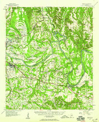
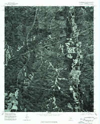
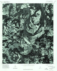 1975 Benton SE1975 Print · USGSBenton and the surrounding Lowndes County bottomlands are captured in detail during the mid-1970s. This aerial orthophotoquad allows researchers to see the actual fields and structures around the Benton settlement and the wide curves of the Alabama River.
 - 1975 Map of Selma NW, 1977 Print
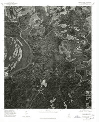
 1975 Selma NW1977 Print · USGSDallas County agriculture and rail infrastructure are captured in high detail in the mid-1970s. Genealogists and local historians can trace the physical layout of Marion Junction and the surrounding farmsteads during this era.
 - 1975 Map of Selma SE, 1977 Print
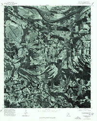
 1975 Selma SE1977 Print · USGSThe floodplain south of Selma is captured here in the mid-1970s, showcasing the winding path of the Alabama River. Local researchers can trace old river access points and rural farmsteads near the historic river stop at Kings Landing.
 - 1975 Map of Benton NE, 1977 Print
 1975 Benton NE1977 Print · USGSAutauga County's agricultural heartland and the winding Alabama River are captured in this mid-seventies aerial survey. Researchers can trace the rural landscape around Mulberry and study the intricate river meanders and historic property boundaries.
 - 1975 Map of Carlowville NE, 1977 Print
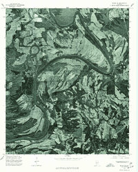
 1975 Carlowville NE1977 Print · USGSThe Alabama riverfront in Dallas County appears in sharp photographic detail in the mid-1970s. Trace the dramatic oxbows of the Alabama River and examine the interplay of timber tracts and agricultural clearings along its fertile banks.
 - 1975 Map of Plantersville SW, 1977 Print
 1975 Plantersville SW1977 Print · USGSCovers Dallas County, including Valley Grande, Jones, and other nearby areas
 - 1975 Map of Benton SW, 1977 Print
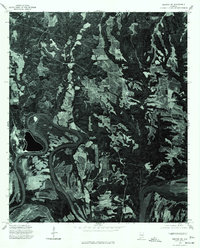
 1975 Benton SW1977 Print · USGSMid-1970s Dallas County comes into sharp focus in this aerial survey of the riverlands east of Selma. Researchers can trace the agricultural footprint and rural infrastructure near Tyler and Sardis, or examine the banks of the Alabama River.
Showing maps 1-25 of 187
Top cities of Dallas County
Frequently asked questions
- What are the different types of historical maps available for Dallas County?
- What is the oldest map of Dallas County?
- Where can I purchase historical maps of Dallas County for my home or office?
- Where can I download high-res historical maps of Dallas County?
- Are there historical topographic maps available for Dallas County?
- Is there historical aerial imagery available for Dallas County?
- Where are historical maps of Dallas County sourced from?