Old Maps of Valley Grande, Alabama
Explore 43 old maps of Valley Grande, spanning from 1891 to today. These high-resolution historic maps reveal how streets, neighborhoods, landmarks, and natural features evolved over time — perfect for genealogy, metal detecting, research, and local history exploration.
What you can do with these maps:
- See how Valley Grande changed over time: Compare historical maps to modern-day views to trace roads, homesites, rail lines & more.
- View detailed metadata: Each map includes creators, publishers, year, scale, and archive source.
- Overlay maps with satellite & LiDAR: Visualize the past alongside modern tools to explore terrain & human change.
- Trusted historical sources: Maps sourced from the USGS, Library of Congress, and other archives.
- Access maps your way: View online, download high-res files, or order prints for personal or research use.
Start exploring old maps of Valley Grande to uncover forgotten places, hidden landmarks, and the deep history beneath your feet.
Valley Grande, AL maps
(43)- 1891 Map of Clanton
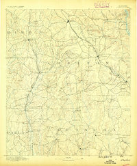 1891 Clanton1891 Print · USGSChilton and Autauga counties are shown here in the 1890s, when the river-and-rail economy defined Central Alabama. Genealogists and historians can trace the foundations of Clanton and rural landmarks like Big Spring Church, Adam's Ferry, and Ousley Store.5 unique versions available
 - 1953 Map of Montgomery, 1964 Print
 1953 Montgomery1964 Print · USGSCentral Alabama's river-and-rail corridor is mapped here in the mid-fifties, showing the vital connections between the capital and the Black Belt. Genealogists and historians can trace rail depots and crossroads from Marion Junction to Wetumpka, alongside landmarks like Craig AFB.4 unique versions available
 - 1956 Map of Montgomery
 1956 Montgomery1956 Print · USGSCentral Alabama in the mid-1950s shows a landscape defined by its great river systems and a booming military aviation presence. Genealogists and historians can trace the rail corridors of the Southern Railway and locate tactical bases like Maxwell AFB and Craig AFB.
 - 1957 Map of Montgomery
 1957 Montgomery1957 Print · USGSCentral Alabama in the mid-fifties is defined by the winding Alabama River and a strategic network of military bases and rail lines. Trace family roots in Montgomery and Selma, or locate landmarks like Craig AFB and the State Capitol before the interstate era.
 - 1957 Map of Benton, 1958 Print
 1957 Benton1958 Print · USGSThe river country along the Alabama-Lowndes border in the late fifties is defined by the deep oxbows of the Alabama River. Genealogists and researchers can trace rural life through a network of landmarks like Pine Flat Ch, the Dulaney Sch, and the rail stops at Benton and Tyler.2 unique versions available
 - 1958 Map of Selma, 1959 Print
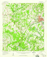 1958 Selma1959 Print · USGSDallas County in the late 1950s centers on the bustling river city of Selma and the critical aviation operations at Craig Air Force Base. Genealogists can trace local roots through numerous rural landmarks like Selma University, Marion Junction, and Childers Chapel Cemetery.3 unique versions available
 - 1958 Map of Selma, 1959 Print
 1958 Selma1959 Print · USGSMid-century Selma and its riverfront come to life just as the city’s residential and educational infrastructure was peaking. Genealogists and historians can trace family roots through dozens of local landmarks, including New Live Oak Cem, Parrish High Sch, and Harper Chapel.3 unique versions available
 - 1959 Map of Plantersville
 1959 Plantersville1959 Print · USGSDuring the late fifties, the rural communities of central Alabama thrived along the Southern and Mobile and Ohio rail lines. Researchers can trace the heritage of vanished landmarks and family churches like Little Zion Ch, Vine Hill, and the Evergreen Lookout Tower.2 unique versions available
 - 1959 Map of Summerfield, 1960 Print
 1959 Summerfield1960 Print · USGSPerry and Dallas counties appear here in the late fifties, showcasing a landscape of timber stands and river-bottom settlements. Researchers can trace the locations of family landmarks and rural centers like Cleveland Mills, Lovelady Cem, and Suttle Sch.2 unique versions available
 - 1975 Map of Plantersville SW, 1977 Print
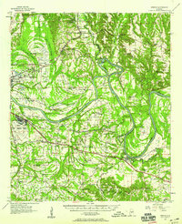
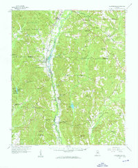
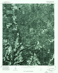
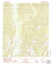
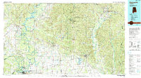
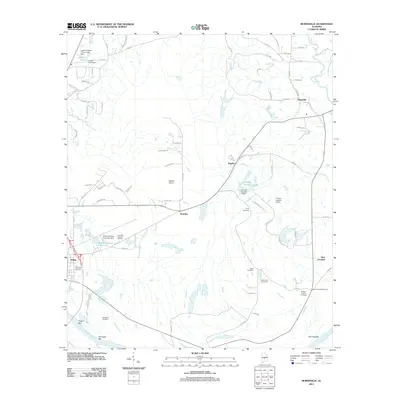
 1975 Plantersville SW1977 Print · USGSCovers Valley Grande, including Jones, Valley Creek Junction, and other nearby areas
 - 1975 Map of Benton NW, 1977 Print
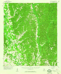
 1975 Benton NW1977 Print · USGSDallas County during the mid-1970s is seen through a detailed aerial lens, capturing the rural landscape between the city and surrounding settlements. Researchers can trace the development of Selma and locate the smaller hubs of Burnsville and Brantley.
 - 1975 Map of Summerfield SE, 1977 Print
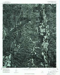
 1975 Summerfield SE1977 Print · USGSDallas County is captured in mid-1970s aerial detail, documenting the rural landscape and timber tracts of the Alabama interior. Trace local land use and transit patterns along the corridor of State Route 219 as it appeared during the 1975 survey.
 - 1975 Map of Selma, 1977 Print
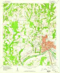
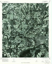 1975 Selma1977 Print · USGSSelma and the surrounding Dallas County countryside are captured in this mid-seventies aerial survey. Researchers can trace the riverfront development along the Alabama River and locate properties near Selma and the rural settlement of Potter.
 - 1982 Map of Burnsville, 1983 Print
 1982 Burnsville1983 Print · USGSIn the early 1980s, the area around the Dallas and Autauga county line remained a landscape of riverfront commerce and rural outposts. Local history researchers can trace the outskirts of Selma and Selmont or locate smaller settlements like Burnsville and Manila near the Blue Gurth Swamp.
 - 1982 Map of Jones, 1983 Print
 1982 Jones1983 Print · USGSThe borderlands of Dallas and Autauga counties are captured here in the early eighties, centered on the SOUTHERN rail line and Mulberry Creek. Researchers can trace rural lineages through numerous landmarks like Pea Ridge Cem, Cedar Grove Ch, and the settlement at Vine Hill.
 - 1986 Map of Montgomery
 1986 Montgomery1986 Print · USGSCentral Alabama's river-and-rail corridor is captured in the mid-1980s, centered on the state capital and its surrounding rural counties. Researchers can trace ancestral landmarks like Oakwood Cemetery, military sites like Maxwell Air Force Base, and small towns such as Lowndesboro.2 unique versions available
 - 1986 Map of Clanton
 1986 Clanton1986 Print · USGSCentral Alabama’s river-driven landscape is captured here in the mid-eighties, centered on the growth of Clanton and the hydroelectric lakes of the Coosa River. Genealogists and historians can trace the Old Indian Treaty Boundary or locate landmarks like Sykes Mill and Collins Chapel.
 - 1986 Map of Selma
 1986 Selma1986 Print · USGSCentral Alabama's river and rail networks are preserved here in the mid-eighties, showing the transition from river travel to modern infrastructure. Researchers can trace the layout of Selma, the historic capital at Cahaba, and the Millers Ferry Lock and Dam.2 unique versions available
 - 1986 Map of Demopolis
 1986 Demopolis1986 Print · USGSWest-central Alabama's river-and-rail corridors are preserved here in the mid-eighties, showing the deep-seated settlement patterns of the Black Belt. Genealogists and historians can locate family-named landmarks like Crenshaw Quarters or industrial sites including Cleveland Mills and the Warrior Lock and Dam.
 - 1987 Map of Summerfield
 1987 Summerfield1987 Print · USGSCentral Alabama in the late eighties reveals a landscape of dense woodlands and winding waterways along the Perry and Dallas County line. Researchers can trace the rural layouts of Perryville and Stonewall or locate the boundaries of Paul M Grist State Park.
 - 1987 Map of Clanton, 1990 Print
 1987 Clanton1990 Print · USGSCentral Alabama in the late eighties reveals a landscape of massive river reservoirs and forest reserves. Trace the rail-and-road corridors through Clanton and Wetumpka to find historic sites like Fort Toulouse and Collins Chapel.
 - 1990 Map of Demopolis
 1990 Demopolis1990 Print · USGSWest-central Alabama's river corridors and educational centers are mapped here in the late twentieth century. Genealogists and local historians can trace old family sites near Oak Grove Ch, the historic Marion Military Institute, or the landings at Finchal Ferry.
 - 2002 Map of Summerfield, 2003 Print
 2002 Summerfield2003 Print · USGSDallas and Perry counties at the start of the twenty-first century show a landscape of protected forests and deep-rooted rural communities. Genealogists and local historians can trace family locations near Shiloh Cem, Stonewall, and the historic College Hill Ch.
 - 2011 Map of Summerfield, 2011 Print
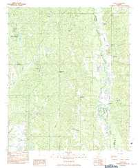
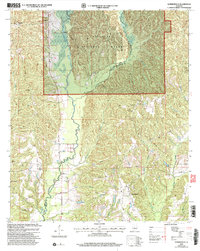
 2011 Summerfield2011 Print · USGSCovers Valley Grande, including Augustin, Stonewall, and other nearby areas
 - 2011 Map of Burnsville, 2011 Print
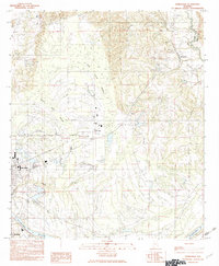
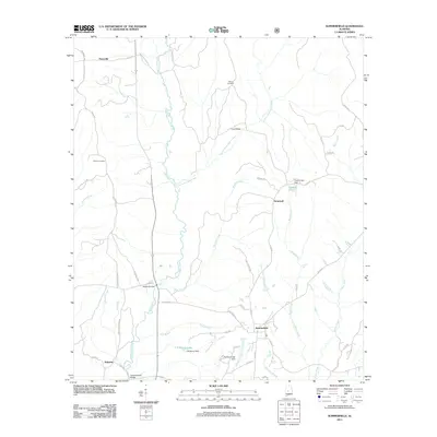
 2011 Burnsville2011 Print · USGSCovers Valley Grande, including Selma, Brantley, and other nearby areas
Showing maps 1-25 of 43
Top cities near Valley Grande
Frequently asked questions
- What are the different types of historical maps available for Valley Grande?
- What is the oldest map of Valley Grande?
- Where can I purchase historical maps of Valley Grande for my home or office?
- Where can I download high-res historical maps of Valley Grande?
- Are there historical topographic maps available for Valley Grande?
- Is there historical aerial imagery available for Valley Grande?
- Where are historical maps of Valley Grande sourced from?