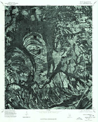
1975 Map of Benton NW
USGS Topo · Published 1977About this map
Selma and its northeastern rural environs are captured here during the mid-1970s via high-altitude aerial photography. This orthophotograph reveals the sharp contrast between the burgeoning industrial and residential footprint of the city's eastern edge and the sweeping agricultural patterns that define the Alabama Black Belt. The image captures the distinct layout of Brantley and Burnsville, where local roads and rail lines bisect the landscape. These settlements appear as small clusters of activity within a broader system of field plots, woodlots, and the meandering corridors of local watercourses. The inclusion of an airfield near Brantley provides a clear look at transportation infrastructure that served the region's agricultural and civil needs during this era.
Find a feature on this map
3 named features on this map. Tap any name to fly to it.
Don’t see what you’re looking for? This feature index may not catch every label — zoom into the map to look around manually.
Map Details
Editions of this 1975 Benton NW Map
This is the sole edition of this map. No revisions or reprints were ever made.
Other maps of this area

1891 · Clanton
USGS Topo · 1:125,000

1953 · Montgomery
USGS Topo · 1:250,000

1956 · Montgomery
USGS Topo · 1:250,000

1957 · Montgomery
USGS Topo · 1:250,000

1957 · Benton
USGS Topo · 1:62,500

1958 · Selma
USGS Topo · 1:62,500

1958 · Selma
USGS Topo · 1:24,000

1959 · Plantersville
USGS Topo · 1:62,500

1959 · Summerfield
USGS Topo · 1:62,500

1975 · Benton SE
USGS Topo · 1:24,000