
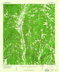
1959 Map of Plantersville
USGS Topo · Published 1959About this map
Mulberry Creek and the Southern railroad line dictate the geography of this central Alabama landscape, where the borders of Chilton, Dallas, and Autauga counties converge. The town of Plantersville sits at a critical junction of local commerce and rail, supported by a dense network of country churches and rural schoolhouses such as New Hope Sch and Vermont Sch. The terrain transitions from the protected timberlands of the Talladega National Forest in the northwest to the agricultural bottomlands and gravel workings along the creek. Genealogists will find significant value in the numerous local congregations and burial sites, including the Plantersville Grove Ch Cem and the remote Fig Tree Ch. Further south, the map details the infrastructure of the Valley Creek State Park and the specialized rail operations at Valley Creek Junction, reflecting the mid-century intersection of recreation, industry, and rural settlement.
Find a feature on this map
67 named features on this map. Tap any name to fly to it.
Don’t see what you’re looking for? This feature index may not catch every label — zoom into the map to look around manually.
Map Details
Editions of this 1959 Plantersville Map
2 editions found
Other maps of this area

1891 · Clanton
USGS Topo · 1:125,000

1953 · Montgomery
USGS Topo · 1:250,000

1956 · Montgomery
USGS Topo · 1:250,000

1957 · Montgomery
USGS Topo · 1:250,000

1957 · Autaugaville
USGS Topo · 1:62,500

1957 · Benton
USGS Topo · 1:62,500

1958 · Selma
USGS Topo · 1:62,500

1958 · Selma
USGS Topo · 1:24,000

1959 · Billingsley
USGS Topo · 1:62,500

1959 · Summerfield
USGS Topo · 1:62,500