
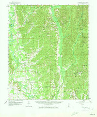
1959 Map of Summerfield
USGS Topo · Published 1960About this map
Talladega National Forest dominates much of this landscape in Perry and Dallas counties, where the Cahaba River winds through the western reaches. The settlement pattern of the late 1950s is defined by small agricultural and lumbering communities like Cleveland Mills, Sprott, and Suttle. This area is particularly dense with rural community anchors, featuring a significant number of country churches such as Iveys Chapel, Ocmulgee Ch, and Santa Felix Ch.
Find a feature on this map
72 named features on this map. Tap any name to fly to it.
Don’t see what you’re looking for? This feature index may not catch every label — zoom into the map to look around manually.
Map Details
Editions of this 1959 Summerfield Map
2 editions found
Other maps of this area

1891 · Clanton
USGS Topo · 1:125,000

1953 · Montgomery
USGS Topo · 1:250,000

1956 · Montgomery
USGS Topo · 1:250,000

1957 · Montgomery
USGS Topo · 1:250,000

1957 · Benton
USGS Topo · 1:62,500

1958 · Selma
USGS Topo · 1:62,500

1958 · Selma
USGS Topo · 1:24,000

1959 · Plantersville
USGS Topo · 1:62,500

1968 · Browns
USGS Topo · 1:24,000

1971 · Maplesville West
USGS Topo · 1:24,000