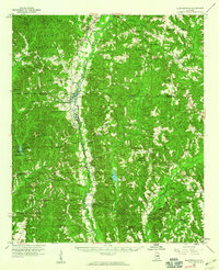
1959 Map of Plantersville
USGS Topo · Published 1960About this map
The Southern railroad corridor serves as the primary artery through this landscape, connecting the rural communities of Stanton, Parnell, and Plantersville. This mid-century survey captures a region defined by its dispersed agricultural settlements and numerous country churches, such as Hill Crest Ch and New Salem Ch, which served as the social anchors for local residents. The terrain transitions from the protected timberlands of the Talladega National Forest in the northwest toward the meandering path of Mulberry Creek.
Find a feature on this map
71 named features on this map. Tap any name to fly to it.
Don’t see what you’re looking for? This feature index may not catch every label — zoom into the map to look around manually.
Map Details
Editions of this 1959 Plantersville Map
2 editions found
Other maps of this area

1891 · Clanton
USGS Topo · 1:125,000

1953 · Montgomery
USGS Topo · 1:250,000

1956 · Montgomery
USGS Topo · 1:250,000

1957 · Montgomery
USGS Topo · 1:250,000

1957 · Autaugaville
USGS Topo · 1:62,500

1957 · Benton
USGS Topo · 1:62,500

1958 · Selma
USGS Topo · 1:62,500

1958 · Selma
USGS Topo · 1:24,000

1959 · Plantersville
USGS Topo · 1:62,500

1959 · Billingsley
USGS Topo · 1:62,500