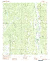
1982 Map of Jones
USGS Topo · Published 1983About this map
Paul M Grist State Park and the surrounding woodlands of Dallas and Autauga counties define this landscape in the early 1980s. The area is marked by a network of rural settlements connected by the Southern railroad line, which follows the winding course of Mulberry Creek. Small communities like Vine Hill and Jones serve as local hubs, characterized by a high density of country churches and family burial grounds including Cedar Grove Ch, Pleasant Grove Ch, and the Pea Ridge Cem.
Find a feature on this map
33 named features on this map. Tap any name to fly to it.
Don’t see what you’re looking for? This feature index may not catch every label — zoom into the map to look around manually.
Map Details
Editions of this 1982 Jones Map
This is the sole edition of this map. No revisions or reprints were ever made.
Other maps of this area

1891 · Clanton
USGS Topo · 1:125,000

1953 · Montgomery
USGS Topo · 1:250,000

1956 · Montgomery
USGS Topo · 1:250,000

1957 · Montgomery
USGS Topo · 1:250,000

1957 · Benton
USGS Topo · 1:62,500

1958 · Selma
USGS Topo · 1:62,500

1958 · Selma
USGS Topo · 1:24,000

1959 · Plantersville
USGS Topo · 1:62,500

1959 · Summerfield
USGS Topo · 1:62,500

1975 · Plantersville SE
USGS Topo · 1:24,000