Old Maps of Parker Springs, Alabama for Genealogy
Trace your family roots with 9 historic maps of Parker Springs. These high-res maps reveal old neighborhoods, homesites, landmarks, and streets — helping you uncover where your ancestors lived and how the area evolved over time.
- Explore historic neighborhoods: Identify where your relatives may have lived in the 1800s or 1900s.
- Compare maps over time: Trace the changes in streets, buildings, and landmarks for multi-generational research.
- Perfect for genealogy & ancestry research: Used by family historians and researchers to map out lineage and migration.
These maps are an incredible resource for exploring your personal connection to Parker Springs's past.
Parker Springs, AL maps
(9)- 1953 Map of Andalusia, 1965 Print
 1953 Andalusia1965 Print · USGSSouth Alabama in the mid-twentieth century remains a land of pine forests and river-fed settlements. You can trace the vital rail corridors of the Louisville & Nashville and locate regional centers such as Andalusia, Brewton, and Monroeville.3 unique versions available
 - 1957 Map of Andalusia
 1957 Andalusia1957 Print · USGSSouthern Alabama in the mid-1950s was a landscape defined by timbered stretches and the rhythmic flow of the Alabama River. Researchers can trace the legacy of the rail era through the Central of Georgia tracks and the storied river bluffs at Choctaw Bluff.
 - 1982 Map of Parker Springs, 1983 Print
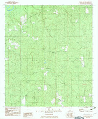 1982 Parker Springs1983 Print · USGSEscambia County, Alabama, is shown in the early eighties as a landscape shaped by the Conecuh National Forest and its winding waterways. Researchers can trace rural settlements like Alaflora and Parker Springs alongside family landmarks like Henley Roberts.
 - 1986 Map of Andalusia
 1986 Andalusia1986 Print · USGSCovington County and the Wiregrass region are shown here in the mid-1980s, centered on the growing hubs of Andalusia and Opp. Genealogists and local historians can trace legacy sites like the Old Pioneer Cem, Straughn Sch, and the rail lines of the Louisville and Nashville RR.2 unique versions available
 - 2011 Map of Parker Springs, 2011 Print
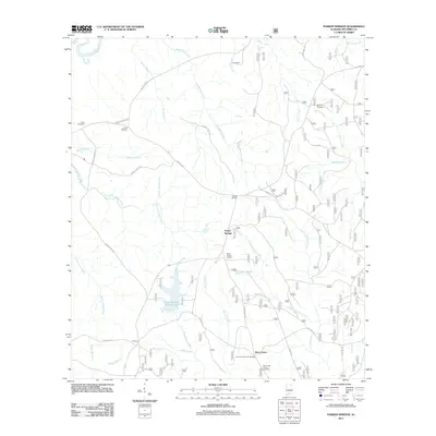 2011 Parker Springs2011 Print · USGSCovers Parker Springs, including Rock Creek, Escambia County, and other nearby areas
 - 2014 Map of Parker Springs, 2014 Print
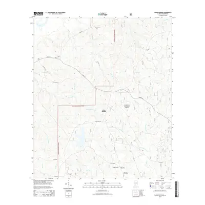 2014 Parker Springs2014 Print · USGSCovers Parker Springs, including Rock Creek, Escambia County, and other nearby areas
 - 2018 Map of Parker Springs, 2018 Print
 2018 Parker Springs2018 Print · USGSCovers Parker Springs, including Rock Creek, Escambia County, and other nearby areas
 - 2021 Map of Parker Springs, 2021 Print
 2021 Parker Springs2021 Print · USGSCovers Parker Springs, including Rock Creek, Escambia County, and other nearby areas
 - 2024 Map of Parker Springs, 2024 Print
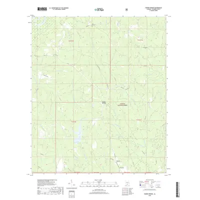
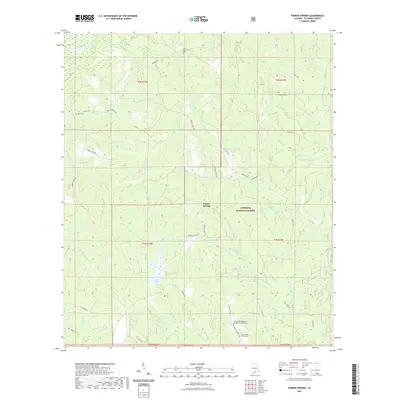
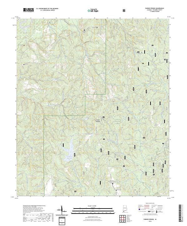 2024 Parker Springs2024 Print · USGSSouthern Escambia County is shown during a time of modern forest management and rural continuity within the Conecuh National Forest. Researchers can trace family history at several local burial sites like Elim Cem and Noah Hill Cem or locate the Rock Creek Apostolic Community Church.
End of results
Showing maps 1-9 of 9
Top cities near Parker Springs
Frequently asked questions
- What are the different types of historical maps available for Parker Springs?
- What is the oldest map of Parker Springs?
- Where can I purchase historical maps of Parker Springs for my home or office?
- Where can I download high-res historical maps of Parker Springs?
- Are there historical topographic maps available for Parker Springs?
- Is there historical aerial imagery available for Parker Springs?
- Where are historical maps of Parker Springs sourced from?