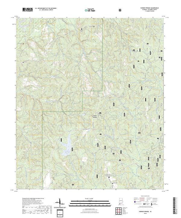
2024 Map of Parker Springs
USGS Topo · Published 2024About this map
Conecuh National Forest dominates the landscape of this Escambia County survey, where a dense network of creek branches and springs defines the rural terrain. The area is characterized by family-named landmarks and cemeteries, suggesting a lineage of deep local roots along the ridges and hollows. The Rock Creek Apostolic Community Church and the adjacent Rock Creek Church Cem serve as a central cultural anchor in the southern portion of the sheet. Notable water features include the Leon-Brooks-Hines Lake and the engineered Brackens Ditch, which redirect the natural drainage of Sweetwater Creek and School House Creek. The settlement at Parker Springs and the numerous small burial grounds, such as Mancil Cem and Sam McGowin Cem, provide essential evidence for genealogists and local historians tracing the settlement patterns of this forested region near the Alabama-Florida border.
Find a feature on this map
56 named features on this map. Tap any name to fly to it.
Don’t see what you’re looking for? This feature index may not catch every label — zoom into the map to look around manually.
Map Details
Editions of this 2024 Parker Springs Map
This is the sole edition of this map. No revisions or reprints were ever made.
Other maps of this area

1948 · Munson
USGS Topo · 1:62,500

1949 · Crestview
USGS Topo · 1:62,500

1950 · Munson
USGS Topo · 1:62,500

1951 · Crestview
USGS Topo · 1:62,500

1953 · Andalusia
USGS Topo · 1:250,000

1957 · Andalusia
USGS Topo · 1:250,000

1957 · Pensacola
USGS Topo · 1:250,000

1959 · Pensacola
USGS Topo · 1:250,000

1960 · Pensacola
USGS Topo · 1:250,000

1971 · Dixie
USGS Topo · 1:24,000