1960s Maps of Etowah County, Alabama
Explore 9 historic maps of Etowah County from the 1960s. These maps offer a rare glimpse into what life looked like during the 1960s — showing old roads, neighborhoods, homes, and landmarks that have changed or disappeared over time.
Whether you're researching your family's past, planning a metal detecting trip, or studying how Etowah County's landscape evolved across the 1960s, these high-resolution maps are a powerful tool for exploring the history of this region.
- Focus on a specific era: All maps on this page are from the 1960s, giving you a focused view of this time period.
- See what’s changed: Compare century-old streets, trails, and buildings to today's modern landscape using overlays and satellite layers.
- Research with precision: Use these maps for genealogy, historical research, land use analysis, or educational projects.
- View, download, or print: Maps are fully viewable online in high resolution, and can be downloaded or printed for your own records.
Start exploring Etowah County's history through authentic maps from the 1960s. This is your window into the past.
Etowah County, AL maps
(9)- 1960 Map of Gadsden
 1960 Gadsden1960 Print · USGSNorthern Alabama in the mid-1950s is defined by the mighty Tennessee River and its massive reservoirs. Trace the development of Huntsville and Redstone Arsenal or explore the vast William B Bankhead National Forest.2 unique versions available
 - 1961 Map of Rome
 1961 Rome1961 Print · USGSNorthwest Georgia and neighboring Tennessee and Alabama are shown here at a moment of significant mid-century growth. Researchers can trace the rail networks of the Central of Georgia or locate landmarks within Chickamauga and Chattanooga Nat Military Park.
 - 1963 Map of Rome
 1963 Rome1963 Print · USGSThe tri-state corner of Georgia, Alabama, and Tennessee is captured here during a period of massive reservoir expansion and post-war growth. Genealogists and historians can trace the rail corridors of the Southern Ry or locate landmarks like Fort Oglethorpe and Cloudland Canyon State Park.
 - 1963 Map of Gadsden
 1963 Gadsden1963 Print · USGSNorthern Alabama underwent a dramatic mid-century transformation as the Tennessee Valley became a hub for defense and industry. Researchers can trace the development of the Redstone Arsenal, the route of the Natchez Trace Parkway, and long-standing rail lines like the Southern Railway.
 - 1967 Map of Piedmont NW, 1969 Print
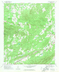 1967 Piedmont NW1969 Print · USGSNortheast Alabama in the late sixties reveals a landscape of mountain ridges and rail-side settlements. Genealogists can trace family landmarks and rural life through Knightens Crossroads, Webb Sch, and the historic tracks of the Southern Railway.3 unique versions available
 - 1967 Map of Weisner Mountain, 1969 Print
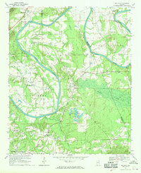
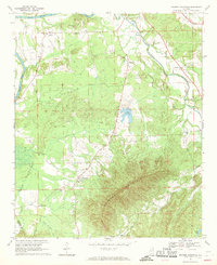 1967 Weisner Mountain1969 Print · USGSCherokee and Etowah counties are captured in the late sixties as the rural landscape transitions between the Coosa River and the high ridge of Weisner Mountain. Researchers can trace ancestral connections to family-named hubs like Plano and Ball Flat, or locate historic local landmarks such as Davis Chapel and Lake Weisner.2 unique versions available
 - 1967 Map of Leesburg, 1970 Print
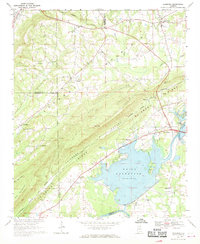 1967 Leesburg1970 Print · USGSCherokee County enters a new era in the late sixties as the newly created Weiss Reservoir reshapes the Coosa River valley. Researchers can locate long-standing community landmarks like Olivers Chapel, Dixon Shop, and the Livingston Jr High Sch.3 unique versions available
 - 1967 Map of Gadsden East, 1970 Print
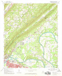 1967 Gadsden East1970 Print · USGSGadsden and the Coosa River are captured here in the late sixties as the region balanced its industrial growth with its rural roots. Trace family history through local landmarks like Tillison Cem, Whites Chapel, and the river crossing at Fitts Ferry.2 unique versions available
 - 1967 Map of Ballplay, 1970 Print
 1967 Ballplay1970 Print · USGSThe Coosa River valley in Northeast Alabama shows its traditional river-crossing network and rural hamlets in the mid-1960s. Genealogists and local historians can trace family locations near several river crossings like Wagnon Ferry and Baskin Ferry, or old church sites like Macedonia Ch.3 unique versions available
End of results
Showing maps 1-9 of 9
Top cities of Etowah County
- Gadsden historical maps
- Rainbow City historical maps
- Southside historical maps
- Attalla historical maps
- Glencoe historical maps
- Hokes Bluff historical maps
See more
Frequently asked questions
- What are the different types of historical maps available for Etowah County?
- What is the oldest map of Etowah County?
- Where can I purchase historical maps of Etowah County for my home or office?
- Where can I download high-res historical maps of Etowah County?
- Are there historical topographic maps available for Etowah County?
- Is there historical aerial imagery available for Etowah County?
- Where are historical maps of Etowah County sourced from?