Old Maps of Etowah County, Alabama for Academic Research
Study the evolution of Etowah County with 170 high-resolution historic maps. Whether you're teaching, researching, or modeling changes in land use, these maps provide essential visual documentation of urban, environmental, and geographic change.
- Analyze long-term change: Track patterns in development, transportation, and natural features.
- Ideal for environmental or urban studies: Support academic projects with primary historical map data.
- Use in the classroom or lab: Educators and researchers rely on these maps to bring historical context to life.
These maps are a powerful tool for teaching, research, and visualizing how Etowah County has changed over the decades.
Etowah County, AL maps
(170)- 1885 Map of Gadsden
 1885 Gadsden1885 Print · USGSNortheast Alabama in the mid-1880s was a landscape of river-side landings and emerging rail towns. Genealogists and historians can trace the early foundations of Guntersville and Gadsden while locating rural landmarks like Hillian Store, Cottonville, and Law Landing.
 - 1888 Map of Gadsden
 1888 Gadsden1888 Print · USGSNorth Alabama's river valleys and plateau lands are captured here in the late nineteenth century as the region transitioned from river landings to rail transport. Researchers can locate early post offices and commerce centers like Hillian's Store, Guntersville, and the ferry at Ft Deposit.
 - 1889 Map of Springville
 1889 Springville1889 Print · USGSSt. Clair County and its neighbors are mapped here during the late Victorian era as railroads began to transform the old plantation and river economy. Genealogists can locate family landmarks like Henry's Mill, trace the path of Jackson's Trace, or find the location of old river crossings at Colman's Ferry.
 - 1892 Map of Springville
 1892 Springville1892 Print · USGSNortheast Alabama at the end of the nineteenth century is a landscape of river crossings and expanding rail lines. Genealogists can trace family footprints at St. Clair Springs, Greensport, and numerous river crossings like Colman's Ferry or Goodwin's Mill.7 unique versions available
 - 1892 Map of Gadsden
 1892 Gadsden1892 Print · USGSNorth Alabama's river-and-rail economy is captured here in the late nineteenth century as Guntersville and Gadsden emerge as regional hubs. Genealogists and historians can trace the routes of the Birmingham Mineral R. R. or locate old community centers like Cottonville and Mt Zion.
 - 1893 Map of Fort Payne
 1893 Fort Payne1893 Print · USGSNortheast Alabama is shown here in the late nineteenth century as the rail network transformed the valley floor. Genealogists and historians can trace family-named crossroads like Hoge's X Roads and vital river crossings including Coker Ferry and Sewell Ferry.
 - 1895 Map of Gadsden
 1895 Gadsden1895 Print · USGSNortheast Alabama at the close of the century was a landscape of river landings and mountain gaps where the Tennessee River met growing rail hubs. Genealogists can trace family holdings near Hillian Store, Cottonville, and the remote heights of Lookout Mountain.
 - 1898 Map of Fort Payne, 1964 Print
 1898 Fort Payne1964 Print · USGSDeKalb and Cherokee counties in the late 1890s are defined by the steep ridges of Lookout Mountain and a bustling network of river ferries. Genealogists can trace family roots through numerous river crossings like Hardwick Ferry and early industrial sites such as Sloan Mill or Abernathy Mill.
 - 1900 Map of Fort Payne
 1900 Fort Payne1900 Print · USGSNortheast Alabama is defined by its deep ridges and river valleys in the late nineteenth century. Researchers can trace the era's ferry network across the Coosa River and find old family-run landmarks like Wagners Store and Santy Mills.6 unique versions available
 - 1900 Map of Anniston
 1900 Anniston1900 Print · USGSNortheast Alabama thrived as a railroad and industrial crossroads at the turn of the century. Genealogists and researchers can trace family landmarks and early transport hubs from the Coosa River to Anniston, including Salt Creek Church and Fowler Ferry.6 unique versions available
 - 1903 Map of Gadsden
 1903 Gadsden1903 Print · USGSNorthern Alabama in the late nineteenth century centers on the busy Tennessee River corridor and its surrounding ridges. Trace old family sites and transport hubs like Hillian Store, Lovelace Landing, and the Mt Zion church.4 unique versions available
 - 1936 Map of Mountainboro
 1936 Mountainboro1936 Print · USGSThe Marshall and Etowah County borderlands are captured here in the mid-1930s, defined by the crossing of the Old Cherokee Boundary. You can trace the rural infrastructure of the day, from the Bethsaida Sch to the Nashville Chattanooga and St Louis railroad.
 - 1936 Map of Rodentown
 1936 Rodentown1936 Print · USGSNortheast Alabama hill country is captured here during the mid-thirties, showing the rural communities of Sand Mountain. Researchers can trace family roots through numerous local landmarks like Whitesboro, Smith Chapel, and Duck Springs Sch.
 - 1936 Map of Roden Gap
 1936 Roden Gap1936 Print · USGSThe upland terrain along the DeKalb and Etowah county line is captured in the mid-1930s as the Tennessee Valley Authority began its systematic mapping. Researchers can trace rural landmarks like Wallace, Marcus Sch, and the natural pass at Roden Gap.
 - 1936 Map of High Point
 1936 High Point1936 Print · USGSMarshall County's upland plateau is captured in the mid-1930s during a period of significant Tennessee Valley Authority activity. Genealogists and local historians can trace family locations near Hyatt, High Point, and the Rock Spring Ch along the heights of Sand Mountain.
 - 1947 Map of Dunaway Mountain, 1953 Print
 1947 Dunaway Mountain1953 Print · USGSThe Etowah County countryside near Gadsden is captured here just after World War II, showing a landscape transitioning from military use to civil expansion. Researchers can trace the grounds of Camp Sibert (Abandoned) or locate local landmarks like Listers Ferry (Abandoned) and Old Harmony Ch.3 unique versions available
 - 1947 Map of Colvin Gap, 1953 Print
 1947 Colvin Gap1953 Print · USGSThe rural border of Etowah and Calhoun Counties comes into sharp focus in the late 1940s, showing a landscape shaped by the ridges of Colvin Mountain. Researchers can trace old family sites and community centers like Pattersons Chapel, Websters Sch, and Landers Cem.2 unique versions available
 - 1947 Map of Glencoe, 1953 Print
 1947 Glencoe1953 Print · USGSGadsden and the Coosa River valley are seen here in the post-war era, showing a mix of industrial mobilization and rural life. Researchers can find military installations like the Specialized Depot 889th AF and historic churches including Antioch Ch and Oak Grove Ch.2 unique versions available
 - 1947 Map of Wellington, 1953 Print
 1947 Wellington1953 Print · USGSNortheast Alabama in the late 1940s reveals a landscape of ridge-top lookouts and busy rail junctions. Genealogists can trace family roots at Crooks Cem, locate Union Ch, or follow the tracks through Wellington and Alexandria.
 - 1947 Map of Jacksonville, 1953 Print
 1947 Jacksonville1953 Print · USGSPostwar Etowah and Calhoun counties show a unique mix of expanding industrial centers and deeply rooted rural communities. Local historians can trace early school sites like Webster Sch and long-standing spiritual hubs such as Tredegar Chapel or Friendship Ch.
 - 1947 Map of Steele, 1953 Print
 1947 Steele1953 Print · USGSNorthern St. Clair County appears here in the immediate post-war years as military installations give way to rural life. Researchers can trace the boundaries of Camp Sibert, find old family church sites like Deerman Chapel, and follow the Southern rail line through Steele.3 unique versions available
 - 1947 Map of Steele, 1953 Print
 1947 Steele1953 Print · USGSMid-century Alabama life centered on the river and rail corridors between Gadsden and Ashville. Genealogists can locate family landmarks like Morgans Crossroad, Old Harmony Ch Cem, and the decommissioned Camp Sibert.2 unique versions available
 - 1949 Map of Ohatchee, 1953 Print
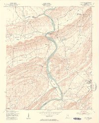 1949 Ohatchee1953 Print · USGSThe Coosa River valley in the late 1940s shows a landscape of steep ridges and tight-knit river settlements along the Calhoun and St. Clair county lines. Local historians can trace the paths of the Seaboard Air Line and find sites like Francis Ferry, Greensport, and Ten Island Ch.5 unique versions available
 - 1953 Map of Birmingham, 1964 Print
 1953 Birmingham1964 Print · USGSCentral Alabama at mid-century shows a landscape defined by industrial expansion and the iron-rich ridges surrounding Birmingham. Researchers can trace the extensive rail networks of the L & N RR or locate historic federal sites like the Anniston Ordnance Depot.4 unique versions available
 - 1953 Map of Atlanta, 1965 Print
 1953 Atlanta1965 Print · USGSThe growing Atlanta metro and the industrial corridors of Eastern Alabama are captured here during the mid-century transition. Researchers can trace the rail-to-road shift through hubs like Anniston and La Grange or locate sites within Fort McClellan.2 unique versions available
Showing maps 1-25 of 170
Top cities of Etowah County
- Gadsden historical maps
- Rainbow City historical maps
- Southside historical maps
- Attalla historical maps
- Glencoe historical maps
- Hokes Bluff historical maps
See more
Frequently asked questions
- What are the different types of historical maps available for Etowah County?
- What is the oldest map of Etowah County?
- Where can I purchase historical maps of Etowah County for my home or office?
- Where can I download high-res historical maps of Etowah County?
- Are there historical topographic maps available for Etowah County?
- Is there historical aerial imagery available for Etowah County?
- Where are historical maps of Etowah County sourced from?