Old Maps of Lamar County, Alabama for Hiking & Exploration
Hike through history with 121 historic maps of Lamar County. Explore old trails, ghost towns, and forgotten backroads — perfect for outdoor adventurers and local explorers.
- Rediscover forgotten places: Map out old mining camps, roads, and footpaths that no longer exist on modern maps.
- Layer with modern tools: Combine with LiDAR or satellite views to plan hikes through historical terrain.
- Made for exploration: Popular among hikers, overlanders, and local history lovers.
Use these maps to find adventure and explore the hidden past of Lamar County.
Lamar County, AL maps
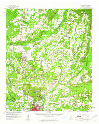
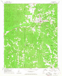
(121)- 1953 Map of Birmingham, 1964 Print
 1953 Birmingham1964 Print · USGSCentral Alabama at mid-century shows a landscape defined by industrial expansion and the iron-rich ridges surrounding Birmingham. Researchers can trace the extensive rail networks of the L & N RR or locate historic federal sites like the Anniston Ordnance Depot.4 unique versions available
 - 1953 Map of West Point, 1973 Print
 1953 West Point1973 Print · USGSNorth-Central Mississippi and the Alabama borderlands are captured here during the mid-twentieth century as new reservoirs and national forests transformed the landscape. Researchers can trace the path of the Mississippi & Skuna Valley railroad or locate old landings along the Tombigbee River and Schooner Creek.3 unique versions available
 - 1956 Map of Birmingham
 1956 Birmingham1956 Print · USGSCentral Alabama in the mid-fifties exhibits a landscape of growing cities and deep-rooted industrial corridors. Genealogists and historians can trace the development of suburban Mountain Brook or locate regional hubs like Sylacauga and Jasper.
 - 1956 Map of Gadsden, 1966 Print
 1956 Gadsden1966 Print · USGSNorth Alabama in the mid-1950s shows a region transformed by river engineering and federal industry. Genealogists and local historians can trace the development of the Tennessee Valley through the growth of Huntsville, the sprawling Redstone Arsenal, and the expansive Guntersville Lake.3 unique versions available
 - 1956 Map of Tupelo, 1967 Print
 1956 Tupelo1967 Print · USGSNortheast Mississippi and parts of Tennessee and Alabama are shown here during the mid-fifties, a time of major reservoir construction and forestry management. Researchers can trace the St Louis-San Francisco RR through Tupelo or locate historic sites like Tishomingo State Park and the University.2 unique versions available
 - 1957 Map of Birmingham
 1957 Birmingham1957 Print · USGSNorth-Central Alabama in the mid-fifties is an industrial powerhouse centered on the steel valleys and sprawling iron ridges. Genealogists and historians can trace the rail-linked growth of Birmingham and Tuscaloosa, or locate rural landmarks like Talladega College and the Anniston Ordnance Depot.
 - 1958 Map of Tupelo
 1958 Tupelo1958 Print · USGSNortheast Mississippi and neighboring Alabama and Tennessee appear here during the late fifties as a region defined by new reservoirs and historic rail lines. Genealogists can trace family locations near Sardis Lake, Woodall Mountain, and the St Louis-San Francisco Ry.
 - 1958 Map of West Point
 1958 West Point1958 Print · USGSNortheastern Mississippi and western Alabama are shown in the late 1950s, highlighting a region defined by its river-and-rail economy. Researchers can trace family roots through numerous settlements like Artesia and Vardaman or explore the corridor of the Tombigbee River.
 - 1958 Map of Gadsden
 1958 Gadsden1958 Print · USGSNorth Alabama comes alive in the late 1950s as the Tennessee Valley Authority’s massive river projects and the rise of the space industry reshaped the landscape. Researchers can trace the mid-century footprints of Huntsville, Redstone Arsenal, and the riverside rail networks of the Southern railroad.
 - 1960 Map of Gadsden
 1960 Gadsden1960 Print · USGSNorthern Alabama in the mid-1950s is defined by the mighty Tennessee River and its massive reservoirs. Trace the development of Huntsville and Redstone Arsenal or explore the vast William B Bankhead National Forest.2 unique versions available
 - 1960 Map of Caledonia, 1961 Print
 1960 Caledonia1961 Print · USGSThe Mississippi-Alabama borderlands in the early sixties reveal a landscape of growing military bases and traditional river commerce. Trace family roots through rural landmarks like Anderson Grove Sch, Waverly Ferry, and the rail lines serving Steens.2 unique versions available
 - 1963 Map of Gadsden
 1963 Gadsden1963 Print · USGSNorthern Alabama underwent a dramatic mid-century transformation as the Tennessee Valley became a hub for defense and industry. Researchers can trace the development of the Redstone Arsenal, the route of the Natchez Trace Parkway, and long-standing rail lines like the Southern Railway.
 - 1963 Map of West Point
 1963 West Point1963 Print · USGSEastern Mississippi and western Alabama are captured in the early sixties as industrial centers and rail lines connected the Black Prairie to the hills. Genealogists and historians can trace family-named watercourses and the early footprints of Starkville, Columbus, and the Noxubee National Wildlife Refuge.2 unique versions available
 - 1967 Map of Sulligent, 1968 Print
 1967 Sulligent1968 Print · USGSThe Alabama-Mississippi state line comes alive in the late 1960s, centered on the railroad hub of Sulligent. Genealogists and local historians can trace rural life through numerous family burial sites like Almon Cem and country churches such as Wesley Chapel.2 unique versions available
 - 1967 Map of Beaverton, 1968 Print
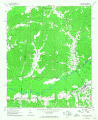
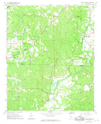
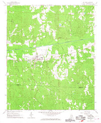
 1967 Beaverton1968 Print · USGSLamar County in the late sixties reveals a landscape shaped by the Buttahatchee River and the St Louis - San Francisco railroad. Genealogists can locate family landmarks like Spruiell Cem and Crews Ch, or trace old crossings at Hawkins Ford.2 unique versions available
 - 1967 Map of Hightogy, 1968 Print
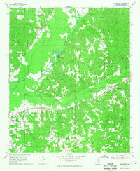
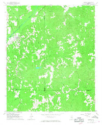
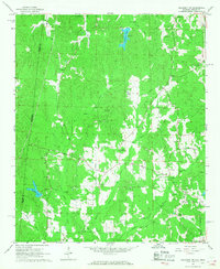
 1967 Hightogy1968 Print · USGSLamar County in the late sixties shows a landscape of dispersed crossroads and rural congregations. Genealogists can trace family names at sites like South Carolina Ch Cem, Walnut Grove Ch Cem, and the settlement of Kingville.3 unique versions available
 - 1967 Map of Kennedy, 1968 Print
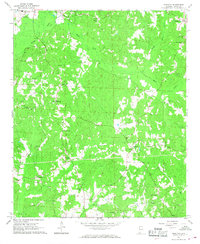
 1967 Kennedy1968 Print · USGSKennedy and the rural borderlands of Lamar, Fayette, and Pickens Counties are captured here in the late sixties as the SOUTHERN railroad still linked these upland communities. Genealogists can locate family landmarks like Moore Cem and Owens Cem or trace rural congregations at Wesley Chapel and Ashcraft Ch.2 unique versions available
 - 1967 Map of Henson Springs, 1968 Print
 1967 Henson Springs1968 Print · USGSMarion and Lamar Counties are captured in the late sixties, showing a landscape defined by the winding Buttahatchee River and rural settlement. Genealogists can trace family landmarks like the Henson Springs Cem, Ballard Ch Cem, and the Old Treaty Bdy.
 - 1967 Map of Bluff, 1968 Print
 1967 Bluff1968 Print · USGSFayette and Lamar counties are seen here in the late sixties, a period when rural church life and small schoolhouses anchored these Alabama communities. Researchers can trace family history through landmarks like Bethabara Ch, Kirkland Sch, and Powell Cem.3 unique versions available
 - 1967 Map of Hamilton SW, 1968 Print
 1967 Hamilton SW1968 Print · USGSMarion County during the late sixties is depicted here as a landscape of small settlements and emerging infrastructure. Genealogists and local historians can trace the locations of family landmarks like Donham Cem, Liberty Ch, and the community of Pikeville.2 unique versions available
 - 1967 Map of Millport, 1968 Print
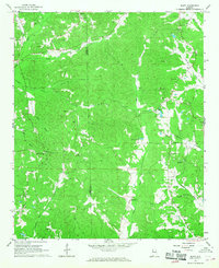
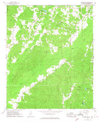
 1967 Millport1968 Print · USGSMillport and the surrounding Lamar County countryside are captured here in the late sixties, showing a landscape defined by the Southern railroad and small-town commerce. Genealogists can trace family roots through numerous local landmarks like Oddfellows Cem, Holly Grove Sch, and Macedonia Ch.2 unique versions available
 - 1967 Map of Sulligent SW, 1968 Print
 1967 Sulligent SW1968 Print · USGSThe Alabama-Mississippi borderlands in the late sixties reveal a landscape of creek-side communities and country churches. Genealogists can locate family landmarks like Taylor Cem and Bedford Sch, or trace the path of Watson Creek.2 unique versions available
 - 1967 Map of Millport NW, 1968 Print
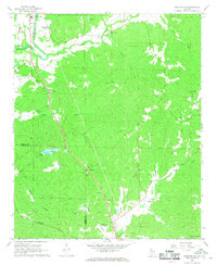
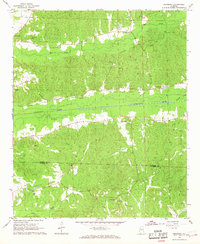
 1967 Millport NW1968 Print · USGSLamar County in the late 1960s was a rural landscape defined by tight-knit communities and winding creek valleys. Researchers can locate family landmarks like Lampkin Cem and Sailor Cem, or trace local history at the Lamar County Training Sch.3 unique versions available
 - 1967 Map of Fernbank, 1968 Print
 1967 Fernbank1968 Print · USGSThe rural borderlands of Lamar and Pickens counties are captured here in the late sixties, centered on the railroad town of Fernbank. Researchers can trace the SOUTHERN rail line and locate ancestral landmarks like Old Harmony Cem and Reeves Chapel.2 unique versions available
 - 1967 Map of Guin, 1968 Print
 1967 Guin1968 Print · USGSMarion County hill country centers on the town of Guin during the late sixties as the local economy balances rail transport and gravel mining. Researchers can trace rural lineages through numerous sites like Mount Olive Cem, Love Joy Ch, and Piney Grove Ch.
Showing maps 1-25 of 121
Top cities of Lamar County
- Vernon historical maps
- Sulligent historical maps
- Millport historical maps
- Kennedy historical maps
- Detroit historical maps
- Beaverton historical maps
Frequently asked questions
- What are the different types of historical maps available for Lamar County?
- What is the oldest map of Lamar County?
- Where can I purchase historical maps of Lamar County for my home or office?
- Where can I download high-res historical maps of Lamar County?
- Are there historical topographic maps available for Lamar County?
- Is there historical aerial imagery available for Lamar County?
- Where are historical maps of Lamar County sourced from?