Old Maps of Poplar Springs Branch, Alabama
Explore old maps of Poplar Springs Branch, spanning from 1914 to today. These high-resolution historic maps reveal how streets, neighborhoods, landmarks, and natural features evolved over time — perfect for genealogy, metal detecting, research, and local history exploration.
What you can do with these maps:
- See how Poplar Springs Branch changed over time: Compare historical maps to modern-day views to trace roads, homesites, rail lines & more.
- View detailed metadata: Each map includes creators, publishers, year, scale, and archive source.
- Overlay maps with satellite & LiDAR: Visualize the past alongside modern tools to explore terrain & human change.
- Trusted historical sources: Maps sourced from the USGS, Library of Congress, and other archives.
- Access maps your way: View online, download high-res files, or order prints for personal or research use.
Start exploring old maps of Poplar Springs Branch to uncover forgotten places, hidden landmarks, and the deep history beneath your feet.
Poplar Springs Branch, AL maps
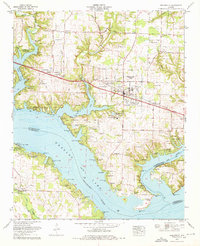
- 1914 Map of Rogersville
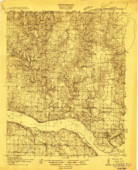 1914 Rogersville1914 Print · USGSBefore the Tennessee River was dammed and widened, this area supported a dense network of river-linked communities. Trace the legacy of early families through landmarks like Lambs Ferry, Mitchell Mill, and the many rural sites like Sweet Gum Church.
 - 1916 Map of Rogersville
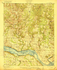 1916 Rogersville1916 Print · USGSLauderdale County was a landscape of river-driven commerce and rural crossroads in the decade before the Tennessee River was transformed. Researchers can trace ancestral locations through dozens of named sites like Lambs Ferry, Hurricane Church, and the Muscle Shoals Canal.2 unique versions available
 - 1936 Map of Thorntontown
 1936 Thorntontown1936 Print · USGSLauderdale County was undergoing a massive transformation in the mid-1930s as the Tennessee Valley Authority flooded the river basin. Researchers can trace the submerged geography of Former Islands or locate family sites like Fuqua Cem and Haraway Sch.
 - 1936 Map of Cairo
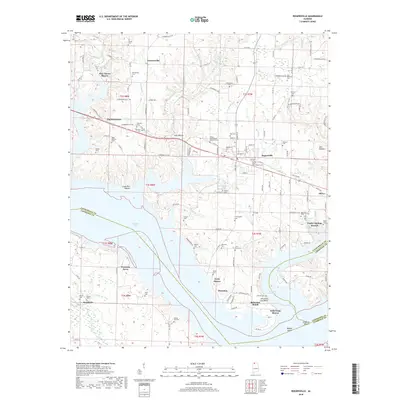
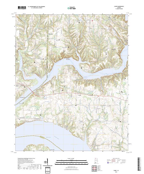
 1936 Cairo1936 Print · USGSLimestone County and the newly formed Wheeler Reservoir are captured here during a pivotal era of regional change. Researchers can trace the submerged Former Tennessee River and locate community sites like Coxey and Temperance Oak Sch.
 - 1950 Map of Cairo
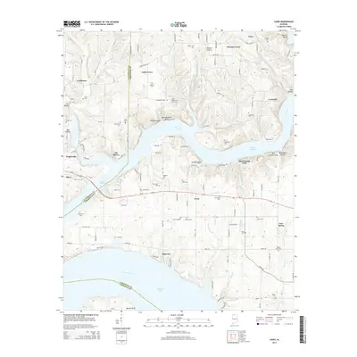
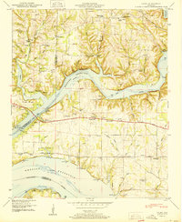 1950 Cairo1950 Print · USGSThe confluence of the Tennessee and Elk Rivers comes into focus during the late nineteen-forties as the Tennessee Valley Authority managed the developing shoreline. Genealogists can trace family names through Lentzville Cem, Confluence School, and Mt Carmel Church.4 unique versions available
 - 1952 Map of Rogersville, 1957 Print
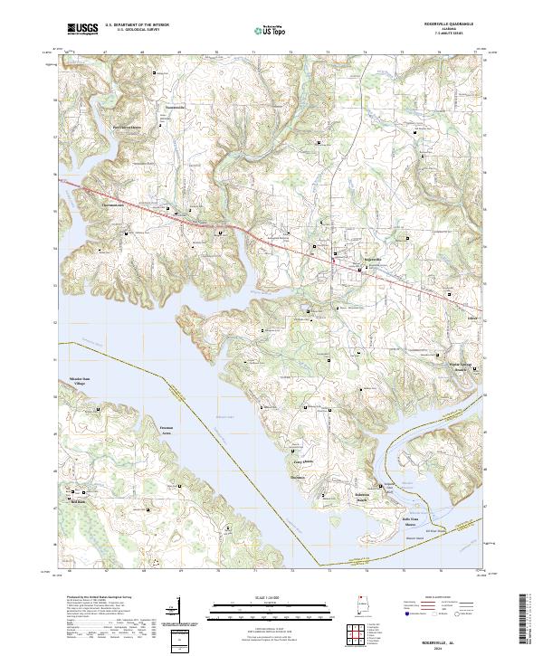
 1952 Rogersville1957 Print · USGSIn the early 1950s, the area around Rogersville, Alabama, was a landscape transformed by the Tennessee Valley Authority. Genealogists and historians can trace family locations through numerous rural burial grounds like McCartney Cem or visit Wheeler Dam Village and Thorntontown.2 unique versions available
 - 1956 Map of Gadsden, 1966 Print
 1956 Gadsden1966 Print · USGSNorth Alabama in the mid-1950s shows a region transformed by river engineering and federal industry. Genealogists and local historians can trace the development of the Tennessee Valley through the growth of Huntsville, the sprawling Redstone Arsenal, and the expansive Guntersville Lake.3 unique versions available
 - 1958 Map of Gadsden
 1958 Gadsden1958 Print · USGSNorth Alabama comes alive in the late 1950s as the Tennessee Valley Authority’s massive river projects and the rise of the space industry reshaped the landscape. Researchers can trace the mid-century footprints of Huntsville, Redstone Arsenal, and the riverside rail networks of the Southern railroad.
 - 1960 Map of Gadsden
 1960 Gadsden1960 Print · USGSNorthern Alabama in the mid-1950s is defined by the mighty Tennessee River and its massive reservoirs. Trace the development of Huntsville and Redstone Arsenal or explore the vast William B Bankhead National Forest.2 unique versions available
 - 1963 Map of Gadsden
 1963 Gadsden1963 Print · USGSNorthern Alabama underwent a dramatic mid-century transformation as the Tennessee Valley became a hub for defense and industry. Researchers can trace the development of the Redstone Arsenal, the route of the Natchez Trace Parkway, and long-standing rail lines like the Southern Railway.
 - 1974 Map of Rogersville, 1975 Print
 1974 Rogersville1975 Print · USGSThe Tennessee River and Elk River converge in Lauderdale County during the mid-seventies, a time of established lakeside communities. Researchers can trace family history through dozens of rural burial grounds like Romine Ch Cem and landmarks such as Saltpeter Cave Bluff.
 - 1986 Map of Tuscumbia
 1986 Tuscumbia1986 Print · USGSThe Tennessee River valley in the mid-1980s shows a landscape transformed by massive reservoirs and industrial hubs. Genealogists and local historians can trace the development of the Shoals area and locate rural communities like Tharp Town, Leighton, and Rogersville.3 unique versions available
 - 2011 Map of Rogersville, 2011 Print
 2011 Rogersville2011 Print · USGSCovers Poplar Springs Branch, including Rogersville, Freeman Acres, and other nearby areas
 - 2011 Map of Cairo, 2011 Print
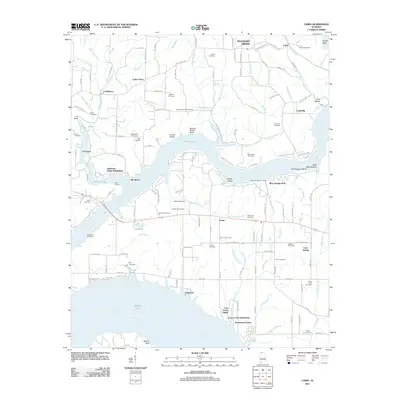 2011 Cairo2011 Print · USGSCovers Poplar Springs Branch, including Rogersville, Coxey, and other nearby areas
 - 2014 Map of Rogersville, 2014 Print
 2014 Rogersville2014 Print · USGSCovers Poplar Springs Branch, including Rogersville, Freeman Acres, and other nearby areas
 - 2014 Map of Cairo, 2014 Print
 2014 Cairo2014 Print · USGSCovers Poplar Springs Branch, including Rogersville, Coxey, and other nearby areas
 - 2018 Map of Rogersville, 2018 Print
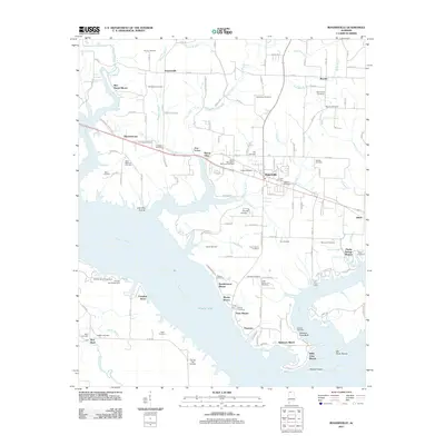
 2018 Rogersville2018 Print · USGSCovers Poplar Springs Branch, including Rogersville, Freeman Acres, and other nearby areas
 - 2018 Map of Cairo, 2018 Print
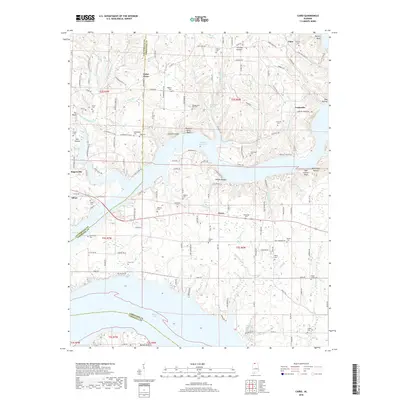 2018 Cairo2018 Print · USGSCovers Poplar Springs Branch, including Rogersville, Coxey, and other nearby areas
 - 2020 Map of Cairo, 2020 Print
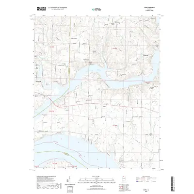 2020 Cairo2020 Print · USGSCovers Poplar Springs Branch, including Rogersville, Coxey, and other nearby areas
 - 2020 Map of Rogersville, 2020 Print
 2020 Rogersville2020 Print · USGSCovers Poplar Springs Branch, including Rogersville, Freeman Acres, and other nearby areas
 - 2024 Map of Cairo, 2024 Print
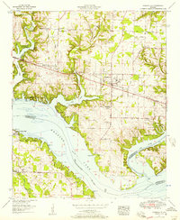
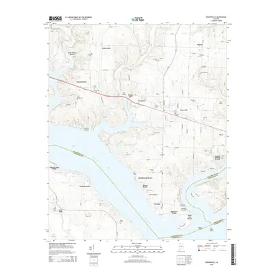
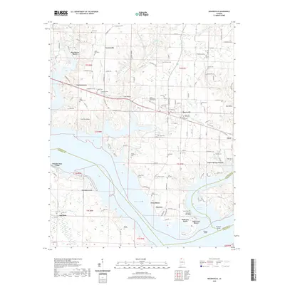
 2024 Cairo2024 Print · USGSLimestone County at the dawn of the 2020s shows a landscape deeply tied to the Tennessee River and its many winding tributaries. Genealogists and local historians can trace family locations through numerous sites like Bedingfield Ferry, Lentzville, and the Barker Cem.
 - 2024 Map of Rogersville, 2024 Print
 2024 Rogersville2024 Print · USGSThe northern banks of the Tennessee River near Rogersville come to life in this modern topographic study. Genealogists can trace dozens of local burial sites like Old Romine Cem and James Whitehead Cem alongside waterfront locales like Ferry Shores.
End of results
Showing maps 1-22
Top cities near Poplar Springs Branch
- Decatur historical maps
- Athens historical maps
- Trinity historical maps
- Rogersville historical maps
- Town Creek historical maps
- Lexington historical maps
See more
Frequently asked questions
- What are the different types of historical maps available for Poplar Springs Branch?
- What is the oldest map of Poplar Springs Branch?
- Where can I purchase historical maps of Poplar Springs Branch for my home or office?
- Where can I download high-res historical maps of Poplar Springs Branch?
- Are there historical topographic maps available for Poplar Springs Branch?
- Is there historical aerial imagery available for Poplar Springs Branch?
- Where are historical maps of Poplar Springs Branch sourced from?