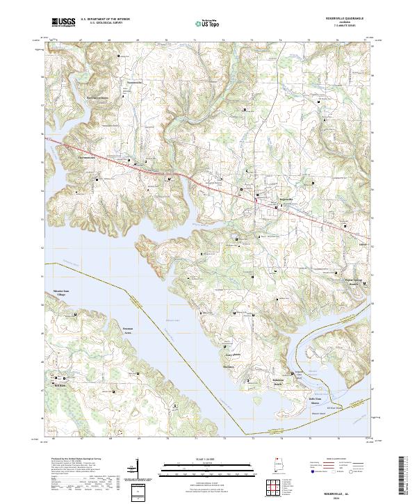
2024 Map of Rogersville
USGS Topo · Published 2024About this map
Rogersville serves as the focal point of this North Alabama landscape, situated just north of the expansive Tennessee River and the waters of Wheeler Lake. The area is densely marked with family and community burial grounds, including the Old Romine Cem, James Whitehead Cem, and the Dean - McNairy Cem, providing a deep genealogical record for the region. Shoreline communities such as Thornton, Ferry Shores, and Pine Haven Shores line the northern banks of the reservoir, while the southern reaches across the Wheeler Reservoir transition into Lawrence County. Notable geological and water features define the southern boundary, specifically the Saltpeter Cave Bluff and the submerged Elk River Shoals. The map also details early-established settlements like Thorntontown and Toonersville, connected by a network of Lauderdale County roads that navigate the numerous branches and creeks feeding into the main river system.
Find a feature on this map
129 named features on this map. Tap any name to fly to it.
Don’t see what you’re looking for? This feature index may not catch every label — zoom into the map to look around manually.
Map Details
Editions of this 2024 Rogersville Map
This is the sole edition of this map. No revisions or reprints were ever made.
Other maps of this area

1914 · Rogersville
USGS Topo · 1:48,000

1916 · Rogersville
USGS Topo · 1:62,500

1936 · Union Hill
USGS Topo · 1:24,000

1936 · Thorntontown
USGS Topo · 1:24,000

1936 · Courtland
USGS Topo · 1:24,000

1936 · Lexington
USGS Topo · 1:24,000

1936 · Hillsboro
USGS Topo · 1:24,000

1936 · Wheeler Dam
USGS Topo · 1:24,000

1936 · Town Creek
USGS Topo · 1:24,000
1936 · Center Hill
USGS Topo · 1:24,000