1900s (20th Century) Maps of Smiths Station, Alabama
Explore 14 historic maps of Smiths Station from the 1900s (20th Century). These maps offer a rare glimpse into what life looked like during the 1900s — showing old roads, neighborhoods, homes, and landmarks that have changed or disappeared over time.
Whether you're researching your family's past, planning a metal detecting trip, or studying how Smiths Station's landscape evolved across the 1900s, these high-resolution maps are a powerful tool for exploring the history of this region.
- Focus on a specific era: All maps on this page are from the 1900s, giving you a focused view of this time period.
- See what’s changed: Compare century-old streets, trails, and buildings to today's modern landscape using overlays and satellite layers.
- Research with precision: Use these maps for genealogy, historical research, land use analysis, or educational projects.
- View, download, or print: Maps are fully viewable online in high resolution, and can be downloaded or printed for your own records.
Start exploring Smiths Station's history through authentic maps from the 1900s. This is your window into the past.
Smiths Station, AL maps
(14)- 1907 Map of Opelika, 1963 Print
 1907 Opelika1963 Print · USGSEastern Alabama and western Georgia come alive in this early 1900s survey of the rail-and-river economy. Genealogists can trace family names at Mitchell Crossroads, find rural landmarks like the Poor Farm, and locate historic river crossings like Dixon Ferry.
 - 1909 Map of Opelika
 1909 Opelika1909 Print · USGSEastern Alabama and western Georgia are seen here in the first decade of the twentieth century as the river-and-rail economy reached its peak. Genealogists and historians can trace old river crossings like Blanton Ferry, rural post offices such as Antioch Church Huckabee P O, and the path of the Chattahoochee Valley railroad.4 unique versions available
 - 1914 Map of Seale
 1914 Seale1914 Print · USGSRussell County's agricultural and railroad landscape is meticulously documented just before the First World War. Genealogists can trace family connections through local landmarks like Kite School, the community of Sand Fort, and historical river crossings like Perrys Ford.6 unique versions available
 - 1950 Map of Phenix City, 1954 Print
 1950 Phenix City1954 Print · USGSPhenix City and Girard are captured here in the early fifties, showing a dense community of schools, churches, and industry along the Georgia border. Genealogists can trace family landmarks like the Carmichael Cemetery, St Pauls Church, and the settlement at Ladonia.2 unique versions available
 - 1950 Map of Seale, 1955 Print
 1950 Seale1955 Print · USGSRussell County during the mid-century shows a landscape of small farming communities and expanding military boundaries. Genealogists can trace family roots through numerous rural landmarks like Evans Cem, Hillside Chapel, and the Brickyard Sch.
 - 1955 Map of Phenix City, 1959 Print
 1955 Phenix City1959 Print · USGSThe mid-century landscape of Russell County reveals the growth of Phenix City and the industrial activity at Kaolin. Genealogists and historians can trace numerous rural landmarks, from Friendship Cemetery and Uchee Hill Church to the legacy of Mother Mary Mission.5 unique versions available
 - 1955 Map of Seale, 1961 Print
 1955 Seale1961 Print · USGSEast Alabama in the mid-1950s was a landscape of river-bend settlements and deep-rooted rural communities. Genealogists can trace family landmarks and historic sites like Fort Mitchell, St Matthews Ch, and the long-standing Oswichee post office.
 - 1955 Map of Phenix City, 1964 Print
 1955 Phenix City1964 Print · USGSPost-war Alabama and Georgia meet along the Chattahoochee River as industry and military installations expand. Trace the rail lines of the Central of Georgia through towns like Opelika, Tuskegee, and Alexander City.3 unique versions available
 - 1957 Map of Phenix City
 1957 Phenix City1957 Print · USGSThe Alabama-Georgia borderlands are captured here in the mid-fifties, centered on the bustling river crossing at Phenix City and Columbus. Researchers can trace the mid-century footprint of the Fort Benning Military Reservation or locate smaller textile and railroad towns like Langdale and Camp Hill.
 - 1958 Map of Phenix City
 1958 Phenix City1958 Print · USGSThe Alabama-Georgia borderlands thrive during the late fifties, anchored by the river-driven industry of Columbus and Phenix City. Researchers can trace the mid-century footprints of Fort Benning, Auburn, and the textile towns of Fairfax and Lanett.
 - 1965 Map of Bleecker, 1966 Print
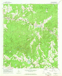 1965 Bleecker1966 Print · USGSEast of Opelika in the mid-sixties, this area shows a landscape of creek-side industry and quiet rural crossroads. Genealogists and historians can locate the Covered Bridge, Moffits Mill, and several community anchors like New Hope Ch and Stroud Cem.3 unique versions available
 - 1965 Map of Smiths, 1967 Print
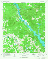 1965 Smiths1967 Print · USGSThe Alabama-Georgia borderlands along the Chattahoochee River are captured here in the mid-sixties as hydroelectric dams reshaped the valley. Trace the growth of Smiths and Monterey Heights or locate family sites at Mt Zion Cem and Union Grove Ch.3 unique versions available
 - 1981 Map of Opelika, 1982 Print
 1981 Opelika1982 Print · USGSEast Alabama and West Georgia appear in the early 1980s as a region defined by massive river reservoirs and the storied textile corridor. Genealogists can trace family roots through the valley towns of Lanett and Fairfax or locate sites near Horseshoe Bend National Military Park.
 - 1981 Map of Tuskegee, 1982 Print
 1981 Tuskegee1982 Print · USGSMacon and Bullock counties are captured here in the early eighties, showcasing a landscape deeply tied to the railroad and the legacies of Tuskegee Institute. Researchers can locate specific sites from Moton Field to rural settlements along the Seaboard Coast Line like Hurtsboro and Pittsview.2 unique versions available
End of results
Showing maps 1-14 of 14
Top cities near Smiths Station
- Columbus historical maps
- Phenix City historical maps
- Opelika historical maps
- Valley historical maps
- Ladonia historical maps
- Hamilton historical maps
Top neighborhoods of Smiths Station
Frequently asked questions
- What are the different types of historical maps available for Smiths Station?
- What is the oldest map of Smiths Station?
- Where can I purchase historical maps of Smiths Station for my home or office?
- Where can I download high-res historical maps of Smiths Station?
- Are there historical topographic maps available for Smiths Station?
- Is there historical aerial imagery available for Smiths Station?
- Where are historical maps of Smiths Station sourced from?