Old Maps of Mount Sinai, Alabama for Genealogy
Trace your family roots with 14 historic maps of Mount Sinai. These high-res maps reveal old neighborhoods, homesites, landmarks, and streets — helping you uncover where your ancestors lived and how the area evolved over time.
- Explore historic neighborhoods: Identify where your relatives may have lived in the 1800s or 1900s.
- Compare maps over time: Trace the changes in streets, buildings, and landmarks for multi-generational research.
- Perfect for genealogy & ancestry research: Used by family historians and researchers to map out lineage and migration.
These maps are an incredible resource for exploring your personal connection to Mount Sinai's past.
Mount Sinai, AL maps
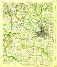
(14)- 1927 Map of Montgomery
 1927 Montgomery1927 Print · USGSThe Alabama state capital and its river-bend surroundings are seen here in the late twenties during a period of growth. Researchers can trace the footprints of Maxwell Aviation Field, the Masonic Home, and rural sites like Stones Cem.
 - 1930 Map of Montgomery
 1930 Montgomery1930 Print · USGSThe Alabama state capital is seen here as a bustling rail and river crossroads in the late twenties. Trace the historic growth of the city and its surrounding rural communities through sites like Maxwell Aviation Field, Kilby Prison, and Oakwood Cemetery.4 unique versions available
 - 1953 Map of Montgomery, 1964 Print
 1953 Montgomery1964 Print · USGSCentral Alabama's river-and-rail corridor is mapped here in the mid-fifties, showing the vital connections between the capital and the Black Belt. Genealogists and historians can trace rail depots and crossroads from Marion Junction to Wetumpka, alongside landmarks like Craig AFB.4 unique versions available
 - 1956 Map of Montgomery
 1956 Montgomery1956 Print · USGSCentral Alabama in the mid-1950s shows a landscape defined by its great river systems and a booming military aviation presence. Genealogists and historians can trace the rail corridors of the Southern Railway and locate tactical bases like Maxwell AFB and Craig AFB.
 - 1957 Map of Montgomery
 1957 Montgomery1957 Print · USGSCentral Alabama in the mid-fifties is defined by the winding Alabama River and a strategic network of military bases and rail lines. Trace family roots in Montgomery and Selma, or locate landmarks like Craig AFB and the State Capitol before the interstate era.
 - 1958 Map of Montgomery, 1959 Print
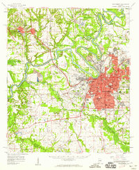 1958 Montgomery1959 Print · USGSThe state capital and its surrounding river bends are captured here during the late fifties, a period of significant military and urban growth. Researchers can trace historic institutions like Alabama State College and the extensive grounds of Maxwell Air Force Base.2 unique versions available
 - 1975 Map of Montgomery SW, 1977 Print
 1975 Montgomery SW1977 Print · USGSSouthwest of the state capital in the mid-seventies, this aerial view captures the rural-urban fringe as it transitioned from traditional farmland to modern infrastructure. Researchers can trace the winding course of the Alabama River and examine the intricate field patterns and roadways that defined the region at the time.
 - 1981 Map of Cantelous, 1982 Print
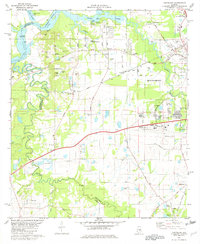 1981 Cantelous1982 Print · USGSSouthwest of Montgomery in the early eighties, this area showcases a landscape defined by military aviation and rural junctions. Genealogists and historians can trace the foundations of Dannelly Field and local settlements like Antioch and Mt Sinai.2 unique versions available
 - 1986 Map of Montgomery
 1986 Montgomery1986 Print · USGSCentral Alabama's river-and-rail corridor is captured in the mid-1980s, centered on the state capital and its surrounding rural counties. Researchers can trace ancestral landmarks like Oakwood Cemetery, military sites like Maxwell Air Force Base, and small towns such as Lowndesboro.2 unique versions available
 - 2011 Map of Cantelous, 2011 Print
 2011 Cantelous2011 Print · USGSCovers Mount Sinai, including Montgomery, Brewer Estates, and other nearby areas
 - 2014 Map of Cantelous, 2014 Print
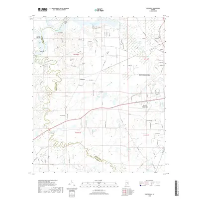
 2014 Cantelous2014 Print · USGSCovers Mount Sinai, including Montgomery, Brewer Estates, and other nearby areas
 - 2018 Map of Cantelous, 2018 Print
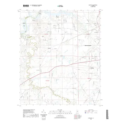
 2018 Cantelous2018 Print · USGSCovers Mount Sinai, including Montgomery, Brewer Estates, and other nearby areas
 - 2020 Map of Cantelous, 2020 Print
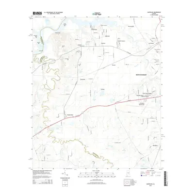
 2020 Cantelous2020 Print · USGSCovers Mount Sinai, including Montgomery, Brewer Estates, and other nearby areas
 - 2024 Map of Cantelous, 2024 Print
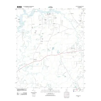
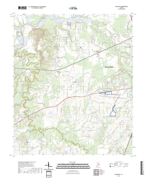 2024 Cantelous2024 Print · USGSThe outskirts of Montgomery come into focus in 2024, showing the balance between suburban expansion and the river-bottom lands of the Alabama River. Genealogists can trace family names at Stones Cem, Cantelous Cem, and Kindle Baptist Church & Memorial Cem.
End of results
Showing maps 1-14 of 14
Top cities near Mount Sinai
- Montgomery historical maps
- Prattville historical maps
- Millbrook historical maps
- Wetumpka historical maps
- Elmore historical maps
- Coosada historical maps
See more
Frequently asked questions
- What are the different types of historical maps available for Mount Sinai?
- What is the oldest map of Mount Sinai?
- Where can I purchase historical maps of Mount Sinai for my home or office?
- Where can I download high-res historical maps of Mount Sinai?
- Are there historical topographic maps available for Mount Sinai?
- Is there historical aerial imagery available for Mount Sinai?
- Where are historical maps of Mount Sinai sourced from?