Old Maps of Talucah, Alabama for Genealogy
Trace your family roots with 17 historic maps of Talucah. These high-res maps reveal old neighborhoods, homesites, landmarks, and streets — helping you uncover where your ancestors lived and how the area evolved over time.
- Explore historic neighborhoods: Identify where your relatives may have lived in the 1800s or 1900s.
- Compare maps over time: Trace the changes in streets, buildings, and landmarks for multi-generational research.
- Perfect for genealogy & ancestry research: Used by family historians and researchers to map out lineage and migration.
These maps are an incredible resource for exploring your personal connection to Talucah's past.
Talucah, AL maps
(17)- 1888 Map of Huntsville
 1888 Huntsville1888 Print · USGSMadison and Limestone counties in the late 1880s showcase a landscape defined by the Tennessee River and major early rail lines. Researchers can trace the layout of Huntsville or locate long-standing communities like Mooresville and Thompsons Mill.
 - 1892 Map of Huntsville
 1892 Huntsville1892 Print · USGSNorth Alabama was a landscape of river ferries and rising rail hubs in the 1890s, caught here just as the region's industry began to modernize. Researchers can locate vanished landmarks like the Monte Sano Hotel and trace old family-named sites from Thompsons Mill to Lemans Ferry.6 unique versions available
 - 1936 Map of Triana
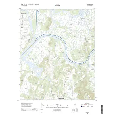
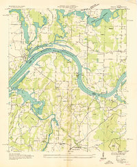 1936 Triana1936 Print · USGSThe Tennessee River bend near the Madison and Morgan county line is captured here just as the Tennessee Valley Authority era began. Researchers can trace the layout of early rural school districts like Horton Sch and Union Sch or locate congregations at Mt Mariah Ch and Talucah Ch.
 - 1948 Map of Triana, 1963 Print
 1948 Triana1963 Print · USGSThe Tennessee River valley in the late 1940s reveals the massive military footprint of Huntsville Arsenal alongside traditional river life. Researchers can trace historic family burial sites like Draper Cem and Grantland Cem or locate the rural crossroads at Talucah and Winton.
 - 1951 Map of Triana
 1951 Triana1951 Print · USGSThe Tennessee River valley at the mid-century shows a landscape transitioning between its rural roots and the growth of the Huntsville area. Researchers can trace historic family landmarks such as Draper Cem and Leadus Sch near the river's edge.2 unique versions available
 - 1956 Map of Gadsden, 1966 Print
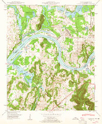
 1956 Gadsden1966 Print · USGSNorth Alabama in the mid-1950s shows a region transformed by river engineering and federal industry. Genealogists and local historians can trace the development of the Tennessee Valley through the growth of Huntsville, the sprawling Redstone Arsenal, and the expansive Guntersville Lake.3 unique versions available
 - 1958 Map of Gadsden
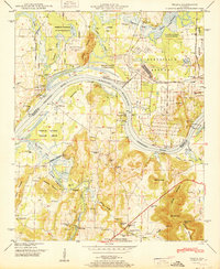
 1958 Gadsden1958 Print · USGSNorth Alabama comes alive in the late 1950s as the Tennessee Valley Authority’s massive river projects and the rise of the space industry reshaped the landscape. Researchers can trace the mid-century footprints of Huntsville, Redstone Arsenal, and the riverside rail networks of the Southern railroad.
 - 1960 Map of Gadsden
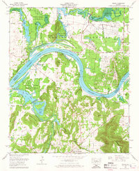
 1960 Gadsden1960 Print · USGSNorthern Alabama in the mid-1950s is defined by the mighty Tennessee River and its massive reservoirs. Trace the development of Huntsville and Redstone Arsenal or explore the vast William B Bankhead National Forest.2 unique versions available
 - 1963 Map of Gadsden
 1963 Gadsden1963 Print · USGSNorthern Alabama underwent a dramatic mid-century transformation as the Tennessee Valley became a hub for defense and industry. Researchers can trace the development of the Redstone Arsenal, the route of the Natchez Trace Parkway, and long-standing rail lines like the Southern Railway.
 - 1964 Map of Triana, 1965 Print
 1964 Triana1965 Print · USGSThe Tennessee River corridor south of Huntsville shows a mix of military expansion and rural tradition in the 1960s. Researchers can locate family landmarks such as Lynch Cem, St Thomas Ch, and the riverside Triana Landing.2 unique versions available
 - 1984 Map of Huntsville, 1986 Print
 1984 Huntsville1986 Print · USGSNorthern Alabama and the Tennessee borderlands are captured in the mid-eighties as Huntsville and the Redstone Arsenal expand. Researchers can trace rural landmarks from Woodlin Mill to the Cumberland Plateau and old rail lines like the Southern.3 unique versions available
 - 2011 Map of Triana, 2011 Print
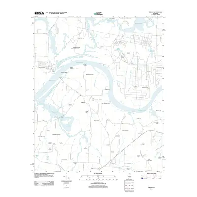 2011 Triana2011 Print · USGSCovers Talucah, including Huntsville, Triana, and other nearby areas
 - 2014 Map of Triana, 2014 Print
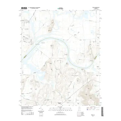 2014 Triana2014 Print · USGSCovers Talucah, including Huntsville, Triana, and other nearby areas
 - 2018 Map of Triana, 2018 Print
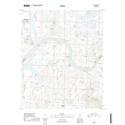 2018 Triana2018 Print · USGSCovers Talucah, including Huntsville, Triana, and other nearby areas
 - 2020 Map of Triana, 2020 Print
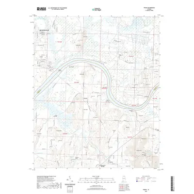 2020 Triana2020 Print · USGSCovers Talucah, including Huntsville, Triana, and other nearby areas
 - 2024 Map of Triana, 2024 Print
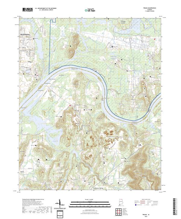 2024 Triana2024 Print · USGSThe Tennessee River corridor south of Huntsville remains a land of historic ferries and family homesteads. Genealogists can trace local roots through numerous sites like New Triana Cem, Draper Cemetery Number 1, and the old river crossings at Slaughter Ferry or Talucah Ferry.
 - 2026 Map of Triana, 2026 Print
 2026 Triana2026 Print · USGSCovers Talucah, including Huntsville, Triana, and other nearby areas
End of results
Showing maps 1-17 of 17
Top cities near Talucah
- Huntsville historical maps
- Decatur historical maps
- Madison historical maps
- Athens historical maps
- Hartselle historical maps
- Arab historical maps
See more
Frequently asked questions
- What are the different types of historical maps available for Talucah?
- What is the oldest map of Talucah?
- Where can I purchase historical maps of Talucah for my home or office?
- Where can I download high-res historical maps of Talucah?
- Are there historical topographic maps available for Talucah?
- Is there historical aerial imagery available for Talucah?
- Where are historical maps of Talucah sourced from?