1980s Maps of Pickens County, Alabama
Explore 8 historic maps of Pickens County from the 1980s. These maps offer a rare glimpse into what life looked like during the 1980s — showing old roads, neighborhoods, homes, and landmarks that have changed or disappeared over time.
Whether you're researching your family's past, planning a metal detecting trip, or studying how Pickens County's landscape evolved across the 1980s, these high-resolution maps are a powerful tool for exploring the history of this region.
- Focus on a specific era: All maps on this page are from the 1980s, giving you a focused view of this time period.
- See what’s changed: Compare century-old streets, trails, and buildings to today's modern landscape using overlays and satellite layers.
- Research with precision: Use these maps for genealogy, historical research, land use analysis, or educational projects.
- View, download, or print: Maps are fully viewable online in high resolution, and can be downloaded or printed for your own records.
Start exploring Pickens County's history through authentic maps from the 1980s. This is your window into the past.
Pickens County, AL maps
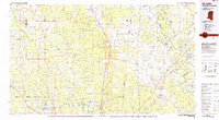
(8)- 1982 Map of West Point, 1983 Print
 1982 West Point1983 Print · USGSEastern Mississippi and western Alabama are captured in the early eighties as the river-and-rail economy evolved. Trace family roots and old township lines near West Point, Columbus Air Force Base, and the historic Natchez Trace Parkway.
 - 1984 Map of De Kalb
 1984 De Kalb1984 Print · USGSThe Mississippi-Alabama borderlands come into focus in the 1980s, where the river-and-rail economy meets military and tribal lands. Researchers can trace rural lineages across the Choctaw Indian Reservation or through the rail towns of Scooba and De Kalb.2 unique versions available
 - 1984 Map of West Point
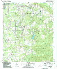
 1984 West Point1984 Print · USGSNorth-Central Mississippi in the mid-eighties shows a landscape defined by massive water management projects and dense timberlands. Researchers can trace the legacy of rural settlements like Geeslin Corner or the rail corridors of the Illinois Central Gulf RR near Grenada Lake.3 unique versions available
 - 1984 Map of Tuscaloosa, 1985 Print
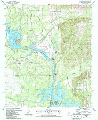
 1984 Tuscaloosa1985 Print · USGSWest-central Alabama centers on the mid-1980s expansion of the university and the river economy. Genealogists and historians can trace small-town connections through Burchfield Store, North Johns, and the rail lines of the Southern railroad.2 unique versions available
 - 1984 Map of Jasper, 1985 Print
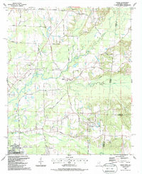
 1984 Jasper1985 Print · USGSIn the mid-1980s, the Walker County coalfields were a complex web of rail lines and river terminals. Researchers can trace the industrial heritage of the Mulberry Fork and locate local landmarks like the Carbon Hill National Fish Hatchery or Saragossa Ch.2 unique versions available
 - 1987 Map of New Hope
 1987 New Hope1987 Print · USGSThe Mississippi-Alabama borderlands in the late eighties show a landscape of rural communities and industrial pockets. Trace local family roots through numerous landmarks like Beersheba Cumberland Ch, Marrshs Chapel, and the Abandoned Landing Field.
 - 1987 Map of Forreston
 1987 Forreston1987 Print · USGSThe Mississippi and Alabama borderlands appear here in the late 1980s, just as the river system was being reshaped by the Tennessee-Tombigbee project. Local researchers can trace family roots through Mt Avery Ch, Toliver Cem, and the rural settlement of Forreston.
 - 1987 Map of Steens
 1987 Steens1987 Print · USGSSteens and the surrounding Lowndes County borderlands are shown in the late eighties as a landscape of rural churches and winding creeks. Genealogists can trace family landmarks like Anderson Grove Sch, New Zion Ch, and Piney Grove Cem along the Southern Railway.
End of results
Showing maps 1-8 of 8
Top cities of Pickens County
- Aliceville historical maps
- Gordo historical maps
- Reform historical maps
- Carrollton historical maps
- Pickensville historical maps
- Macedonia historical maps
See more
Frequently asked questions
- What are the different types of historical maps available for Pickens County?
- What is the oldest map of Pickens County?
- Where can I purchase historical maps of Pickens County for my home or office?
- Where can I download high-res historical maps of Pickens County?
- Are there historical topographic maps available for Pickens County?
- Is there historical aerial imagery available for Pickens County?
- Where are historical maps of Pickens County sourced from?