Old Maps of Pickens County, Alabama
Explore 172 old maps of Pickens County, spanning from 1953 to today. These high-resolution historic maps reveal how streets, neighborhoods, landmarks, and natural features evolved over time — perfect for genealogy, metal detecting, research, and local history exploration.
What you can do with these maps:
- See how Pickens County changed over time: Compare historical maps to modern-day views to trace roads, homesites, rail lines & more.
- View detailed metadata: Each map includes creators, publishers, year, scale, and archive source.
- Overlay maps with satellite & LiDAR: Visualize the past alongside modern tools to explore terrain & human change.
- Trusted historical sources: Maps sourced from the USGS, Library of Congress, and other archives.
- Access maps your way: View online, download high-res files, or order prints for personal or research use.
Start exploring old maps of Pickens County to uncover forgotten places, hidden landmarks, and the deep history beneath your feet.
Pickens County, AL maps
(172)- 1953 Map of Birmingham, 1964 Print
 1953 Birmingham1964 Print · USGSCentral Alabama at mid-century shows a landscape defined by industrial expansion and the iron-rich ridges surrounding Birmingham. Researchers can trace the extensive rail networks of the L & N RR or locate historic federal sites like the Anniston Ordnance Depot.4 unique versions available
 - 1953 Map of Meridian, 1966 Print
 1953 Meridian1966 Print · USGSEast Central Mississippi and the Alabama borderlands are captured here during a period of steady growth and infrastructure expansion. Genealogists and historians can trace rail-town development along the Gulf Mobile & Ohio Railroad and find early settlements like Scooba, Pelahatchie, and De Kalb.2 unique versions available
 - 1953 Map of West Point, 1973 Print
 1953 West Point1973 Print · USGSNorth-Central Mississippi and the Alabama borderlands are captured here during the mid-twentieth century as new reservoirs and national forests transformed the landscape. Researchers can trace the path of the Mississippi & Skuna Valley railroad or locate old landings along the Tombigbee River and Schooner Creek.3 unique versions available
 - 1956 Map of Birmingham
 1956 Birmingham1956 Print · USGSCentral Alabama in the mid-fifties exhibits a landscape of growing cities and deep-rooted industrial corridors. Genealogists and historians can trace the development of suburban Mountain Brook or locate regional hubs like Sylacauga and Jasper.
 - 1957 Map of Birmingham
 1957 Birmingham1957 Print · USGSNorth-Central Alabama in the mid-fifties is an industrial powerhouse centered on the steel valleys and sprawling iron ridges. Genealogists and historians can trace the rail-linked growth of Birmingham and Tuscaloosa, or locate rural landmarks like Talladega College and the Anniston Ordnance Depot.
 - 1957 Map of Meridian
 1957 Meridian1957 Print · USGSEast Central Mississippi and parts of Western Alabama come alive in the mid-1950s, centered on the transit hub of Meridian. Researchers can trace old rail lines like the Illinois Central and find historic sites such as the Choctaw Indian Reservation and Roosevelt State Park.
 - 1958 Map of West Point
 1958 West Point1958 Print · USGSNortheastern Mississippi and western Alabama are shown in the late 1950s, highlighting a region defined by its river-and-rail economy. Researchers can trace family roots through numerous settlements like Artesia and Vardaman or explore the corridor of the Tombigbee River.
 - 1960 Map of Caledonia, 1961 Print
 1960 Caledonia1961 Print · USGSThe Mississippi-Alabama borderlands in the early sixties reveal a landscape of growing military bases and traditional river commerce. Trace family roots through rural landmarks like Anderson Grove Sch, Waverly Ferry, and the rail lines serving Steens.2 unique versions available
 - 1960 Map of Columbus, 1961 Print
 1960 Columbus1961 Print · USGSThe Tombigbee River valley at the start of the 1960s shows a landscape of river-bend farms and rural communities centered around family churches and schools. Researchers can trace historic river crossings like the Nashville Ferry or locate ancestral sites at St Mathis Cem and Plum Grove Sch.2 unique versions available
 - 1963 Map of West Point
 1963 West Point1963 Print · USGSEastern Mississippi and western Alabama are captured in the early sixties as industrial centers and rail lines connected the Black Prairie to the hills. Genealogists and historians can trace family-named watercourses and the early footprints of Starkville, Columbus, and the Noxubee National Wildlife Refuge.2 unique versions available
 - 1965 Map of Meridian
 1965 Meridian1965 Print · USGSEast Mississippi and West Alabama are mapped here in the mid-sixties as the region's modern highway and reservoir systems began to take shape. Researchers can trace rural lineages through local landmarks like Prince Chapel and Tuscahoma Landing, or follow the historic Gulf Mobile & Ohio rail lines.
 - 1966 Map of Ethelsville, 1968 Print
 1966 Ethelsville1968 Print · USGSWestern Pickens County in the mid-sixties remains a landscape defined by the Gulf Mobile and Ohio rail line and its string of rural settlements. Genealogists can locate family landmarks like Strawbridge Cem, Liberty Sch, and Martin Cem.3 unique versions available
 - 1966 Map of Reform SW, 1968 Print
 1966 Reform SW1968 Print · USGSPickens County, Alabama, is documented here in the mid-sixties, showing a landscape defined by small rural congregations and creek drainages. Genealogists and local historians can locate the County Training Sch, Big Creek Cem, and several local churches like Spring Hill Ch.2 unique versions available
 - 1967 Map of Carrollton
 1967 Carrollton1967 Print · USGSPickens County comes into focus during the late sixties as the regional rail and road networks centered on Carrollton matured. Researchers can trace family history through sites like Cockrell Cem, New Providence Ch, and the old ICG railroad corridor.3 unique versions available
 - 1967 Map of Brownville, 1968 Print
 1967 Brownville1968 Print · USGSThe rural border of Pickens and Tuscaloosa Counties is documented here in the late sixties, showcasing a landscape of river-bottom wetlands and timbered ridges. Genealogists can locate numerous community landmarks like Shelton Chapel, Winn Cem, and the Old Railroad Grade.2 unique versions available
 - 1967 Map of Newtonville, 1968 Print
 1967 Newtonville1968 Print · USGSThe rural borderlands of Fayette and Tuscaloosa counties are captured here in the late sixties, centered on the community of Newtonville. Genealogists can trace family landmarks and burial sites like Brotherton Cemetery and Gravlee Cemetery or locate the Newtonville School.3 unique versions available
 - 1967 Map of Kennedy, 1968 Print
 1967 Kennedy1968 Print · USGSKennedy and the rural borderlands of Lamar, Fayette, and Pickens Counties are captured here in the late sixties as the SOUTHERN railroad still linked these upland communities. Genealogists can locate family landmarks like Moore Cem and Owens Cem or trace rural congregations at Wesley Chapel and Ashcraft Ch.2 unique versions available
 - 1967 Map of Gordo, 1968 Print
 1967 Gordo1968 Print · USGSIn late 1960s Pickens County, the town of Gordo and the settlement of Lathrop stood at a crossroads of rail history and modern highway expansion. Researchers can trace numerous family-named landmarks like Arbor Springs Ch, Linebarger Cem, and the Lathrop Lookout Tower.2 unique versions available
 - 1967 Map of Millport, 1968 Print
 1967 Millport1968 Print · USGSMillport and the surrounding Lamar County countryside are captured here in the late sixties, showing a landscape defined by the Southern railroad and small-town commerce. Genealogists can trace family roots through numerous local landmarks like Oddfellows Cem, Holly Grove Sch, and Macedonia Ch.2 unique versions available
 - 1967 Map of Palmetto, 1968 Print
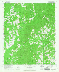 1967 Palmetto1968 Print · USGSPickens County was a landscape of creek-side settlements and rural churches during the late 1960s. Genealogists can locate family landmarks like Mt Tabor Cem and Unity Grove Ch, or trace the winding courses of Lubbub Creek and Holly Creek.2 unique versions available
 - 1967 Map of Elrod, 1968 Print
 1967 Elrod1968 Print · USGSTuscaloosa and Pickens Counties are captured here in the late sixties, as rural life centered on the Gulf Mobile and Ohio railroad. Genealogists and local historians can trace family-named sites like Wilburn Cem, Echola, and Shirley Bridge along the Sipsey River.2 unique versions available
 - 1967 Map of Reform, 1968 Print
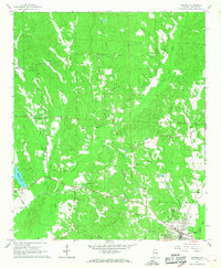 1967 Reform1968 Print · USGSReform and the surrounding Pickens County countryside appear here in the late sixties as the local railroad economy remained in full swing. Genealogists can locate family landmarks like Hopewell Cem, Christian Hope Ch, and the Gulf Mobile and Ohio rail line.3 unique versions available
 - 1967 Map of Fernbank, 1968 Print
 1967 Fernbank1968 Print · USGSThe rural borderlands of Lamar and Pickens counties are captured here in the late sixties, centered on the railroad town of Fernbank. Researchers can trace the SOUTHERN rail line and locate ancestral landmarks like Old Harmony Cem and Reeves Chapel.2 unique versions available
 - 1970 Map of Kirk, 1972 Print
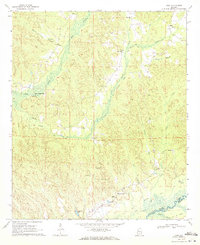 1970 Kirk1972 Print · USGSPickens County hill country and the Sipsey River bottomlands appear here as they were in the early 1970s, before modern changes. Genealogists and historians can trace the Old Railroad Grade and find rural sites like Speeds Water Mill, Souls Chapel, and Piney Grove Cem.2 unique versions available
 - 1970 Map of Aliceville North, 1972 Print
 1970 Aliceville North1972 Print · USGSThe town of Aliceville and its rural surroundings in Pickens County are documented here during the early 1970s. Local researchers can locate family-named landmarks and institutions like Kirksey High Sch, Franconia Cem, and the Pilgrim Rest Ch.2 unique versions available
Showing maps 1-25 of 172
Top cities of Pickens County
- Aliceville historical maps
- Gordo historical maps
- Reform historical maps
- Carrollton historical maps
- Pickensville historical maps
- Macedonia historical maps
See more
Frequently asked questions
- What are the different types of historical maps available for Pickens County?
- What is the oldest map of Pickens County?
- Where can I purchase historical maps of Pickens County for my home or office?
- Where can I download high-res historical maps of Pickens County?
- Are there historical topographic maps available for Pickens County?
- Is there historical aerial imagery available for Pickens County?
- Where are historical maps of Pickens County sourced from?