Old Maps of Randolph County, Alabama for Genealogy
Trace your family roots with 120 historic maps of Randolph County. These high-res maps reveal old neighborhoods, homesites, landmarks, and streets — helping you uncover where your ancestors lived and how the area evolved over time.
- Explore historic neighborhoods: Identify where your relatives may have lived in the 1800s or 1900s.
- Compare maps over time: Trace the changes in streets, buildings, and landmarks for multi-generational research.
- Perfect for genealogy & ancestry research: Used by family historians and researchers to map out lineage and migration.
These maps are an incredible resource for exploring your personal connection to Randolph County's past.
Randolph County, AL maps
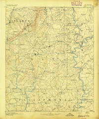
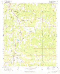
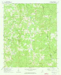
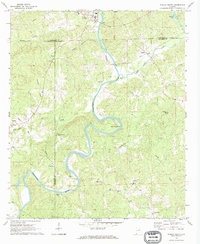
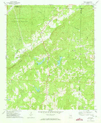
(120)- 1889 Map of Tallapoosa
 1889 Tallapoosa1889 Print · USGSAcross the Georgia and Alabama border in the late nineteenth century, iron furnaces and river mills powered the local economy. Genealogists can trace family homesteads near landmarks like Tecumseh Furnace, Pine Wood Church, and Allgood's Mill.
 - 1891 Map of Ashland
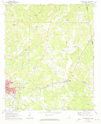
 1891 Ashland1891 Print · USGSEast Central Alabama in the late nineteenth century is defined by the sharp ridges of the mountains and the vital crossings of the Tallapoosa River. Genealogists can trace family movements across Malone's Ferry or locate vanished sites like the Pine Tuckey Town Site and Ironaton.5 unique versions available
 - 1892 Map of Tallapoosa
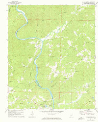
 1892 Tallapoosa1892 Print · USGSThe Georgia-Alabama borderlands at the end of the nineteenth century reveal a landscape of early industry and river-powered mills. Genealogists and historians can trace family-named landmarks like Allgood Mill, Rainwater Ford, and the Tecumseh Furnace ruins.
 - 1897 Map of Tallapoosa
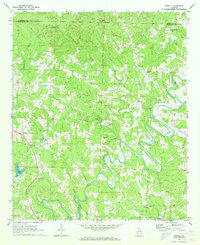
 1897 Tallapoosa1897 Print · USGSThe Georgia and Alabama borderlands are captured here in the late nineteenth century as the railroad and milling industries reshaped the landscape. Researchers can trace family-named sites like Munroe Mill, early crossings at Rainwater Ford, and old depots at Rockrun Station.4 unique versions available
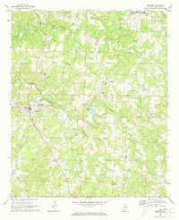
 - 1899 Map of Wedowee, 1958 Print
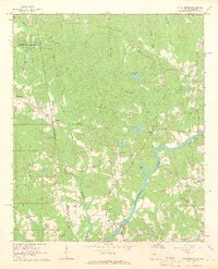
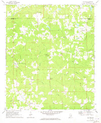
 1899 Wedowee1958 Print · USGSEastern Alabama and western Georgia are mapped here at the close of the nineteenth century, documenting the rural river-and-rail landscape. Researchers can trace historic crossings like Philpots Ferry and early industrial sites such as the Copper Mine.
 - 1902 Map of Wedowee
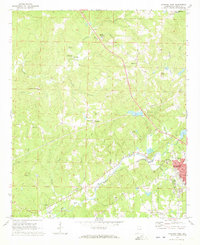
 1902 Wedowee1902 Print · USGSThe Alabama and Georgia state line bisects this turn-of-the-century landscape of river crossings and hill-country settlements. Genealogists can trace early homesteads and commerce at Philpots Ferry, the Copper Mine, or the town of Wedowee.3 unique versions available
 - 1953 Map of Atlanta, 1965 Print
 1953 Atlanta1965 Print · USGSThe growing Atlanta metro and the industrial corridors of Eastern Alabama are captured here during the mid-century transition. Researchers can trace the rail-to-road shift through hubs like Anniston and La Grange or locate sites within Fort McClellan.2 unique versions available
 - 1957 Map of Atlanta
 1957 Atlanta1957 Print · USGSAtlanta and the Alabama borderlands appear here in the mid-fifties, capturing the region's post-war suburban and industrial transition. Trace the development of early transport hubs and military sites like Fort McPherson, Anniston, and the Kennesaw Mountain National Battlefield Park.
 - 1958 Map of Atlanta
 1958 Atlanta1958 Print · USGSMid-century Georgia and Alabama are shown in this regional study of the corridor between the Chattahoochee River and the Appalachian foothills. Local historians can trace the development of suburban Atlanta alongside vital landmarks like Stone Mountain, Dobbins AFB, and the Seaboard Air Line rail routes.
 - 1964 Map of Abbottsford, 1966 Print
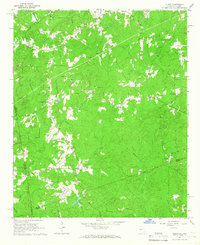
 1964 Abbottsford1966 Print · USGSThe Alabama-Georgia state line in the mid-1960s was a landscape of river-valley communities and rural rail stops. You can trace family-named roads and historic crossings like the Covered Bridge, Glass Bridge, and the Atlantic Coast Line railroad.5 unique versions available
 - 1964 Map of Glenn, 1966 Print
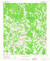
 1964 Glenn1966 Print · USGSThe Georgia-Alabama borderlands come alive in the mid-1960s, showing a rural landscape of crossroads settlements and small country parishes. Family historians can trace ancestral sites like Pleasant Grove Ch, Liberty Hill Cem, and the old community at Denver.2 unique versions available
 - 1966 Map of Bowdon West, 1968 Print
 1966 Bowdon West1968 Print · USGSThe Alabama-Georgia state line cuts through this 1960s landscape between the settlements of Ranburne and Bowdon. Genealogists can trace family roots through numerous local landmarks, including Indian Creek Ch, Hudson School, and Macedonia.3 unique versions available
 - 1968 Map of Five Points, 1973 Print
 1968 Five Points1973 Print · USGSChambers County and Randolph County meet in the late sixties as the rail lines of the Central of Georgia and Seaboard Coast Line still define the local landscape. Researchers can locate vanished landmarks and rural crossroads like Standing Rock, Cumbee Mill, and Stroud.2 unique versions available
 - 1969 Map of Roanoke East, 1973 Print
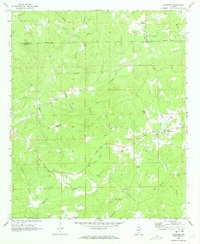
 1969 Roanoke East1973 Print · USGSRandolph County's rural landscape is captured in the late sixties, showing a network of crossroads settlements and active rail lines near the Georgia border. Genealogists and historians can trace family roots through Randolph Memory Gardens, Bacon Level, and the many rural schools like Handley High Sch.2 unique versions available
 - 1969 Map of Wadley North, 1973 Print
 1969 Wadley North1973 Print · USGSRandolph County in the late sixties reveals a landscape shaped by the Tallapoosa River and the Seaboard Coast Line Railroad. Genealogists can trace family landmarks like Knight Cem and Forester Chapel or explore the campus grounds of Southern Union State College.2 unique versions available
 - 1969 Map of Newell, 1973 Print
 1969 Newell1973 Print · USGSRandolph County's rural backcountry is documented here during the late sixties, where the winding Little Tallapoosa River shapes the local landscape. Genealogists can locate family landmarks like Smyrna Ch, Rock Springs Ch, and the community at Newell.2 unique versions available
 - 1969 Map of Napoleon, 1973 Print
 1969 Napoleon1973 Print · USGSThe Alabama-Georgia borderlands come into focus in the late sixties, centered on the Napoleon and Omaha communities. Researchers can trace rural lineages through numerous country churches like Mount Carmel Ch and the crossroads at Potash.
 - 1969 Map of Wedowee, 1973 Print
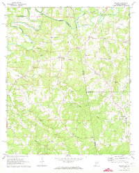
 1969 Wedowee1973 Print · USGSRandolph County life in the late sixties centers on the town of Wedowee and the surrounding rural settlements. Genealogists and historians can trace family roots through numerous local landmarks like Zion Ch, Wildcat Creek Cem, and Ava.
 - 1969 Map of Daviston, 1973 Print
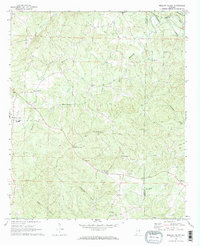
 1969 Daviston1973 Print · USGSThe rural borderlands of Tallapoosa and Clay counties come into focus during the late 1960s. Researchers can trace local heritage through sites like the Zana Training School, the Old Vickers Cemetery, and the Rocky Mount Lookout Tower.
 - 1969 Map of Graham, 1973 Print
 1969 Graham1973 Print · USGSRandolph and Cleburne Counties are captured here in the late sixties as traditional agricultural communities along the Georgia border. Researchers can trace family roots at numerous rural sites like Graham, the Old Shiloh Church, and Sewell.3 unique versions available
 - 1969 Map of Wadley South, 1973 Print
 1969 Wadley South1973 Print · USGSThe Tallapoosa River valley in eastern Alabama was a region of remote crossroads and river bends in the late sixties. Genealogists and local historians can trace the foundations of communities like Frog Eye, Abanda, and the family-named Sims Cem or Bibbys Ferry.
 - 1969 Map of Milltown, 1973 Print
 1969 Milltown1973 Print · USGSChambers County in the late sixties remains a landscape of quiet crossroads and rural parishes. Researchers can trace the exact locations of family homesteads near Milltown or explore the many country churches like New Harmony Ch and Antioch Ch.2 unique versions available
 - 1969 Map of Mellow Valley, 1973 Print
 1969 Mellow Valley1973 Print · USGSClay and Randolph Counties in the late sixties remain a landscape of rural junctions and small-town outposts. Genealogists and local historians can trace family locations near Cooley Crossroads, McDaniel Cem, and the old High Sch at Mellow Valley.2 unique versions available
 - 1969 Map of Roanoke West, 1973 Print
 1969 Roanoke West1973 Print · USGSWest of the Georgia border in the late sixties, this area shows a landscape of rail-connected commerce and scattered rural crossroads. Genealogists can trace family footprints through numerous country churches like Union Hill Ch and named landmarks such as Broughton and Rock Stand.2 unique versions available
 - 1970 Map of Delta, 1973 Print
 1970 Delta1973 Print · USGSThe upland forests and creek valleys of rural Clay County are captured here in the early 1970s. Genealogists can trace family landmarks like Ragan Chapel Cem and Pleasant Hill Cem near the settlements of Delta and Needmore.2 unique versions available
Showing maps 1-25 of 120
Top cities of Randolph County
- Roanoke historical maps
- Wedowee historical maps
- Wadley historical maps
- Morrison Crossroads historical maps
- Woodland historical maps
Frequently asked questions
- What are the different types of historical maps available for Randolph County?
- What is the oldest map of Randolph County?
- Where can I purchase historical maps of Randolph County for my home or office?
- Where can I download high-res historical maps of Randolph County?
- Are there historical topographic maps available for Randolph County?
- Is there historical aerial imagery available for Randolph County?
- Where are historical maps of Randolph County sourced from?