
1969 Map of Mellow Valley
USGS Topo · Published 1973About this map
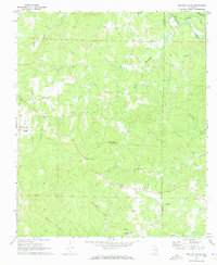
The boundary between Clay and Randolph Counties divides this section of Alabama, where a network of small rural communities centers around Mellow Valley and Cooley Crossroads. The landscape is defined by the winding paths of Wesobulga Creek and Emuckfaw Creek, with smaller tributaries like Little Mississippi Creek and Hurricane Creek carving through the terrain. These watercourses historically dictated the placement of early settlements and road junctions, such as Sikesville and Almond, which remained vital focal points for the surrounding farmsteads in the late 1960s.
Find a feature on this map
30 named features on this map. Tap any name to fly to it.
Don’t see what you’re looking for? This feature index may not catch every label — zoom into the map to look around manually.
Map Details
Editions of this 1969 Mellow Valley Map
2 editions found
Other maps of this area

1891 · Ashland
USGS Topo · 1:125,000

1953 · Atlanta
USGS Topo · 1:250,000

1957 · Atlanta
USGS Topo · 1:250,000

1958 · Atlanta
USGS Topo · 1:250,000

1969 · New Site
USGS Topo · 1:24,000

1969 · Wadley North
USGS Topo · 1:24,000

1969 · Gibsonville
USGS Topo · 1:24,000
1969 · Daviston
USGS Topo · 1:24,000
1969 · Wadley South
USGS Topo · 1:24,000
1969 · Lineville West
USGS Topo · 1:24,000