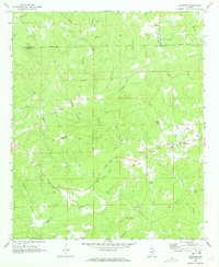
1969 Map of Daviston
USGS Topo · Published 1973About this map
The boundary lines of Clay, Tallapoosa, and Randolph counties converge in this rural landscape, which is defined by a dense network of small family-named landmarks and country churches. The area around Daviston and Zana is characterized by its rolling topography and numerous small drainages like Emuckfaw Creek and Milam Creek. Local history and genealogy interest is particularly high here due to the presence of legacy sites such as the Zana Training School and the Old Vickers Cemetery.
Find a feature on this map
37 named features on this map. Tap any name to fly to it.
Don’t see what you’re looking for? This feature index may not catch every label — zoom into the map to look around manually.
Map Details
Editions of this 1969 Daviston Map
This is the sole edition of this map. No revisions or reprints were ever made.
Other maps of this area

1891 · Ashland
USGS Topo · 1:125,000

1906 · Dadeville
USGS Topo · 1:125,000

1953 · Atlanta
USGS Topo · 1:250,000

1955 · Phenix City
USGS Topo · 1:250,000

1957 · Phenix City
USGS Topo · 1:250,000

1957 · Atlanta
USGS Topo · 1:250,000

1958 · Phenix City
USGS Topo · 1:250,000

1958 · Atlanta
USGS Topo · 1:250,000

1969 · New Site
USGS Topo · 1:24,000

1969 · Wadley North
USGS Topo · 1:24,000