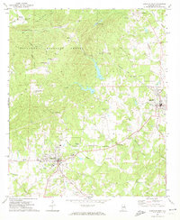
1969 Map of Lineville West
USGS Topo · Published 1974About this map
The Seaboard Coast Line railroad cuts through the heart of the southern Appalachians here, connecting the settlements of Pyriton and Highland as it winds through the Talladega National Forest. This 1969 field survey reveals a landscape of ridge-and-valley agriculture and small rural crossroads, centered between the municipal hubs of Ashland and Lineville. The terrain is deeply etched by a network of waterways including Talladega Creek and Horsetrough Creek, which historically supported local industry like Shireys Mill on Shirey Mill Creek.
Find a feature on this map
51 named features on this map. Tap any name to fly to it.
Don’t see what you’re looking for? This feature index may not catch every label — zoom into the map to look around manually.
Map Details
Editions of this 1969 Lineville West Map
2 editions found
Other maps of this area

1891 · Ashland
USGS Topo · 1:125,000

1953 · Atlanta
USGS Topo · 1:250,000

1957 · Atlanta
USGS Topo · 1:250,000

1958 · Atlanta
USGS Topo · 1:250,000
1969 · Clairmont Springs
USGS Topo · 1:24,000
1969 · Millerville
USGS Topo · 1:24,000

1969 · Gibsonville
USGS Topo · 1:24,000

1969 · Mellow Valley
USGS Topo · 1:24,000
1969 · Cheaha Mountain
USGS Topo · 1:24,000
1969 · Ironaton
USGS Topo · 1:24,000