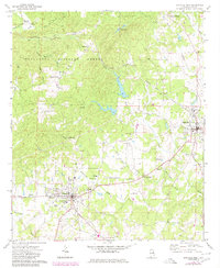
1969 Map of Lineville West
USGS Topo · Published 1980About this map
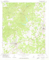
Ashland and Lineville anchor the development of central Clay County in this late-1960s survey, updated for the 1980s. The Seaboard Coast Line railroad cuts through the northern timberlands, passing through the settlement of Pyriton and skirting the edge of the Talladega National Forest. The landscape is a transition from the wooded ridges of Hassell Gap to the agricultural and civic centers where the Ashland-Lineville Airport and County Country Club sit between the two main towns. Local heritage is preserved in the numerous country churches like Concord Ch and Olive Branch Ch, alongside the historic Shireys Mill on Shireys Mill Branch. The map documents the growth of local infrastructure, including the County Hospital and the expansion of the County Training School near the eastern edge of the quadrangle.
Find a feature on this map
71 named features on this map. Tap any name to fly to it.
Don’t see what you’re looking for? This feature index may not catch every label — zoom into the map to look around manually.
Map Details
Editions of this 1969 Lineville West Map
2 editions found
Other maps of this area

1891 · Ashland
USGS Topo · 1:125,000

1953 · Atlanta
USGS Topo · 1:250,000

1957 · Atlanta
USGS Topo · 1:250,000

1958 · Atlanta
USGS Topo · 1:250,000
1969 · Clairmont Springs
USGS Topo · 1:24,000
1969 · Millerville
USGS Topo · 1:24,000

1969 · Gibsonville
USGS Topo · 1:24,000

1969 · Mellow Valley
USGS Topo · 1:24,000
1969 · Cheaha Mountain
USGS Topo · 1:24,000
1969 · Lineville West
USGS Topo · 1:24,000