Old Maps of Oswichee, Alabama for Hiking & Exploration
Hike through history with 14 historic maps of Oswichee. Explore old trails, ghost towns, and forgotten backroads — perfect for outdoor adventurers and local explorers.
- Rediscover forgotten places: Map out old mining camps, roads, and footpaths that no longer exist on modern maps.
- Layer with modern tools: Combine with LiDAR or satellite views to plan hikes through historical terrain.
- Made for exploration: Popular among hikers, overlanders, and local history lovers.
Use these maps to find adventure and explore the hidden past of Oswichee.
Oswichee, AL maps
(14)- 1914 Map of Seale
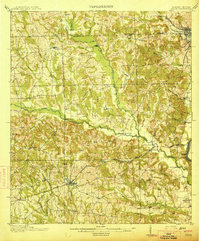 1914 Seale1914 Print · USGSRussell County's agricultural and railroad landscape is meticulously documented just before the First World War. Genealogists can trace family connections through local landmarks like Kite School, the community of Sand Fort, and historical river crossings like Perrys Ford.6 unique versions available
 - 1949 Map of Fort Mitchell
 1949 Fort Mitchell1949 Print · USGSRussell County, Alabama, was a landscape of military expansion and rural rail stops shortly after the war. You can trace the Central of Georgia line as it passes through Fort Mitchell and Lato, or locate riverfront sites like Bradley Landing.2 unique versions available
 - 1950 Map of Seale, 1955 Print
 1950 Seale1955 Print · USGSRussell County during the mid-century shows a landscape of small farming communities and expanding military boundaries. Genealogists can trace family roots through numerous rural landmarks like Evans Cem, Hillside Chapel, and the Brickyard Sch.
 - 1955 Map of Fort Mitchell, 1959 Print
 1955 Fort Mitchell1959 Print · USGSThe Alabama-Georgia borderlands come to life in the mid-fifties as the Chattahoochee River meets the expanding Fort Benning Military Reservation. Genealogists and local historians can trace rural sites like Oswichee, Bradley Landing, and the Providence Cem before modern development altered the landscape.3 unique versions available
 - 1955 Map of Seale, 1961 Print
 1955 Seale1961 Print · USGSEast Alabama in the mid-1950s was a landscape of river-bend settlements and deep-rooted rural communities. Genealogists can trace family landmarks and historic sites like Fort Mitchell, St Matthews Ch, and the long-standing Oswichee post office.
 - 1955 Map of Phenix City, 1964 Print
 1955 Phenix City1964 Print · USGSPost-war Alabama and Georgia meet along the Chattahoochee River as industry and military installations expand. Trace the rail lines of the Central of Georgia through towns like Opelika, Tuskegee, and Alexander City.3 unique versions available
 - 1957 Map of Phenix City
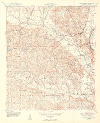
 1957 Phenix City1957 Print · USGSThe Alabama-Georgia borderlands are captured here in the mid-fifties, centered on the bustling river crossing at Phenix City and Columbus. Researchers can trace the mid-century footprint of the Fort Benning Military Reservation or locate smaller textile and railroad towns like Langdale and Camp Hill.
 - 1958 Map of Phenix City
 1958 Phenix City1958 Print · USGSThe Alabama-Georgia borderlands thrive during the late fifties, anchored by the river-driven industry of Columbus and Phenix City. Researchers can trace the mid-century footprints of Fort Benning, Auburn, and the textile towns of Fairfax and Lanett.
 - 1981 Map of Tuskegee, 1982 Print
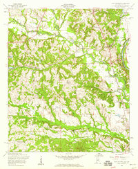
 1981 Tuskegee1982 Print · USGSMacon and Bullock counties are captured here in the early eighties, showcasing a landscape deeply tied to the railroad and the legacies of Tuskegee Institute. Researchers can locate specific sites from Moton Field to rural settlements along the Seaboard Coast Line like Hurtsboro and Pittsview.2 unique versions available
 - 2011 Map of Fort Mitchell, 2011 Print
 2011 Fort Mitchell2011 Print · USGSCovers Oswichee, including Phenix City, Nuckols, and other nearby areas2 unique versions available
 - 2014 Map of Fort Mitchell, 2014 Print
 2014 Fort Mitchell2014 Print · USGSCovers Oswichee, including Phenix City, Nuckols, and other nearby areas
 - 2018 Map of Fort Mitchell, 2018 Print
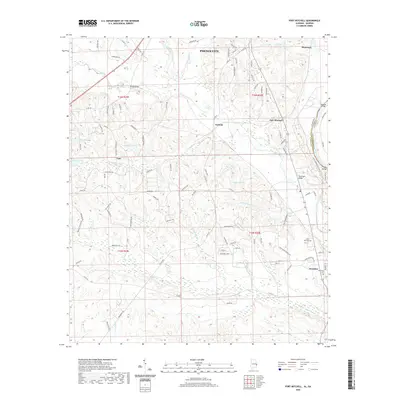
 2018 Fort Mitchell2018 Print · USGSCovers Oswichee, including Phenix City, Nuckols, and other nearby areas
 - 2020 Map of Fort Mitchell, 2020 Print
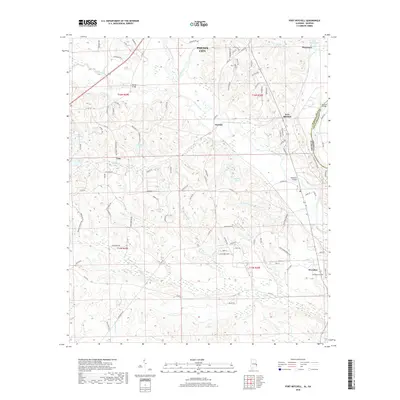
 2020 Fort Mitchell2020 Print · USGSCovers Oswichee, including Phenix City, Nuckols, and other nearby areas
 - 2024 Map of Fort Mitchell, 2024 Print
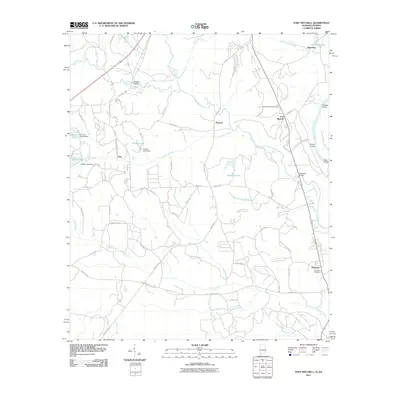
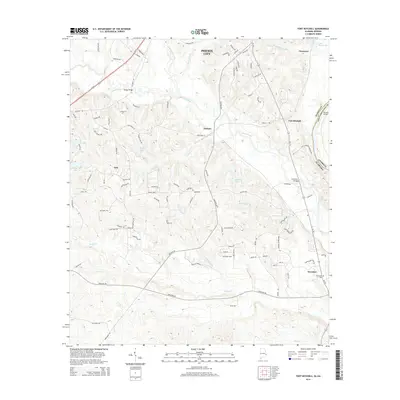
 2024 Fort Mitchell2024 Print · USGSThe Alabama-Georgia border near Fort Mitchell comes to life in this detailed survey of the local military and rural landscape. Genealogists can trace family connections at Saint John Cem and Oswichee Cem or explore the history of Lato and Perrys Ford.
End of results
Showing maps 1-14 of 14
Top cities near Oswichee
- Columbus historical maps
- Phenix City historical maps
- Cusseta historical maps
- Smiths Station historical maps
- Ladonia historical maps
- Lumpkin historical maps
Frequently asked questions
- What are the different types of historical maps available for Oswichee?
- What is the oldest map of Oswichee?
- Where can I purchase historical maps of Oswichee for my home or office?
- Where can I download high-res historical maps of Oswichee?
- Are there historical topographic maps available for Oswichee?
- Is there historical aerial imagery available for Oswichee?
- Where are historical maps of Oswichee sourced from?