Old Maps of Seale, Alabama
Explore 14 old maps of Seale, spanning from 1914 to today. These high-resolution historic maps reveal how streets, neighborhoods, landmarks, and natural features evolved over time — perfect for genealogy, metal detecting, research, and local history exploration.
What you can do with these maps:
- See how Seale changed over time: Compare historical maps to modern-day views to trace roads, homesites, rail lines & more.
- View detailed metadata: Each map includes creators, publishers, year, scale, and archive source.
- Overlay maps with satellite & LiDAR: Visualize the past alongside modern tools to explore terrain & human change.
- Trusted historical sources: Maps sourced from the USGS, Library of Congress, and other archives.
- Access maps your way: View online, download high-res files, or order prints for personal or research use.
Start exploring old maps of Seale to uncover forgotten places, hidden landmarks, and the deep history beneath your feet.
Seale, AL maps
(14)- 1914 Map of Seale
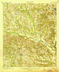 1914 Seale1914 Print · USGSRussell County's agricultural and railroad landscape is meticulously documented just before the First World War. Genealogists can trace family connections through local landmarks like Kite School, the community of Sand Fort, and historical river crossings like Perrys Ford.6 unique versions available
 - 1950 Map of Seale, 1953 Print
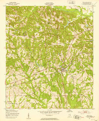 1950 Seale1953 Print · USGSRussell County, Alabama, is documented here in the early postwar era as its rural communities and rail corridors remained firmly established. Genealogists and historians can trace local family roots through sites like Sandfort Sch, Friendship Ch, and the settlement of Villula.2 unique versions available
 - 1950 Map of Seale, 1955 Print
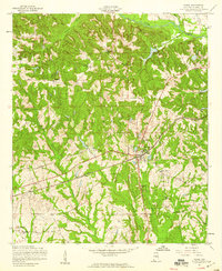
 1950 Seale1955 Print · USGSRussell County during the mid-century shows a landscape of small farming communities and expanding military boundaries. Genealogists can trace family roots through numerous rural landmarks like Evans Cem, Hillside Chapel, and the Brickyard Sch.
 - 1955 Map of Seale, 1959 Print
 1955 Seale1959 Print · USGSRussell County in the mid-fifties is captured here as a landscape of rural communities and vital rail connections. Researchers can trace the local lineage through family-named landmarks and rural institutions like Chavala High Sch, Sandfort, and Ross Chapel.3 unique versions available
 - 1955 Map of Seale, 1961 Print
 1955 Seale1961 Print · USGSEast Alabama in the mid-1950s was a landscape of river-bend settlements and deep-rooted rural communities. Genealogists can trace family landmarks and historic sites like Fort Mitchell, St Matthews Ch, and the long-standing Oswichee post office.
 - 1955 Map of Phenix City, 1964 Print
 1955 Phenix City1964 Print · USGSPost-war Alabama and Georgia meet along the Chattahoochee River as industry and military installations expand. Trace the rail lines of the Central of Georgia through towns like Opelika, Tuskegee, and Alexander City.3 unique versions available
 - 1957 Map of Phenix City
 1957 Phenix City1957 Print · USGSThe Alabama-Georgia borderlands are captured here in the mid-fifties, centered on the bustling river crossing at Phenix City and Columbus. Researchers can trace the mid-century footprint of the Fort Benning Military Reservation or locate smaller textile and railroad towns like Langdale and Camp Hill.
 - 1958 Map of Phenix City
 1958 Phenix City1958 Print · USGSThe Alabama-Georgia borderlands thrive during the late fifties, anchored by the river-driven industry of Columbus and Phenix City. Researchers can trace the mid-century footprints of Fort Benning, Auburn, and the textile towns of Fairfax and Lanett.
 - 1981 Map of Tuskegee, 1982 Print
 1981 Tuskegee1982 Print · USGSMacon and Bullock counties are captured here in the early eighties, showcasing a landscape deeply tied to the railroad and the legacies of Tuskegee Institute. Researchers can locate specific sites from Moton Field to rural settlements along the Seaboard Coast Line like Hurtsboro and Pittsview.2 unique versions available
 - 2011 Map of Seale, 2011 Print
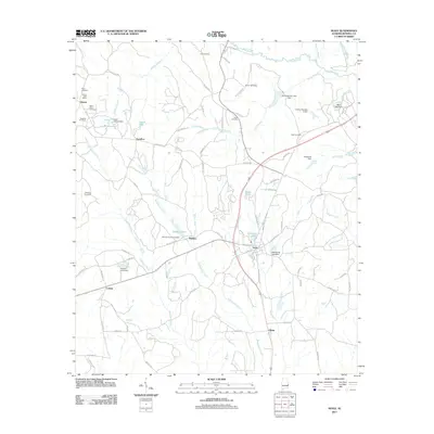 2011 Seale2011 Print · USGSCovers Seale, including Dudleys, Sandfort, and other nearby areas
 - 2014 Map of Seale, 2014 Print
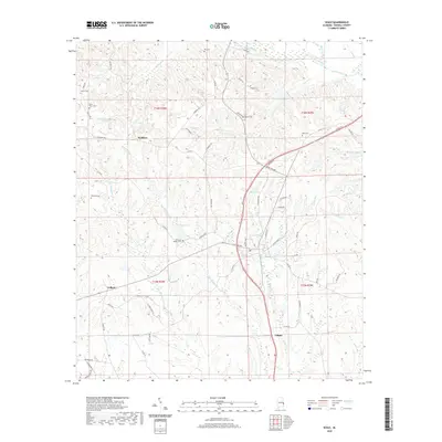
 2014 Seale2014 Print · USGSCovers Seale, including Dudleys, Sandfort, and other nearby areas
 - 2018 Map of Seale, 2018 Print
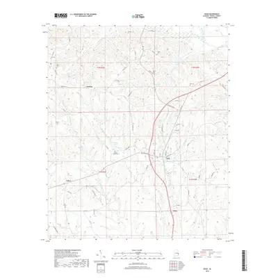 2018 Seale2018 Print · USGSCovers Seale, including Dudleys, Sandfort, and other nearby areas
 - 2020 Map of Seale, 2020 Print
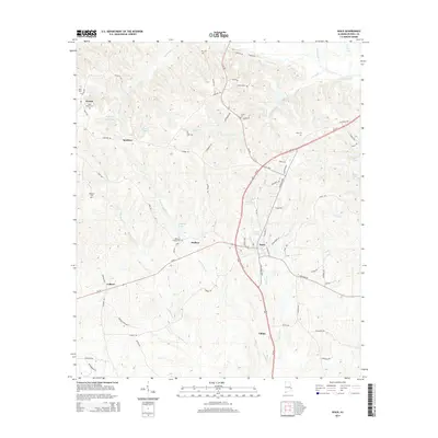
 2020 Seale2020 Print · USGSCovers Seale, including Dudleys, Sandfort, and other nearby areas
 - 2024 Map of Seale, 2024 Print
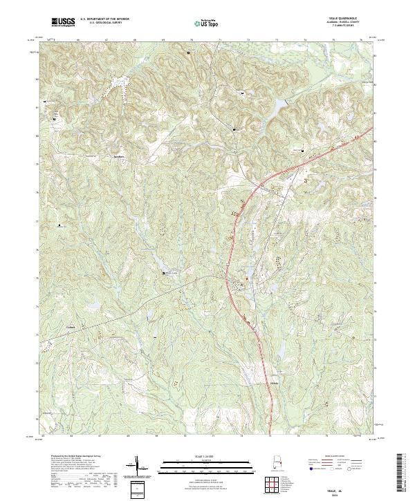 2024 Seale2024 Print · USGSRussell County's rural landscape is captured here in the early twenty-first century, showing the enduring structure of its local communities. Researchers can trace family history through numerous sites like Williams Dudley Cem, the crossing at Perrys Ford, and the crossroads at Sandfort.
End of results
Showing maps 1-14 of 14
Top cities near Seale
- Columbus historical maps
- Phenix City historical maps
- Smiths Station historical maps
- Ladonia historical maps
Frequently asked questions
- What are the different types of historical maps available for Seale?
- What is the oldest map of Seale?
- Where can I purchase historical maps of Seale for my home or office?
- Where can I download high-res historical maps of Seale?
- Are there historical topographic maps available for Seale?
- Is there historical aerial imagery available for Seale?
- Where are historical maps of Seale sourced from?