1900s (20th Century) Maps of Epes, Alabama
Explore 8 historic maps of Epes from the 1900s (20th Century). These maps offer a rare glimpse into what life looked like during the 1900s — showing old roads, neighborhoods, homes, and landmarks that have changed or disappeared over time.
Whether you're researching your family's past, planning a metal detecting trip, or studying how Epes's landscape evolved across the 1900s, these high-resolution maps are a powerful tool for exploring the history of this region.
- Focus on a specific era: All maps on this page are from the 1900s, giving you a focused view of this time period.
- See what’s changed: Compare century-old streets, trails, and buildings to today's modern landscape using overlays and satellite layers.
- Research with precision: Use these maps for genealogy, historical research, land use analysis, or educational projects.
- View, download, or print: Maps are fully viewable online in high resolution, and can be downloaded or printed for your own records.
Start exploring Epes's history through authentic maps from the 1900s. This is your window into the past.
Epes, AL maps
(8)- 1929 Map of Epes
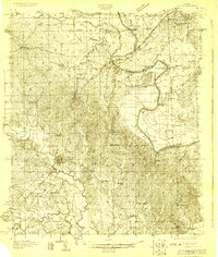 1929 Epes1929 Print · USGSThe Tombigbee and Sucarnoochee rivers meet in this 1920s portrait of West Alabama. Genealogists can trace family roots at Livingston or search for old schoolhouses like the Ezell Sch and rural landmarks like Hixon Switch.
 - 1932 Map of Epes
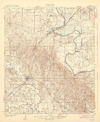 1932 Epes1932 Print · USGSSumter and Greene counties are shown in the early 1930s as the regional economy relied heavily on the Southern Railway and river transport. Genealogists can locate family landmarks like Wesley Chapel, Hillman Ferry, and the Industrial School.4 unique versions available
 - 1953 Map of Meridian, 1966 Print
 1953 Meridian1966 Print · USGSEast Central Mississippi and the Alabama borderlands are captured here during a period of steady growth and infrastructure expansion. Genealogists and historians can trace rail-town development along the Gulf Mobile & Ohio Railroad and find early settlements like Scooba, Pelahatchie, and De Kalb.2 unique versions available
 - 1957 Map of Meridian
 1957 Meridian1957 Print · USGSEast Central Mississippi and parts of Western Alabama come alive in the mid-1950s, centered on the transit hub of Meridian. Researchers can trace old rail lines like the Illinois Central and find historic sites such as the Choctaw Indian Reservation and Roosevelt State Park.
 - 1965 Map of Meridian
 1965 Meridian1965 Print · USGSEast Mississippi and West Alabama are mapped here in the mid-sixties as the region's modern highway and reservoir systems began to take shape. Researchers can trace rural lineages through local landmarks like Prince Chapel and Tuscahoma Landing, or follow the historic Gulf Mobile & Ohio rail lines.
 - 1974 Map of Epes West, 1978 Print
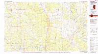
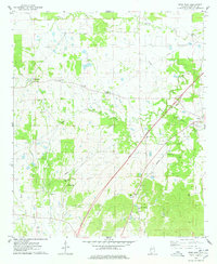 1974 Epes West1978 Print · USGSSumter County, Alabama, is captured in the mid-1970s as a region of quiet rural settlements and established family homesteads. Genealogists can locate family burial sites like Eskeridge-Pettigrew Cem and historic local landmarks such as Sumterville Ch.2 unique versions available
 - 1974 Map of Epes East, 1978 Print
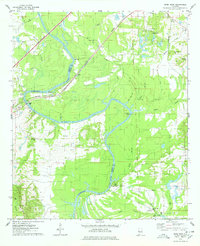 1974 Epes East1978 Print · USGSThe Tombigbee River divides Sumter and Greene counties during the mid-seventies, showing a landscape defined by its deep bends and river crossings. Genealogists can trace family landmarks like Mt Bethel Cem, Lukes Landing, and Christian Valley Ch.2 unique versions available
 - 1984 Map of De Kalb
 1984 De Kalb1984 Print · USGSThe Mississippi-Alabama borderlands come into focus in the 1980s, where the river-and-rail economy meets military and tribal lands. Researchers can trace rural lineages across the Choctaw Indian Reservation or through the rail towns of Scooba and De Kalb.2 unique versions available
End of results
Showing maps 1-8 of 8
Top cities near Epes
- Livingston historical maps
- Eutaw historical maps
- York historical maps
- Boligee historical maps
- Gainesville historical maps
- Geiger historical maps
See more
Frequently asked questions
- What are the different types of historical maps available for Epes?
- What is the oldest map of Epes?
- Where can I purchase historical maps of Epes for my home or office?
- Where can I download high-res historical maps of Epes?
- Are there historical topographic maps available for Epes?
- Is there historical aerial imagery available for Epes?
- Where are historical maps of Epes sourced from?