1900s (20th Century) Maps of Chatom, Alabama
Explore 8 historic maps of Chatom from the 1900s (20th Century). These maps offer a rare glimpse into what life looked like during the 1900s — showing old roads, neighborhoods, homes, and landmarks that have changed or disappeared over time.
Whether you're researching your family's past, planning a metal detecting trip, or studying how Chatom's landscape evolved across the 1900s, these high-resolution maps are a powerful tool for exploring the history of this region.
- Focus on a specific era: All maps on this page are from the 1900s, giving you a focused view of this time period.
- See what’s changed: Compare century-old streets, trails, and buildings to today's modern landscape using overlays and satellite layers.
- Research with precision: Use these maps for genealogy, historical research, land use analysis, or educational projects.
- View, download, or print: Maps are fully viewable online in high resolution, and can be downloaded or printed for your own records.
Start exploring Chatom's history through authentic maps from the 1900s. This is your window into the past.
Chatom, AL maps
(8)- 1943 Map of McIntosh, 1972 Print
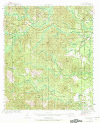 1943 McIntosh1972 Print · USGSMcIntosh and the Piney Woods of Washington County are shown here during the early 1940s, highlighting a landscape of timber, rails, and small settlements. Researchers can trace family roots through landmarks like Harris Cem, Fields Sch, and Pine Lodge Ch.
 - 1944 Map of McIntosh
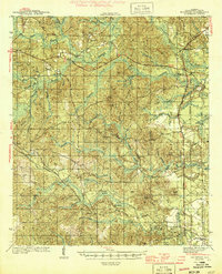 1944 McIntosh1944 Print · USGSWashington County during the early 1940s is captured here in detail, showing the rural communities of the Alabama pine belt. Genealogists can trace family landmarks like Harris Cem and the small country congregations at Bethel Ch and Pine Lodge Ch.2 unique versions available
 - 1953 Map of Hattiesburg, 1965 Print
 1953 Hattiesburg1965 Print · USGSSouth Mississippi and western Alabama are shown here during the mid-twentieth century as the timber and rail industries shaped the region. Genealogists and historians can trace rail lines like the Mississippi Central and locate rural centers such as Magee, Richton, and Mount Vernon.4 unique versions available
 - 1958 Map of Hattiesburg
 1958 Hattiesburg1958 Print · USGSSoutheastern Mississippi's timber and rail networks are at their peak during the late fifties, centered on the growing hubs of Hattiesburg and Laurel. Researchers can trace old family landmarks like Sims Chapel, the Busbey Game Refuge, and the vanished stops along the Mississippi Central railroad.2 unique versions available
 - 1974 Map of Chatom, 1977 Print
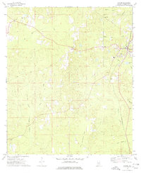 1974 Chatom1977 Print · USGSChatom and its rural Washington County surroundings are captured in the mid-seventies, showing the area's transition between timberlands and small-town industry. Genealogists and historians can locate specific landmarks like Laton Hill Cem, Spring Bank Ch, and the St Louis-San Francisco rail line.
 - 1982 Map of Rutan
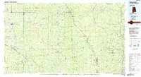
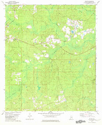 1982 Rutan1982 Print · USGSThe Washington County seat of Chatom and surrounding rural settlements are documented here in the early 1980s. Researchers can locate the County Hospital, trace the route of Old Copeland Road, and find local landmarks like Pine Level Ch and the Turner Lookout Tower.
 - 1984 Map of Citronelle
 1984 Citronelle1984 Print · USGSThe Alabama-Mississippi borderlands in the mid-1980s were a hub of timber and rail, spanning from the Leaf River to the Mobile County line. Genealogists can trace family roots through rural communities like Sims Chapel, Leakesville, and Vinegar Bend.2 unique versions available
 - 1984 Map of Hattiesburg
 1984 Hattiesburg1984 Print · USGSSouth Mississippi’s Pine Belt is seen here in the mid-eighties, showing the region as a hub of timber production and petroleum extraction. Trace the rail lines of the Illinois Central Gulf RR through old settlements like Richton or the energy developments at the Heidelberg Oil Field.2 unique versions available
End of results
Showing maps 1-8 of 8
Top cities near Chatom
Frequently asked questions
- What are the different types of historical maps available for Chatom?
- What is the oldest map of Chatom?
- Where can I purchase historical maps of Chatom for my home or office?
- Where can I download high-res historical maps of Chatom?
- Are there historical topographic maps available for Chatom?
- Is there historical aerial imagery available for Chatom?
- Where are historical maps of Chatom sourced from?