2000s (21st Century) Maps of Bristol Bay, Alaska
Explore 36 historic maps of Bristol Bay from the 2000s (21st Century). These maps offer a rare glimpse into what life looked like during the 2000s — showing old roads, neighborhoods, homes, and landmarks that have changed or disappeared over time.
Whether you're researching your family's past, planning a metal detecting trip, or studying how Bristol Bay's landscape evolved across the 2000s, these high-resolution maps are a powerful tool for exploring the history of this region.
- Focus on a specific era: All maps on this page are from the 2000s, giving you a focused view of this time period.
- See what’s changed: Compare century-old streets, trails, and buildings to today's modern landscape using overlays and satellite layers.
- Research with precision: Use these maps for genealogy, historical research, land use analysis, or educational projects.
- View, download, or print: Maps are fully viewable online in high resolution, and can be downloaded or printed for your own records.
Start exploring Bristol Bay's history through authentic maps from the 2000s. This is your window into the past.
Bristol Bay, AK maps
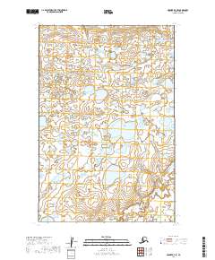
(36)- 2019 Map of Naknek D-3 NW, 2019 Print
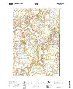
 2019 Naknek D-3 NW2019 Print · USGSCoastal Alaska at the end of the second decade reveals a landscape shaped by the Kvichak River. Researchers can trace the braided watercourse from Cape Horn down to Sea Gull Flat and the small settlement of Kvichak.
 - 2019 Map of Naknek C-6 NW, 2019 Print
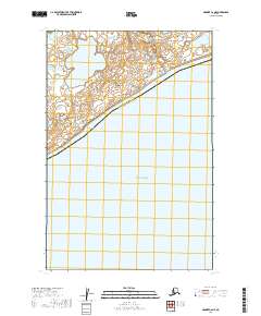
 2019 Naknek C-6 NW2019 Print · USGSThe coastal tundra of southwest Alaska meets the sea in this recent survey of the Bristol Bay region. Researchers can trace the administrative line of the Dillingham Census Area and the hydrologic patterns surrounding Kvichak Bay.
 - 2019 Map of Naknek C-2 SW, 2019 Print
 2019 Naknek C-2 SW2019 Print · USGSThe Bristol Bay lowlands come alive in the late 2010s, showcasing a landscape of shifting wetlands and protected wilderness. Researchers can trace the course of the Naknek River and identify the intersection of Katmai National Park and Becharof National Wildlife Refuge.
 - 2019 Map of Naknek C-3 NW, 2019 Print
 2019 Naknek C-3 NW2019 Print · USGSCoastal life in Bristol Bay is centered on the Naknek River and the local hub of South Naknek in this modern survey. Researchers can trace aviation and maritime links through the South Naknek Airport and the village's Borough Dock Road.
 - 2019 Map of Naknek D-2 SE, 2019 Print
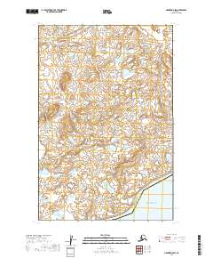
 2019 Naknek D-2 SE2019 Print · USGSBristol Bay Borough at the edge of the wilderness during the early twenty-first century. Researchers can trace the natural drainage of Pauls Cr or examine the northern boundary of Katmai National Park.
 - 2019 Map of Naknek C-2 SE, 2019 Print
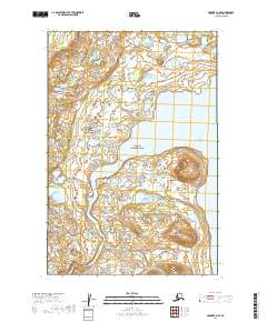
 2019 Naknek C-2 SE2019 Print · USGSThe wild borderlands between Katmai National Park and Becharof National Wildlife Refuge are captured here in the late twenty-teens. Trace the headwaters of the Naknek River and the shore of Naknek Lake through this remote stretch of the Alaska Peninsula.
 - 2019 Map of Naknek D-4 SE, 2019 Print
 2019 Naknek D-4 SE2019 Print · USGSThe eastern coast of Kvichak Bay comes into focus in this late 2010s survey of the Bristol Bay shoreline. Genealogists and researchers can trace the coastal settlements of Koggiung and Libbyville, alongside landmarks like Graveyard Point and Pederson Point.
 - 2019 Map of Naknek D-2 NW, 2019 Print
 2019 Naknek D-2 NW2019 Print · USGSThe intersection of the Lake and Peninsula and Bristol Bay boroughs is captured here in the early twenty-first century. This remote landscape allows researchers to trace the course of Coffee Cr and survey the countless unnamed lakes that define this wilderness.
 - 2019 Map of Naknek C-3 NE, 2019 Print
 2019 Naknek C-3 NE2019 Print · USGSThe Bristol Bay region along the Naknek River is shown here during a period of modern Alaskan infrastructure growth. Researchers can trace the river's many landmarks including Horseshoe Bend, the historic Bear Trail Lodge, and the confluence of Smelt Creek.
 - 2019 Map of Nushagak Bay C-1 SE, 2019 Print
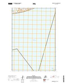 2019 Nushagak Bay C-1 SE2019 Print · USGSCoastal Alaska in the early twenty-first century reveals a remote landscape defined by its maritime boundaries and administrative borders. Researchers can trace the division of the Dillingham Census Area Lake and Peninsula Borough where it meets the waters of Bristol Bay.
 - 2019 Map of Nushagak Bay C-1 NE, 2019 Print
 2019 Nushagak Bay C-1 NE2019 Print · USGSKvichak Bay meets the vast Alaskan tundra in this 2019 survey of the Dillingham Census Area. Researchers can trace the intricate shoreline of Kvichak Bay and explore a landscape dense with unnamed lakes across sections like T17S R53W.
 - 2019 Map of Naknek C-2 NW, 2019 Print
 2019 Naknek C-2 NW2019 Print · USGSThe Bristol Bay region hums with aviation and river activity in this 2019 survey. Researchers can trace the infrastructure surrounding King Salmon Airport and follow the Naknek River to the edge of Katmai National Park.
 - 2019 Map of Naknek D-1 NW, 2019 Print
 2019 Naknek D-1 NW2019 Print · USGSThe Lake and Peninsula Borough of Alaska is mapped here during the late 2010s, showing a remote landscape shaped by water and elevation. Researchers can trace the winding path of Pauls Cr through the tundra and identify the official borough boundaries.
 - 2019 Map of Naknek D-3 SE, 2019 Print
 2019 Naknek D-3 SE2019 Print · USGSThe Bristol Bay region of the Alaska Peninsula remains a pristine expanse of tundra and interconnected wetlands in the late 2010s. Modern researchers can trace the winding paths of Graveyard Cr and Pauls Cr through the intricate coastal lowlands.
 - 2019 Map of Naknek D-3 NE, 2019 Print
 2019 Naknek D-3 NE2019 Print · USGSThe borderlands of the Alaska Peninsula are captured here in the late 2010s, showcasing a landscape of dense wetlands and interior lakes. Researchers can trace the path of Coffee Cr or study the municipal boundary between Lake and Peninsula Borough and Bristol Bay Borough.
 - 2019 Map of Naknek D-5 SW, 2019 Print
 2019 Naknek D-5 SW2019 Print · USGSKvichak Bay meets the southern coast of Alaska in this early twenty-first-century survey of the Bristol Bay region. Trace the boundary of the Dillingham Census Area and the winding course of Portage Cr through the tundra.
 - 2019 Map of Naknek C-4 SW, 2019 Print
 2019 Naknek C-4 SW2019 Print · USGSCoastal lowlands along the Alaska Peninsula meet the tide in this 2019 survey of the Bristol Bay region. Researchers can trace the drainage of Johnson Hill Cr and Big Creek near the prominent rise of Johnson Hill.
 - 2019 Map of Naknek D-1 SW, 2019 Print
 2019 Naknek D-1 SW2019 Print · USGSThe Lake and Peninsula wilderness of Southwest Alaska is captured here in the late twenty-tens, showing the transition from mountain foothills to tundra wetlands. Researchers can trace the boundary of Katmai National Park and the winding path of King Salmon Cr through the borough interior.
 - 2019 Map of Naknek C-1 SW, 2019 Print
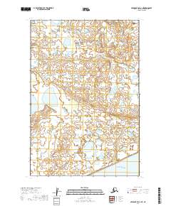
 2019 Naknek C-1 SW2019 Print · USGSThe Alaska Peninsula interior comes into focus in this late twenty-first-century survey, where the boundaries of major conservation lands meet. Researchers can trace the shoreline of Naknek Lake and the administrative borders of Katmai National Park and Becharof National Wildlife Refuge.
 - 2019 Map of Naknek C-2 NE, 2019 Print
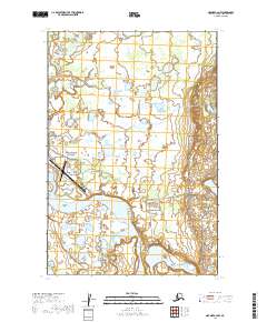
 2019 Naknek C-2 NE2019 Print · USGSKatmai's wilderness and the headwaters of the Alaska Peninsula are documented in this late-decade survey. Researchers can trace the path of the Naknek River as it flows from Naknek Lake, accessible via the historic Lake Camp Road.
 - 2019 Map of Naknek C-6 NE, 2019 Print
 2019 Naknek C-6 NE2019 Print · USGSCoastal Bristol Bay is captured here in the late twenty-tens as the waters of Kvichak Bay meet the shoreline. Genealogists and researchers can trace the hydrologic connections between Supply Lake, Supply Cr, and the landmark at Lake Point.
 - 2019 Map of Naknek C-4 SE, 2019 Print
 2019 Naknek C-4 SE2019 Print · USGSThe Alaska Peninsula's interior wetlands are captured in the late 2010s, showing the border between Bristol Bay Borough and Lake and Peninsula Borough. Trace the winding paths of Big Cr and Johnson Hill Cr through this vast watery landscape.
 - 2019 Map of Naknek D-4 NE, 2019 Print
 2019 Naknek D-4 NE2019 Print · USGSCovers Bristol Bay, including Nakeen, Unorganized Borough, and other nearby areas
 - 2019 Map of Naknek D-2 NE, 2019 Print
 2019 Naknek D-2 NE2019 Print · USGSThe boundary between Lake and Peninsula Borough and Bristol Bay Borough is documented here as it stood in the late twenty-teens. Trace the intricate wetland drainage of Coffee Cr and Pauls Cr across the tundra.
 - 2019 Map of Naknek C-5 SE, 2019 Print
 2019 Naknek C-5 SE2019 Print · USGSKvichak Bay and the surrounding Bristol Bay lowlands are captured here in the late twenty-first century. Researchers can trace the coastal boundary between Bristol Bay Borough and Lake and Peninsula Borough or study the shoreline of Big Flat.
Showing maps 1-25 of 36
Frequently asked questions
- What are the different types of historical maps available for Bristol Bay?
- What is the oldest map of Bristol Bay?
- Where can I purchase historical maps of Bristol Bay for my home or office?
- Where can I download high-res historical maps of Bristol Bay?
- Are there historical topographic maps available for Bristol Bay?
- Is there historical aerial imagery available for Bristol Bay?
- Where are historical maps of Bristol Bay sourced from?