1900s (20th Century) Maps of Bristol Bay, Alaska
Explore 18 historic maps of Bristol Bay from the 1900s (20th Century). These maps offer a rare glimpse into what life looked like during the 1900s — showing old roads, neighborhoods, homes, and landmarks that have changed or disappeared over time.
Whether you're researching your family's past, planning a metal detecting trip, or studying how Bristol Bay's landscape evolved across the 1900s, these high-resolution maps are a powerful tool for exploring the history of this region.
- Focus on a specific era: All maps on this page are from the 1900s, giving you a focused view of this time period.
- See what’s changed: Compare century-old streets, trails, and buildings to today's modern landscape using overlays and satellite layers.
- Research with precision: Use these maps for genealogy, historical research, land use analysis, or educational projects.
- View, download, or print: Maps are fully viewable online in high resolution, and can be downloaded or printed for your own records.
Start exploring Bristol Bay's history through authentic maps from the 1900s. This is your window into the past.
Bristol Bay, AK maps
(18)- 1945 Map of Nushagak Bay, 1954 Print
 1945 Nushagak Bay1954 Print · USGSNushagak Bay and the sprawling Alaskan coastline are captured in the mid-1940s, highlighting a landscape defined by salmon fishing and tidal waters. Researchers can locate remote outposts like Old Saltery, the busy Nushagak Cannery, and the coastal settlement of Clarks Point.
 - 1949 Map of Nushagak Bay
 1949 Nushagak Bay1949 Print · USGSCoastal Alaska at the height of the mid-century salmon industry reveals a landscape of isolated canneries and subsistence camps. You can trace the shorelines to find sites like Nushagak Cannery, the Old Saltery, and the remote Igushik Cannery along the river.2 unique versions available
 - 1951 Map of Nushagak Bay, 1955 Print
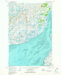
 1951 Nushagak Bay1955 Print · USGSBristol Bay's eastern coastline is captured here in the early fifties, highlighting the salmon fishing and canning hubs of the era. Genealogists and historians can trace coastal settlements like Ekuk and Nushagak or locate the Igushik (Site).7 unique versions available
 - 1951 Map of Naknek D-1, 1956 Print
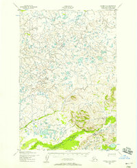
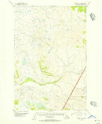 1951 Naknek D-11956 Print · USGSThe Alaska Peninsula wilderness is captured here in the early fifties, showcasing the natural hydrology near the western edge of Katmai National Monument. You can trace the winding course of King Salmon Creek and identify the original Katmai National Monument Boundary.2 unique versions available
 - 1951 Map of Naknek C-1, 1956 Print
 1951 Naknek C-11956 Print · USGSThe Alaska Peninsula in the early fifties remains a vast wilderness of water and ice-sculpted terrain. Researchers can trace the early National Monument Boundary (Approximate) where it bisects Naknek Lake (North Arm) and enters Katmai National Monument.3 unique versions available
 - 1952 Map of Naknek, 1953 Print
 1952 Naknek1953 Print · USGSBristol Bay at the dawn of the fifties reveals a world of salmon canneries and strategic outposts. Genealogists and historians can trace old coastal settlements like Koggiung and Libbyville or locate early facilities at Naknek Air Base.10 unique versions available
 - 1952 Map of Naknek D-2, 1958 Print
 1952 Naknek D-21958 Print · USGSThe wilderness of the Bristol Bay region is captured in the early 1950s as a complex network of glacial ponds and waterways. Researchers can trace the winding paths of Pauls Creek, Salmon Creek, and King Salmon Creek through this undeveloped landscape.3 unique versions available
 - 1952 Map of Naknek C-5, 1958 Print
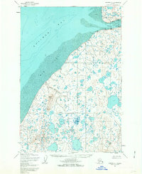
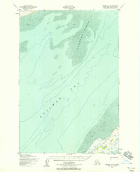 1952 Naknek C-51958 Print · USGSThe northern reaches of Kvichak Bay appear in the early fifties, documenting a landscape of shifting tides and coastal wilderness. Researchers can trace the path of the Winter Trail and locate isolated landmarks like the shore-side cabin and the Big Flat coastal region.2 unique versions available
 - 1952 Map of Nushagak Bay C-1, 1958 Print
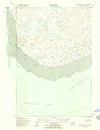 1952 Nushagak Bay C-11958 Print · USGSCoastal Alaska in the early fifties reveals a labyrinth of tundra lakes and shifting sediment banks at the edge of the Bering Sea. Maritime researchers and historians can trace the vital navigation points like Etolin Point Beacon and the reach of Flounder Flat.2 unique versions available
 - 1952 Map of Naknek C-6, 1958 Print
 1952 Naknek C-61958 Print · USGSThe Alaska Peninsula coast meets the waters of Kvichak Bay in the early 1950s, showing a landscape defined by water and shifting sands. Researchers can locate a coastal Cabin and trace the drainage of Supply Lake through Supply Creek.3 unique versions available
 - 1952 Map of Naknek C-2, 1962 Print
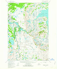 1952 Naknek C-21962 Print · USGSKing Salmon served as a critical aviation and maritime hub in the Bristol Bay region during the early fifties. Researchers can trace the layout of the Airport and Seaplane Docks or locate seasonal Cabins along the Naknek River.2 unique versions available
 - 1952 Map of Naknek C-3, 1962 Print
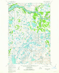 1952 Naknek C-31962 Print · USGSThe Bristol Bay region during the early fifties reveals a landscape shaped by the Naknek River and the salmon industry. Trace the early layout of South Naknek and King Salmon or locate traditional camps like Savonoski and Kanaknok.3 unique versions available
 - 1952 Map of Naknek D-5, 1962 Print
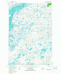
 1952 Naknek D-51962 Print · USGSCoastal wetlands and tidal flats define the northern shores of the Alaska Peninsula in the early fifties. Researchers can trace the seasonal Winter Trail and locate isolated landmarks like the Keefer Cutoff and Half Moon Bay.
 - 1952 Map of Naknek D-3, 1963 Print
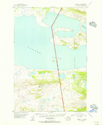
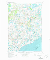
 1952 Naknek D-31963 Print · USGSCoastal Bristol Bay is captured in the early fifties, showing a water-heavy landscape of tundra lakes and tidal flats. Local historians can trace the Winter Trail as it crosses the region toward the settlement at Kvichak and the Kvichak River.2 unique versions available
 - 1952 Map of Naknek D-4, 1963 Print
 1952 Naknek D-41963 Print · USGSBristol Bay's coastal landscape and fishing outposts are captured here in the early fifties. Researchers can trace seasonal transport routes like the Winter Trail and locate commercial hubs at Koggiung, Nakeen, and Libbyville.3 unique versions available
 - 1952 Map of Naknek C-4, 1963 Print
 1952 Naknek C-41963 Print · USGSBristol Bay at the start of the 1950s shows a landscape defined by the salmon industry and seasonal travel. Researchers can trace the layout of Naknek and South Naknek, locating the Cannery, the local Landing Strip, and the historic Winter Trail.2 unique versions available
 - 1964 Map of Nushagak Bay
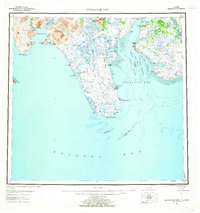
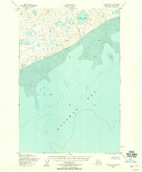
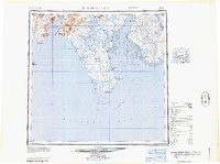 1964 Nushagak Bay1964 Print · USGSNushagak Bay and the Bristol Bay coastline appear in mid-century detail, capturing the seasonal fishing hubs and maritime hazards of the era. Researchers can trace historic cannery sites, coastal settlements like Ekuk, and the shifting sands of Ship Channel or Etolin Pt.
 - 1964 Map of Naknek
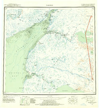
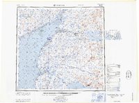 1964 Naknek1964 Print · USGSBristol Bay and the Alaska Peninsula come into focus in the mid-1960s, a time when coastal life centered on the great river estuaries. Genealogists and historians can trace the foundations of local industry at Libbyville, the military's footprint at King Salmon Air Force Base, and the path of the Winter Trail.
End of results
Showing maps 1-18 of 18
Frequently asked questions
- What are the different types of historical maps available for Bristol Bay?
- What is the oldest map of Bristol Bay?
- Where can I purchase historical maps of Bristol Bay for my home or office?
- Where can I download high-res historical maps of Bristol Bay?
- Are there historical topographic maps available for Bristol Bay?
- Is there historical aerial imagery available for Bristol Bay?
- Where are historical maps of Bristol Bay sourced from?