Old Maps of Bristol Bay, Alaska
Explore 54 old maps of Bristol Bay, spanning from 1945 to today. These high-resolution historic maps reveal how streets, neighborhoods, landmarks, and natural features evolved over time — perfect for genealogy, metal detecting, research, and local history exploration.
What you can do with these maps:
- See how Bristol Bay changed over time: Compare historical maps to modern-day views to trace roads, homesites, rail lines & more.
- View detailed metadata: Each map includes creators, publishers, year, scale, and archive source.
- Overlay maps with satellite & LiDAR: Visualize the past alongside modern tools to explore terrain & human change.
- Trusted historical sources: Maps sourced from the USGS, Library of Congress, and other archives.
- Access maps your way: View online, download high-res files, or order prints for personal or research use.
Start exploring old maps of Bristol Bay to uncover forgotten places, hidden landmarks, and the deep history beneath your feet.
Bristol Bay, AK maps
(54)- 1945 Map of Nushagak Bay, 1954 Print
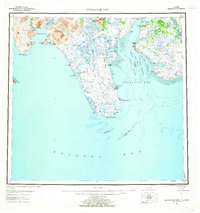
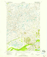
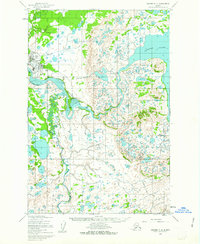
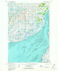
 1945 Nushagak Bay1954 Print · USGSNushagak Bay and the sprawling Alaskan coastline are captured in the mid-1940s, highlighting a landscape defined by salmon fishing and tidal waters. Researchers can locate remote outposts like Old Saltery, the busy Nushagak Cannery, and the coastal settlement of Clarks Point.
 - 1949 Map of Nushagak Bay
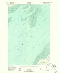
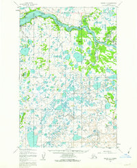
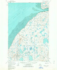
 1949 Nushagak Bay1949 Print · USGSCoastal Alaska at the height of the mid-century salmon industry reveals a landscape of isolated canneries and subsistence camps. You can trace the shorelines to find sites like Nushagak Cannery, the Old Saltery, and the remote Igushik Cannery along the river.2 unique versions available
 - 1951 Map of Nushagak Bay, 1955 Print
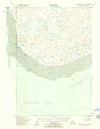
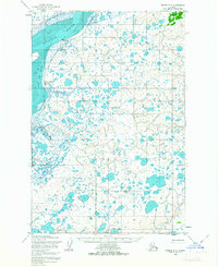
 1951 Nushagak Bay1955 Print · USGSBristol Bay's eastern coastline is captured here in the early fifties, highlighting the salmon fishing and canning hubs of the era. Genealogists and historians can trace coastal settlements like Ekuk and Nushagak or locate the Igushik (Site).7 unique versions available
 - 1951 Map of Naknek D-1, 1956 Print
 1951 Naknek D-11956 Print · USGSThe Alaska Peninsula wilderness is captured here in the early fifties, showcasing the natural hydrology near the western edge of Katmai National Monument. You can trace the winding course of King Salmon Creek and identify the original Katmai National Monument Boundary.2 unique versions available
 - 1951 Map of Naknek C-1, 1956 Print
 1951 Naknek C-11956 Print · USGSThe Alaska Peninsula in the early fifties remains a vast wilderness of water and ice-sculpted terrain. Researchers can trace the early National Monument Boundary (Approximate) where it bisects Naknek Lake (North Arm) and enters Katmai National Monument.3 unique versions available
 - 1952 Map of Naknek, 1953 Print
 1952 Naknek1953 Print · USGSBristol Bay at the dawn of the fifties reveals a world of salmon canneries and strategic outposts. Genealogists and historians can trace old coastal settlements like Koggiung and Libbyville or locate early facilities at Naknek Air Base.10 unique versions available
 - 1952 Map of Naknek D-2, 1958 Print
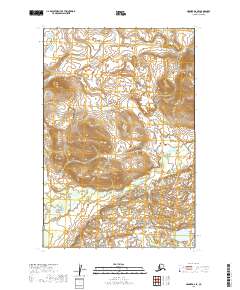
 1952 Naknek D-21958 Print · USGSThe wilderness of the Bristol Bay region is captured in the early 1950s as a complex network of glacial ponds and waterways. Researchers can trace the winding paths of Pauls Creek, Salmon Creek, and King Salmon Creek through this undeveloped landscape.3 unique versions available
 - 1952 Map of Naknek C-5, 1958 Print
 1952 Naknek C-51958 Print · USGSThe northern reaches of Kvichak Bay appear in the early fifties, documenting a landscape of shifting tides and coastal wilderness. Researchers can trace the path of the Winter Trail and locate isolated landmarks like the shore-side cabin and the Big Flat coastal region.2 unique versions available
 - 1952 Map of Nushagak Bay C-1, 1958 Print
 1952 Nushagak Bay C-11958 Print · USGSCoastal Alaska in the early fifties reveals a labyrinth of tundra lakes and shifting sediment banks at the edge of the Bering Sea. Maritime researchers and historians can trace the vital navigation points like Etolin Point Beacon and the reach of Flounder Flat.2 unique versions available
 - 1952 Map of Naknek C-6, 1958 Print
 1952 Naknek C-61958 Print · USGSThe Alaska Peninsula coast meets the waters of Kvichak Bay in the early 1950s, showing a landscape defined by water and shifting sands. Researchers can locate a coastal Cabin and trace the drainage of Supply Lake through Supply Creek.3 unique versions available
 - 1952 Map of Naknek C-2, 1962 Print
 1952 Naknek C-21962 Print · USGSKing Salmon served as a critical aviation and maritime hub in the Bristol Bay region during the early fifties. Researchers can trace the layout of the Airport and Seaplane Docks or locate seasonal Cabins along the Naknek River.2 unique versions available
 - 1952 Map of Naknek C-3, 1962 Print
 1952 Naknek C-31962 Print · USGSThe Bristol Bay region during the early fifties reveals a landscape shaped by the Naknek River and the salmon industry. Trace the early layout of South Naknek and King Salmon or locate traditional camps like Savonoski and Kanaknok.3 unique versions available
 - 1952 Map of Naknek D-5, 1962 Print
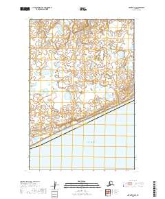
 1952 Naknek D-51962 Print · USGSCoastal wetlands and tidal flats define the northern shores of the Alaska Peninsula in the early fifties. Researchers can trace the seasonal Winter Trail and locate isolated landmarks like the Keefer Cutoff and Half Moon Bay.
 - 1952 Map of Naknek D-3, 1963 Print
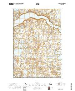
 1952 Naknek D-31963 Print · USGSCoastal Bristol Bay is captured in the early fifties, showing a water-heavy landscape of tundra lakes and tidal flats. Local historians can trace the Winter Trail as it crosses the region toward the settlement at Kvichak and the Kvichak River.2 unique versions available
 - 1952 Map of Naknek D-4, 1963 Print
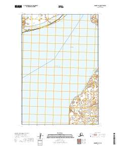
 1952 Naknek D-41963 Print · USGSBristol Bay's coastal landscape and fishing outposts are captured here in the early fifties. Researchers can trace seasonal transport routes like the Winter Trail and locate commercial hubs at Koggiung, Nakeen, and Libbyville.3 unique versions available
 - 1952 Map of Naknek C-4, 1963 Print
 1952 Naknek C-41963 Print · USGSBristol Bay at the start of the 1950s shows a landscape defined by the salmon industry and seasonal travel. Researchers can trace the layout of Naknek and South Naknek, locating the Cannery, the local Landing Strip, and the historic Winter Trail.2 unique versions available
 - 1964 Map of Nushagak Bay
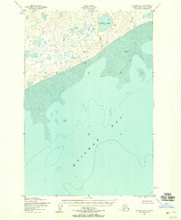
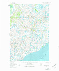
 1964 Nushagak Bay1964 Print · USGSNushagak Bay and the Bristol Bay coastline appear in mid-century detail, capturing the seasonal fishing hubs and maritime hazards of the era. Researchers can trace historic cannery sites, coastal settlements like Ekuk, and the shifting sands of Ship Channel or Etolin Pt.
 - 1964 Map of Naknek
 1964 Naknek1964 Print · USGSBristol Bay and the Alaska Peninsula come into focus in the mid-1960s, a time when coastal life centered on the great river estuaries. Genealogists and historians can trace the foundations of local industry at Libbyville, the military's footprint at King Salmon Air Force Base, and the path of the Winter Trail.
 - 2019 Map of Naknek D-3 NW, 2019 Print
 2019 Naknek D-3 NW2019 Print · USGSCoastal Alaska at the end of the second decade reveals a landscape shaped by the Kvichak River. Researchers can trace the braided watercourse from Cape Horn down to Sea Gull Flat and the small settlement of Kvichak.
 - 2019 Map of Naknek C-6 NW, 2019 Print
 2019 Naknek C-6 NW2019 Print · USGSThe coastal tundra of southwest Alaska meets the sea in this recent survey of the Bristol Bay region. Researchers can trace the administrative line of the Dillingham Census Area and the hydrologic patterns surrounding Kvichak Bay.
 - 2019 Map of Naknek C-2 SW, 2019 Print
 2019 Naknek C-2 SW2019 Print · USGSThe Bristol Bay lowlands come alive in the late 2010s, showcasing a landscape of shifting wetlands and protected wilderness. Researchers can trace the course of the Naknek River and identify the intersection of Katmai National Park and Becharof National Wildlife Refuge.
 - 2019 Map of Naknek C-3 NW, 2019 Print
 2019 Naknek C-3 NW2019 Print · USGSCoastal life in Bristol Bay is centered on the Naknek River and the local hub of South Naknek in this modern survey. Researchers can trace aviation and maritime links through the South Naknek Airport and the village's Borough Dock Road.
 - 2019 Map of Naknek D-2 SE, 2019 Print
 2019 Naknek D-2 SE2019 Print · USGSBristol Bay Borough at the edge of the wilderness during the early twenty-first century. Researchers can trace the natural drainage of Pauls Cr or examine the northern boundary of Katmai National Park.
 - 2019 Map of Naknek C-2 SE, 2019 Print
 2019 Naknek C-2 SE2019 Print · USGSThe wild borderlands between Katmai National Park and Becharof National Wildlife Refuge are captured here in the late twenty-teens. Trace the headwaters of the Naknek River and the shore of Naknek Lake through this remote stretch of the Alaska Peninsula.
 - 2019 Map of Naknek D-4 SE, 2019 Print
 2019 Naknek D-4 SE2019 Print · USGSThe eastern coast of Kvichak Bay comes into focus in this late 2010s survey of the Bristol Bay shoreline. Genealogists and researchers can trace the coastal settlements of Koggiung and Libbyville, alongside landmarks like Graveyard Point and Pederson Point.
Showing maps 1-25 of 54
Frequently asked questions
- What are the different types of historical maps available for Bristol Bay?
- What is the oldest map of Bristol Bay?
- Where can I purchase historical maps of Bristol Bay for my home or office?
- Where can I download high-res historical maps of Bristol Bay?
- Are there historical topographic maps available for Bristol Bay?
- Is there historical aerial imagery available for Bristol Bay?
- Where are historical maps of Bristol Bay sourced from?