Old Maps of Denali, Alaska for Metal Detecting
Plan your next treasure hunt with 554 historic maps of Denali. Find old homesites, ghost towns, trails, and gathering spots that may be lost to time — perfect for identifying promising metal detecting locations.
- Locate forgotten sites: Uncover places like long-lost settlements, abandoned rail lines, or gathering spots.
- Plan better hunts: Use map overlays combined with LiDAR or satellite views to narrow in on historically rich areas.
- Made for detectorists: Thousands of hobbyists use these maps to discover relics, coins, and hidden history.
Use these historic maps to boost your research and find new opportunities beneath the surface of Denali.
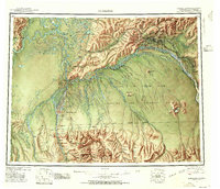
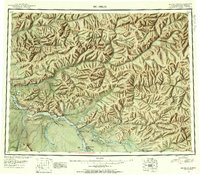
Denali, AK maps
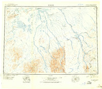
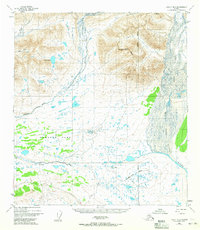
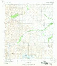
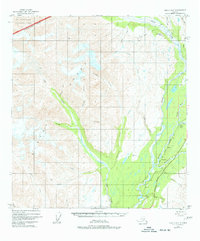
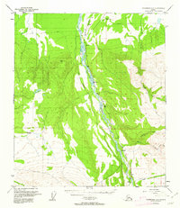
(554)- 1948 Map of Kantishna River, 1956 Print
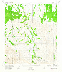
 1948 Kantishna River1956 Print · USGSInterior Alaska during the late 1940s remained a frontier of river landings and winter trails before the era of major highway expansion. Genealogists and historians can trace the remote outposts of Manley Hot Springs Po, Roosevelt, and Toklat along the vast Kantishna River system.
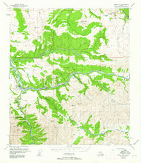
 - 1949 Map of McGrath, 1955 Print
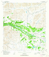
 1949 McGrath1955 Print · USGSThe Alaskan interior at mid-century comes to life through this survey of the river valleys and mountain passes near McGrath. Trace old-world wilderness routes via the Winter Trail and remote stops like the Big River Roadhouse or the Rohn Roadhouse.
 - 1949 Map of Fairbanks B-5, 1958 Print
 1949 Fairbanks B-51958 Print · USGSThe braided river valleys and military outposts of Interior Alaska are captured here just before statehood. Researchers can trace the path of the Alaska Railroad past the Clear Air Force Auxiliary Field and the small siding at Julius.
 - 1949 Map of Healy B-4, 1958 Print
 1949 Healy B-41958 Print · USGSThe Interior of Alaska comes into focus during the late 1940s as the rail and road network began to expand near the park boundary. Trace the early alignment of the Alaska Railroad and search for local landmarks like the Cantwell Airstrip and Windy.4 unique versions available
 - 1949 Map of Fairbanks B-4, 1963 Print
 1949 Fairbanks B-41963 Print · USGSThe interior wilderness along the Tatlanika River is captured here just after the war. Local historians can trace the early Clear Military Reservation Boundary and follow the route of an old Winter Trail.5 unique versions available
 - 1949 Map of Big Delta A-6, 1964 Print
 1949 Big Delta A-61964 Print · USGSThe interior Alaskan wilderness near the Tanana Valley is captured here in the late forties, defined by the braided path of the Little Delta River. Trace seasonal movement along the Winter Trail and locate high-altitude survey markers like VABM Hayes 3641.2 unique versions available
 - 1949 Map of Healy C-3, 1965 Print
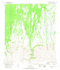
 1949 Healy C-31965 Print · USGSAlaskan wilderness near the Fairbanks Meridian is captured here in the late 1940s, showing a landscape without established roads or trails. Researchers can trace the extensive drainage of the Yanert Fork and its tributaries like Grizzly Creek and Moose Creek.2 unique versions available
 - 1949 Map of Healy B-2, 1965 Print
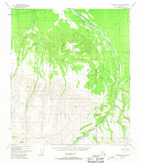
 1949 Healy B-21965 Print · USGSThe Alaskan interior during the late 1940s is revealed here through its complex glacial drainages and untouched peaks. Map collectors and researchers can trace the intricate braided channels of the Nenana River and the sweeping terrain of Monahan Flat.2 unique versions available
 - 1949 Map of Fairbanks B-3, 1967 Print
 1949 Fairbanks B-31967 Print · USGSThe roadless interior of Alaska south of Fairbanks is revealed here during the late 1940s, a period of expanding military land use. Researchers can trace the winding Wood River or locate remote drainage points like Bonnifield Gold King Creek and Blair Lake.3 unique versions available
 - 1949 Map of Fairbanks A-2, 1967 Print
 1949 Fairbanks A-21967 Print · USGSThe Tanana Valley wilderness comes into focus in the late 1940s as bush pilots and surveyors began documenting the interior. Researchers can trace the path of the Wood River and locate isolated landmarks like the Landing Strip and a lonely Cabin.3 unique versions available
 - 1949 Map of Fairbanks A-1, 1968 Print
 1949 Fairbanks A-11968 Print · USGSThe interior Alaskan wilderness near Fairbanks is captured here just after the war, showing a landscape defined by braided river systems and high summits. Researchers can trace the courses of Dry Creek and Slide Creek as they flow from the slopes of Snow Mountain.2 unique versions available
 - 1949 Map of Healy D-1, 1969 Print
 1949 Healy D-11969 Print · USGSThe Alaska interior near the Little Delta River is captured here in the late 1940s, showing a roadless landscape before modern development. Researchers can locate early Cabins and trace the drainage of Whiskey Pup and Fort Greely.3 unique versions available
 - 1949 Map of Healy A-6, 1977 Print
 1949 Healy A-61977 Print · USGSUpper Matanuska-Susitna was a hub of mining and rail expansion in the late 1940s. Genealogists and historians can trace the paths of the Alaska Railroad and find remote sites like the Golden Zone Mine and Hurricane Gulch.5 unique versions available
 - 1950 Map of McGrath
 1950 McGrath1950 Print · USGSThe Kuskokwim River valley and the Alaska Range foothills appear here at the dawn of the fifties. Trace the old interior supply routes through McGrath and Nikolai, or locate remote landmarks like Farewell Mtn Roadhouse and Rainy Pass.
 - 1950 Map of Talkeetna, 1954 Print
 1950 Talkeetna1954 Print · USGSThe Susitna Valley and the foothills of the Alaska Range appear in this mid-century survey as a frontier of remote lodges and rail-side outposts. You can trace the path of The Alaska Railroad through Talkeetna and locate vanished settlements like Sunflower.2 unique versions available
 - 1950 Map of Fairbanks, 1955 Print
 1950 Fairbanks1955 Print · USGSMid-century Interior Alaska centers on the growing hub of Fairbanks and the massive military infrastructure that reshaped the region. Trace the path of the Alaska Railroad past remote stops like Nenana and Dunbar, or locate early aviation and mining landmarks such as Weeks Field and various Placer Mine sites.2 unique versions available
 - 1950 Map of Mount Hayes, 1955 Print
 1950 Mount Hayes1955 Print · USGSThe Alaska Interior in the early fifties shows a landscape of high peaks and essential roadhouse stops along the primitive highway system. Genealogists and historians can trace old travel routes and outposts like Rapids Roadhouse, Donnelly, and Paxson.2 unique versions available
 - 1950 Map of Big Delta, 1956 Print
 1950 Big Delta1956 Print · USGSAlaska's interior corridors reveal a landscape of military outposts and river-valley lodges in the mid-twentieth century. Trace historic routes along the Richardson Highway to find Big Delta, Fort Greely, and Shaw Creek Lodge.2 unique versions available
 - 1950 Map of Fairbanks A-5, 1962 Print
 1950 Fairbanks A-51962 Print · USGSThe Nenana River valley comes to life in this mid-century survey of the Alaska Interior during a period of infrastructure expansion. You can trace the path of The Alaska Railroad through trackside stops like Rex, locate remote Cabins, and follow the seasonal Winter Trail.4 unique versions available
 - 1950 Map of Healy D-4, 1963 Print
 1950 Healy D-41963 Print · USGSAlaska's interior mining and rail corridor comes to life in the mid-century as the coal industry expanded along the river forks. Researchers can trace the industrial footprint of the Usibelli Mine, the settlement at Suntrana, and the path of The Alaska Railroad.4 unique versions available
 - 1950 Map of Healy C-4, 1963 Print
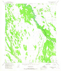
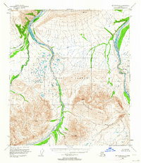
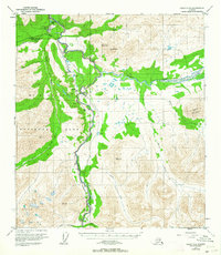 1950 Healy C-41963 Print · USGSThe Alaska interior at the start of the 1950s reveals the early development of Mt McKinley National Park and its surrounding river valleys. Trace the Alaska Railroad as it services McKinley Park and the settlement at Carlo along the Nenana River.6 unique versions available
 - 1950 Map of Fairbanks A-4, 1964 Print
 1950 Fairbanks A-41964 Print · USGSInterior Alaska during the early statehood era shows a landscape of mining claims and seasonal routes. You can trace the mineral history of the region through the Liberty Bell Mine, the isolated Cabin sites, and the old Winter Trail along California Creek.4 unique versions available
 - 1950 Map of Fairbanks A-3, 1964 Print
 1950 Fairbanks A-31964 Print · USGSAlaska's interior near the Fairbanks Meridian is captured here in the early fifties, documenting a remote landscape defined by mining prospects and seasonal transit. Researchers can find isolated evidence of early industry and infrastructure like the Placer Mine, a remote Landing Strip, and a historic Sled Road.4 unique versions available
 - 1950 Map of Healy B-3, 1964 Print
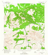
 1950 Healy B-31964 Print · USGSThe Denali Highway corridor in the early fifties shows a rugged interior landscape shaped by the Nenana River and the high peaks of the Alaska Range. Researchers can locate remote backcountry sites like the Landing Strip, Brushkana Campground, and isolated cabins.2 unique versions available
 - 1950 Map of Mount Hayes D-6, 1964 Print
 1950 Mount Hayes D-61964 Print · USGSSoutheast Fairbanks was still a frontier of military expansion and glacial rivers in the early fifties. Researchers can trace the early bounds of the Fort Greely Military Reservation and landmarks like Molybdenum Ridge and Jarvis Creek.2 unique versions available
Showing maps 1-25 of 554
Top cities of Denali
Frequently asked questions
- What are the different types of historical maps available for Denali?
- What is the oldest map of Denali?
- Where can I purchase historical maps of Denali for my home or office?
- Where can I download high-res historical maps of Denali?
- Are there historical topographic maps available for Denali?
- Is there historical aerial imagery available for Denali?
- Where are historical maps of Denali sourced from?