Old Maps of Thane, Alaska for Academic Research
Study the evolution of Thane with 8 high-resolution historic maps. Whether you're teaching, researching, or modeling changes in land use, these maps provide essential visual documentation of urban, environmental, and geographic change.
- Analyze long-term change: Track patterns in development, transportation, and natural features.
- Ideal for environmental or urban studies: Support academic projects with primary historical map data.
- Use in the classroom or lab: Educators and researchers rely on these maps to bring historical context to life.
These maps are a powerful tool for teaching, research, and visualizing how Thane has changed over the decades.
Thane, AK maps
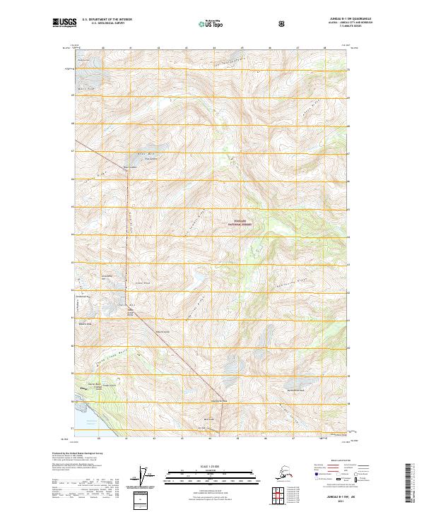
(8)- 1948 Map of Juneau B-1, 1967 Print
 1948 Juneau B-11967 Print · USGSThe wilderness surrounding Juneau in the late 1940s reveals a specialized landscape of industrial camps and massive ice fields. Genealogists and historians can trace mining activity and infrastructure near Thane, identifying local landmarks like the Power Plant and Portal Camp.2 unique versions available
 - 1951 Map of Juneau
 1951 Juneau1951 Print · USGSJuneau and the industrial waterfront of the Gastineau Channel are shown here at the start of the 1950s. Researchers can trace the mid-century footprint of Juneau, the mining history of Treadwell, and remote maritime outposts like Hoonah and Gustavus.4 unique versions available
 - 1952 Map of Juneau B-1, 1953 Print
 1952 Juneau B-11953 Print · USGSSoutheast Alaska in the early fifties shows a rugged landscape defined by massive ice fields and industrial outposts. Genealogists and historians can trace the mining footprint at Thane or the remote sites of Portal Camp and Camp No 6 near the Gastineau Channel.3 unique versions available
 - 1962 Map of Juneau, 1966 Print
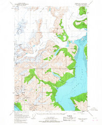
 1962 Juneau1966 Print · USGSSoutheast Alaska in the early sixties showcases a maritime landscape defined by the Tongass National Forest and the peaks of the Coast Mountains. Trace the footprints of coastal industry at Treadwell, Thane, and the regional hub of Juneau.7 unique versions available
 - 1986 Map of Juneau B-1 SW, 1987 Print
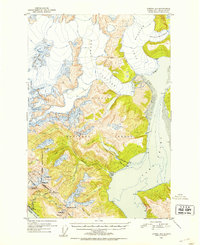
 1986 Juneau B-1 SW1987 Print · USGSThe Gastineau Channel and the rugged glaciers east of Juneau are captured here in the mid-eighties. Researchers can trace the industrial footprint at Thane, locate early mining Adits, and find the Fish Hatchery and Portal Camp.
 - 1997 Map of Juneau B-1, 2000 Print
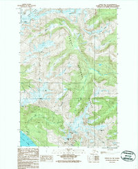
 1997 Juneau B-12000 Print · USGSThe glacial landscapes and industrial outposts south of Juneau are captured here in the late 1990s as ice and sea meet. Trace the legacy of early industry through the Mines near Thane and remote camps like Portal Camp and Camp No 2.
 - 2017 Map of Juneau B-1 SW, 2017 Print
 2017 Juneau B-1 SW2017 Print · USGSCovers Thane, including Juneau, United States, and other nearby areas
 - 2021 Map of Juneau B-1 SW, 2021 Print
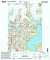
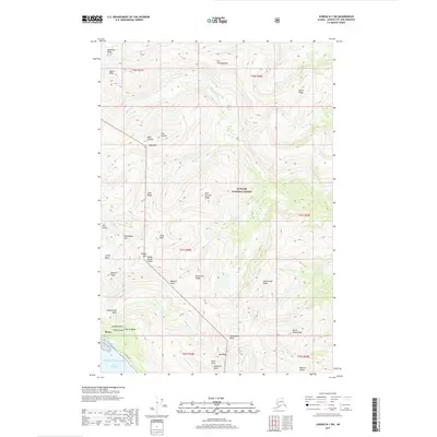
 2021 Juneau B-1 SW2021 Print · USGSThe coastal settlement of Thane meets the wilderness of the Tongass National Forest in this 2021 study of the terrain east of Juneau. Local researchers can trace old routes along Thane Road and locate sites like Glacier Basin and Lost Rocker Gulch.
End of results
Showing maps 1-8 of 8
Top cities near Thane
Frequently asked questions
- What are the different types of historical maps available for Thane?
- What is the oldest map of Thane?
- Where can I purchase historical maps of Thane for my home or office?
- Where can I download high-res historical maps of Thane?
- Are there historical topographic maps available for Thane?
- Is there historical aerial imagery available for Thane?
- Where are historical maps of Thane sourced from?