Old Maps of Port Nikiski, Alaska for Academic Research
Study the evolution of Port Nikiski with 8 high-resolution historic maps. Whether you're teaching, researching, or modeling changes in land use, these maps provide essential visual documentation of urban, environmental, and geographic change.
- Analyze long-term change: Track patterns in development, transportation, and natural features.
- Ideal for environmental or urban studies: Support academic projects with primary historical map data.
- Use in the classroom or lab: Educators and researchers rely on these maps to bring historical context to life.
These maps are a powerful tool for teaching, research, and visualizing how Port Nikiski has changed over the decades.
Port Nikiski, AK maps
(8)- 1944 Map of Kenai, 1954 Print
 1944 Kenai1954 Print · USGSThe Kenai Peninsula and Cook Inlet are captured here during a period of postwar growth, just as the regional road system began to expand. Genealogists and historians can trace early settlements and family landmarks such as Salamatoff, Stelters Ranch, and the Snug Harbor Cannery.4 unique versions available
 - 1950 Map of Kenai
 1950 Kenai1950 Print · USGSThe Kenai Peninsula and Cook Inlet appear here during a pivotal era of mid-century growth and road construction. Researchers can trace the early layout of Soldotna, locate the Snug Harbor Cannery, and see the footprint of Salamatof.2 unique versions available
 - 1951 Map of Kenai C-4, 1965 Print
 1951 Kenai C-41965 Print · USGSThe Kenai Peninsula coastline comes into focus during the early 1950s as a vital military and industrial corridor. Trace the early development of Kenai and Wildwood Station alongside historical features like the coastal Sawmill, the riverfront Cannery, and Salamatof Beach.3 unique versions available
 - 1952 Map of Kenai C-4, 1954 Print
 1952 Kenai C-41954 Print · USGSThe Kenai Peninsula shoreline is captured here in the early fifties as the region's aviation and fishing sectors expanded. Researchers can trace the development of Kenai, locate the East Foreland Lighthouse Reserve, and find now-quiet sites like Salamato (Aband).3 unique versions available
 - 1958 Map of Kenai, 1967 Print
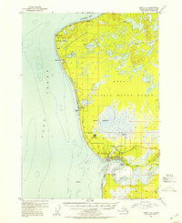
 1958 Kenai1967 Print · USGSThe Kenai Peninsula and Cook Inlet are captured here during a period of mid-century growth and wilderness management. Researchers can trace early settlements and infrastructure like Nikishka No 1, Salamatof, and the Wildwood Military Reservation.6 unique versions available
 - 1986 Map of Kenai C-4 NW
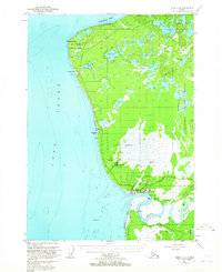
 1986 Kenai C-4 NW1986 Print · USGSThe Kenai Peninsula coastline in the mid-eighties shows an expanding industrial and residential landscape. Genealogists and historians can trace the growth of Port Nikiski and locate family landmarks like the East Foreland Lighthouse and Lower Salamatof Lake.
 - 2018 Map of Kenai C-4 NW, 2018 Print
 2018 Kenai C-4 NW2018 Print · USGSCovers Port Nikiski, including Nikishka, Kenai Peninsula, and other nearby areas
 - 2024 Map of Kenai C-4 NW, 2024 Print
 2024 Kenai C-4 NW2024 Print · USGSThe Kenai Peninsula coastline comes into focus here during a period of modern industrial and residential growth. Genealogists and researchers can trace the development of Nikiski and Salamatof or locate landmarks like McGahan Industrial Airpark and Bernice Lake.
End of results
Showing maps 1-8 of 8
Top cities near Port Nikiski
Frequently asked questions
- What are the different types of historical maps available for Port Nikiski?
- What is the oldest map of Port Nikiski?
- Where can I purchase historical maps of Port Nikiski for my home or office?
- Where can I download high-res historical maps of Port Nikiski?
- Are there historical topographic maps available for Port Nikiski?
- Is there historical aerial imagery available for Port Nikiski?
- Where are historical maps of Port Nikiski sourced from?