Old Maps of Clover Pass, Alaska for Academic Research
Study the evolution of Clover Pass with 8 high-resolution historic maps. Whether you're teaching, researching, or modeling changes in land use, these maps provide essential visual documentation of urban, environmental, and geographic change.
- Analyze long-term change: Track patterns in development, transportation, and natural features.
- Ideal for environmental or urban studies: Support academic projects with primary historical map data.
- Use in the classroom or lab: Educators and researchers rely on these maps to bring historical context to life.
These maps are a powerful tool for teaching, research, and visualizing how Clover Pass has changed over the decades.
Clover Pass, AK maps
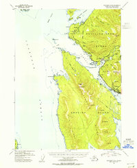
(8)- 1952 Map of Ketchikan, 1953 Print
 1952 Ketchikan1953 Print · USGSThe Ketchikan region of Southeast Alaska is mapped here in the early fifties, documenting the remote settlements and deep-water inlets of the southern panhandle. Genealogists and historians can trace the foundations of Ketchikan, Metlakatla, and Saxman alongside lonely backcountry cabins.4 unique versions available
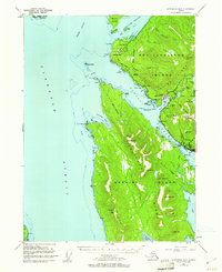
 - 1953 Map of Ketchikan B-6, 1955 Print
 1953 Ketchikan B-61955 Print · USGSCoastal life in Southeast Alaska comes into focus in the mid-fifties as industry and wilderness meet along the Tongass Narrows. Trace the early layout of Ketchikan, locate the Cannery at Wards Cove, and find the US Coast Guard Station at Point Higgins.
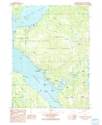
 - 1954 Map of Ketchikan B-6, 1960 Print
 1954 Ketchikan B-61960 Print · USGSSoutheast Alaska in the mid-fifties is defined by the coastal settlements and industrial outposts lining the Tongass Narrows. Maritime and cultural researchers can trace the development of Ketchikan, the facilities at Wacker, and landmarks like Totem Bight.4 unique versions available
 - 1955 Map of Ketchikan, 1966 Print
 1955 Ketchikan1966 Print · USGSSoutheast Alaska’s maritime character is captured in the mid-fifties, showing the vital waterways and remote outposts of the Alexander Archipelago. Researchers can trace the waterfronts of Ketchikan and Metlakatla or locate isolated spots like Hyder and Loring.3 unique versions available
 - 1991 Map of Ketchikan B-6 NE
 1991 Ketchikan B-6 NE1991 Print · USGSSoutheast Alaska’s maritime and industrial landscape is captured here in the early nineties, centered on the western shore of Revillagigedo Island. Researchers can trace coastal history through the U S Coast Guard Station, Ward Cannery, and the Totem Bight State Historical Park.
 - 1994 Map of Ketchikan B-6, 1998 Print
 1994 Ketchikan B-61998 Print · USGSSoutheast Alaska in the 1990s reveals a landscape defined by the maritime economy and the North Tongass Highway corridor. Genealogists and historians can trace coastal development through the US Coast Guard Station, Higgins Elm Sch, and industrial landmarks at Ward Cove.
 - 2017 Map of Ketchikan B-6 NE, 2017 Print
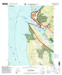
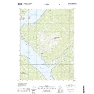 2017 Ketchikan B-6 NE2017 Print · USGSCovers Clover Pass, including Peninsula Point, Mud Bay, and other nearby areas
 - 2021 Map of Ketchikan B-6 NE, 2021 Print
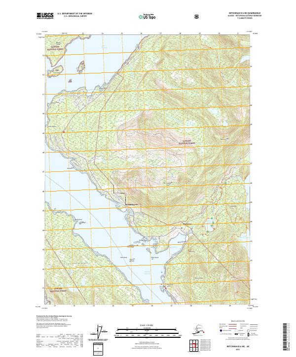 2021 Ketchikan B-6 NE2021 Print · USGSThe Tongass coast comes into sharp focus during the early 2020s, revealing the intricate shoreline and mountain terrain northwest of Ketchikan. Trace the residential growth near Point Higgins or locate maritime landmarks like Totem Bight, Knudson Cove, and Bolles Ledge.
End of results
Showing maps 1-8 of 8
Top cities near Clover Pass
Frequently asked questions
- What are the different types of historical maps available for Clover Pass?
- What is the oldest map of Clover Pass?
- Where can I purchase historical maps of Clover Pass for my home or office?
- Where can I download high-res historical maps of Clover Pass?
- Are there historical topographic maps available for Clover Pass?
- Is there historical aerial imagery available for Clover Pass?
- Where are historical maps of Clover Pass sourced from?