Old Maps of Kanatak, Alaska for Hiking & Exploration
Hike through history with 6 historic maps of Kanatak. Explore old trails, ghost towns, and forgotten backroads — perfect for outdoor adventurers and local explorers.
- Rediscover forgotten places: Map out old mining camps, roads, and footpaths that no longer exist on modern maps.
- Layer with modern tools: Combine with LiDAR or satellite views to plan hikes through historical terrain.
- Made for exploration: Popular among hikers, overlanders, and local history lovers.
Use these maps to find adventure and explore the hidden past of Kanatak.
Kanatak, AK maps
(6)- 1943 Map of Ugashik, 1958 Print
 1943 Ugashik1958 Print · USGSThe remote Alaska Peninsula is captured here in the 1940s, showing a wilderness of volcanic peaks and vast coastal drainages. You can trace early 20th-century outposts like Pilot Point and Lee Cabin set against landmarks like Mt Peulik and the waters of Becharof Lake.3 unique versions available
 - 1948 Map of Ugashik, 1954 Print
 1948 Ugashik1954 Print · USGSThe remote reaches of the Alaska Peninsula are documented here during the late 1940s, highlighting the early footprint of coastal settlements and mountain passes. Researchers can trace the layout of Kanatak and Pilot Point or locate isolated landmarks like Lee's Cabin and The Gas Rocks.
 - 1949 Map of Ugashik
 1949 Ugashik1949 Print · USGSThe Alaska Peninsula in the late 1940s reveals a wild landscape of salmon-rich rivers and volcanic peaks. Researchers can trace remote coastal settlements like Pilot Point and Kanatak, or locate landmarks such as Lee's Cabin and The Gas Rocks.2 unique versions available
 - 1951 Map of Ugashik C-1, 1956 Print
 1951 Ugashik C-11956 Print · USGSThe Alaska Peninsula in the early fifties shows a landscape defined by coastal outposts and high mountain passes. Trace the legacy of resource exploration at the Oil Camp or locate the village site of Kanatak near Portage Bay.2 unique versions available
 - 1963 Map of Ugashik, 1968 Print
 1963 Ugashik1968 Print · USGSThe Alaska Peninsula in the early sixties reveals a wild coastal landscape of volcanic peaks and isolated maritime settlements. Researchers can trace the layout of Pilot Point and Ugashik or locate landmarks like Greig Light and Mount Peulik.3 unique versions available
 - 2019 Map of Ugashik C-1 SE, 2019 Print
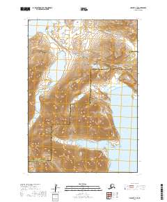 2019 Ugashik C-1 SE2019 Print · USGSCoastal mountains and historic overland routes define this region of the Alaska Peninsula in 2019. Trace the Kanatak Trail as it climbs over Kanatak Pass to reach the shore at Portage Bay and Kanatak Lagoon.
End of results
Showing maps 1-6 of 6
Frequently asked questions
- What are the different types of historical maps available for Kanatak?
- What is the oldest map of Kanatak?
- Where can I purchase historical maps of Kanatak for my home or office?
- Where can I download high-res historical maps of Kanatak?
- Are there historical topographic maps available for Kanatak?
- Is there historical aerial imagery available for Kanatak?
- Where are historical maps of Kanatak sourced from?