
1951 Map of Ugashik C-1
USGS Topo · Published 1956About this map
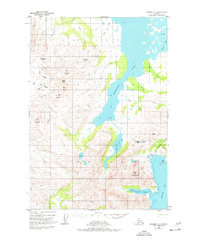
Kanatak sits at the head of Kanatak Lagoon on the Alaska Peninsula, serving as a critical coastal gateway during this early postwar era. The landscape is defined by the massive expanse of Becharof Lake and the steep mountain passes that connect the interior water bodies to the Pacific coast at Portage Bay. The presence of an Oil Camp (Aband) and a nearby Cem suggests the transient and industrial history of resource extraction in this remote terrain. Several mountain peaks, including Mt Becharof and Mt Simeon, create a formidable barrier navigated by traditional routes like Kanatak Pass and Burls Pass. Small Cabin and Cabins labels scattered near Lake Ruth and the south fork of South Fork Burls Creek indicate the localized patterns of seasonal trapping or subsistence living common in the region before modern infrastructure expanded.
Find a feature on this map
45 named features on this map. Tap any name to fly to it.
Don’t see what you’re looking for? This feature index may not catch every label — zoom into the map to look around manually.
Map Details
Editions of this 1951 Ugashik C-1 Map
2 editions found
Other maps of this area

1943 · Ugashik
USGS Topo · 1:250,000

1948 · Ugashik
USGS Topo · 1:250,000

1949 · Ugashik
USGS Topo · 1:250,000

1951 · Karluk
USGS Topo · 1:250,000

1951 · Ugashik B-1
USGS Topo · 1:63,360

1951 · Ugashik D-1
USGS Topo · 1:63,360

1951 · Ugashik C-2
USGS Topo · 1:63,360

1951 · Karluk D-6
USGS Topo · 1:63,360

1951 · Ugashik D-2
USGS Topo · 1:63,360
1951 · Karluk C-6
USGS Topo · 1:63,360