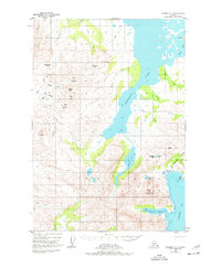
1951 Map of Ugashik C-1
USGS Topo · Published 1977About this map
Kanatak stands as a primary point of human activity in this mid-century survey of the Alaska Peninsula, situated along the shoreline of Portage Bay. The geography is defined by a narrow mountainous corridor that connects the saltwater bay to the interior waters of Becharof Lake. This passage, navigated through Kanatak Pass, represents a vital historical link between the Pacific coast and the vast lake systems of the Bristol Bay drainage.
Find a feature on this map
47 named features on this map. Tap any name to fly to it.
Don’t see what you’re looking for? This feature index may not catch every label — zoom into the map to look around manually.
Map Details
Editions of this 1951 Ugashik C-1 Map
2 editions found
Other maps of this area

1943 · Ugashik
USGS Topo · 1:250,000

1948 · Ugashik
USGS Topo · 1:250,000

1949 · Ugashik
USGS Topo · 1:250,000

1951 · Karluk
USGS Topo · 1:250,000

1951 · Ugashik B-1
USGS Topo · 1:63,360

1951 · Ugashik D-1
USGS Topo · 1:63,360

1951 · Ugashik C-1
USGS Topo · 1:63,360

1951 · Ugashik C-2
USGS Topo · 1:63,360

1951 · Karluk D-6
USGS Topo · 1:63,360

1951 · Ugashik D-2
USGS Topo · 1:63,360