
1951 Map of Ugashik D-1
USGS Topo · Published 1956About this map
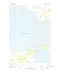
Becharof Lake dominates this mid-century survey of the Alaska Peninsula, capturing a shoreline marked by isolated survival and rugged navigation. Along the northern coast, several Cabins and a lone Cabin represent the sparse human presence in this remote landscape during the early 1950s. The geography is further defined by the prominent Severson Peninsula, which extends into the lake's expansive waters. Inland, the drainage of Featherly Creek and landmarks like Grindle provide reference points for those traversing the tundra. This map, based on 1951 aerial photography, serves as a record of the region's topography before more modern infrastructure arrived, documenting specialized markers such as the Featherly Az Mk used by surveyors to establish precise locations in the wilderness.
Find a feature on this map
8 named features on this map. Tap any name to fly to it.
Don’t see what you’re looking for? This feature index may not catch every label — zoom into the map to look around manually.
Map Details
Editions of this 1951 Ugashik D-1 Map
2 editions found
Other maps of this area

1943 · Ugashik
USGS Topo · 1:250,000

1948 · Mt Katmai
USGS Topo · 1:250,000

1948 · Ugashik
USGS Topo · 1:250,000

1949 · Ugashik
USGS Topo · 1:250,000

1951 · Mt Katmai
USGS Topo · 1:250,000

1951 · Karluk
USGS Topo · 1:250,000

1951 · Mount Katmai A-6
USGS Topo · 1:63,360

1951 · Ugashik C-1
USGS Topo · 1:63,360

1951 · Ugashik C-2
USGS Topo · 1:63,360

1951 · Karluk D-6
USGS Topo · 1:63,360