Old Maps of Port O'Brien, Alaska for Academic Research
Study the evolution of Port O'Brien with 4 high-resolution historic maps. Whether you're teaching, researching, or modeling changes in land use, these maps provide essential visual documentation of urban, environmental, and geographic change.
- Analyze long-term change: Track patterns in development, transportation, and natural features.
- Ideal for environmental or urban studies: Support academic projects with primary historical map data.
- Use in the classroom or lab: Educators and researchers rely on these maps to bring historical context to life.
These maps are a powerful tool for teaching, research, and visualizing how Port O'Brien has changed over the decades.
Port O'Brien, AK maps
(4)- 1952 Map of Kodiak, 1953 Print
 1952 Kodiak1953 Print · USGSKodiak Island in the early fifties shows a landscape of strategic military bases and coastal fishing villages. Researchers can trace the layout of the Naval Reservation, the whaling station at Port Hobron, and remote settlements like Old Harbor.12 unique versions available
 - 1952 Map of Kodiak C-4, 1966 Print
 1952 Kodiak C-41966 Print · USGSKodiak Island in the early fifties is shown here as a landscape of deep fjords and isolated outposts. Researchers can trace the coastal operations at Port O'Brien or locate remote landmarks like the Gaging Sta and Mount Glottof.4 unique versions available
 - 1954 Map of Kodiak C-4, 1955 Print
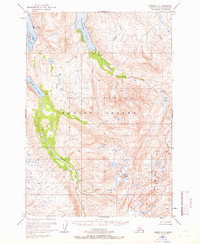
 1954 Kodiak C-41955 Print · USGSKodiak Island in the early fifties remains a landscape of deep fjords and isolated outposts within a newly established wildlife refuge. Researchers can locate remote coastal sites like Port O'Brien, trace the Uganik River to Uganik Lake, and find a lonely Cabin on the bay.
 - 2021 Map of Kodiak C-4 NW, 2021 Print
 2021 Kodiak C-4 NW2021 Print · USGSKodiak Island's maritime landscape is captured in this recent survey, showcasing the remote coastal settlement of Port O'Brien. Researchers can trace the drainage of Uganik Lake and the rugged shoreline from Terror Bay to Sheep Island.
End of results
Showing maps 1-4 of 4
Frequently asked questions
- What are the different types of historical maps available for Port O'Brien?
- What is the oldest map of Port O'Brien?
- Where can I purchase historical maps of Port O'Brien for my home or office?
- Where can I download high-res historical maps of Port O'Brien?
- Are there historical topographic maps available for Port O'Brien?
- Is there historical aerial imagery available for Port O'Brien?
- Where are historical maps of Port O'Brien sourced from?