Old Maps of Kivalina, Alaska for Metal Detecting
Plan your next treasure hunt with 8 historic maps of Kivalina. Find old homesites, ghost towns, trails, and gathering spots that may be lost to time — perfect for identifying promising metal detecting locations.
- Locate forgotten sites: Uncover places like long-lost settlements, abandoned rail lines, or gathering spots.
- Plan better hunts: Use map overlays combined with LiDAR or satellite views to narrow in on historically rich areas.
- Made for detectorists: Thousands of hobbyists use these maps to discover relics, coins, and hidden history.
Use these historic maps to boost your research and find new opportunities beneath the surface of Kivalina.
Kivalina, AK maps
(8)- 1951 Map of Noatak
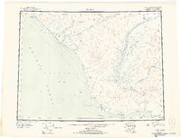 1951 Noatak1951 Print · USGSThe Arctic coast and interior river valleys of northwest Alaska are detailed here in the early fifties. Researchers can trace the path of the Winter Trail and locate remote outposts like Tikizat and various Cabins along the Noatak River.2 unique versions available
 - 1952 Map of Noatak C-5, 1959 Print
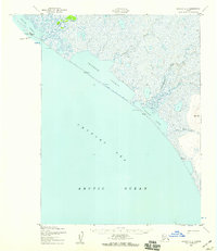 1952 Noatak C-51959 Print · USGSThe Northwest Arctic coast comes into focus in the early fifties, centering on the barrier island settlement of Kivalina. Researchers can trace the shifting shoreline and inland waterways from the Airstrip to the winding Owhesokrek River.3 unique versions available
 - 1955 Map of Noatak, 1962 Print
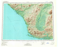 1955 Noatak1962 Print · USGSThe Northwest Arctic coast and Noatak River valley are shown here in the mid-1950s, detailing a landscape of vast lagoons and high peaks. Genealogists and researchers can trace the footings of Kivalina and Noatak, or follow the Winter Trail past Cape Krusenstern.7 unique versions available
 - 1955 Map of Noatak D-6, 1970 Print
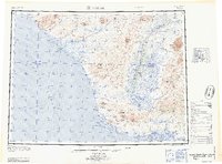
 1955 Noatak D-61970 Print · USGSThe Northwest Arctic coast appears in the mid-1950s as a landscape of shifting lagoons and interior peaks. Local historians can trace the Winter Trail along the Chukchi Sea shoreline or locate landmarks like Kavrorak Springs and the Siaktak Hills.
 - 1964 Map of Noatak
 1964 Noatak1964 Print · USGSCoastal life in Northwest Arctic Alaska was centered on the river mouths and lagoons of the Chukchi Sea during the mid-1960s. Researchers can trace the Winter Trail connecting Kivalina to the interior and locate the remote landing area at Cape Krusenstern.
 - 2014 Map of Noatak D-6 SE, 2014 Print
 2014 Noatak D-6 SE2014 Print · USGSCoastal Northwest Arctic Alaska is captured here in the early twenty-first century, showing where the tundra meets the sea. Researchers can trace the braided path of the Kivalina River into the Kivalina Lagoon and locate landmarks like Atsakirak Mound.
 - 2014 Map of Noatak C-5 OE W NE, 2014 Print
 2014 Noatak C-5 OE W NE2014 Print · USGSCoastal life in the Northwest Arctic is centered on a narrow barrier island during the early 2010s. Researchers can trace the layout of Kivalina along Bering Street, situated between Kivalina Lagoon and the Chukchi Sea.
 - 2016 Map of Noatak C-5 NW, 2016 Print
 2016 Noatak C-5 NW2016 Print · USGSCoastal life in the Northwest Arctic Borough is documented here as the new millennium progresses. Researchers can trace the narrow Singigrak Spit, the isolated settlement of Kivalina, and the meandering path of the Wulik River through the tundra.
End of results
Showing maps 1-8 of 8
Frequently asked questions
- What are the different types of historical maps available for Kivalina?
- What is the oldest map of Kivalina?
- Where can I purchase historical maps of Kivalina for my home or office?
- Where can I download high-res historical maps of Kivalina?
- Are there historical topographic maps available for Kivalina?
- Is there historical aerial imagery available for Kivalina?
- Where are historical maps of Kivalina sourced from?