
1951 Map of Noatak
USGS Topo · Published 1951About this map
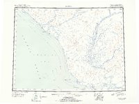
Kivalina and Noatak stand as the primary hubs of human activity in this coastal Alaskan landscape, documented in the early 1950s. The region is defined by its complex hydrology, where the Wulik River and Kivalina River empty into the Corwin Lagoon along the Chukchi Sea. Further south, the expansive drainage of the Noatak River dominates the interior, winding between the Mulgrave Hills and Igichuk Hills before reaching the Kotzebue Sound.
Find a feature on this map
21 named features on this map. Tap any name to fly to it.
Don’t see what you’re looking for? This feature index may not catch every label — zoom into the map to look around manually.
Map Details
Editions of this 1951 Noatak Map
2 editions found
Other maps of this area

1950 · Shishmaref
USGS Topo · 1:250,000

1951 · De Long Mountains
USGS Topo · 1:250,000

1951 · Baird Mountains
USGS Topo · 1:250,000

1951 · Selawik
USGS Topo · 1:250,000

1951 · Shishmaref
USGS Topo · 1:250,000

1951 · Kotzebue
USGS Topo · 1:250,000

1951 · Misheguk Mountain
USGS Topo · 1:250,000

1951 · Kotzebue D-1
USGS Topo · 1:63,360

1951 · Kotzebue D-2
USGS Topo · 1:63,360

1951 · Selawik D-6
USGS Topo · 1:63,360