1900s (20th Century) Maps of Bethel, Alaska
Explore 4 historic maps of Bethel from the 1900s (20th Century). These maps offer a rare glimpse into what life looked like during the 1900s — showing old roads, neighborhoods, homes, and landmarks that have changed or disappeared over time.
Whether you're researching your family's past, planning a metal detecting trip, or studying how Bethel's landscape evolved across the 1900s, these high-resolution maps are a powerful tool for exploring the history of this region.
- Focus on a specific era: All maps on this page are from the 1900s, giving you a focused view of this time period.
- See what’s changed: Compare century-old streets, trails, and buildings to today's modern landscape using overlays and satellite layers.
- Research with precision: Use these maps for genealogy, historical research, land use analysis, or educational projects.
- View, download, or print: Maps are fully viewable online in high resolution, and can be downloaded or printed for your own records.
Start exploring Bethel's history through authentic maps from the 1900s. This is your window into the past.
Bethel, AK maps
(4)- 1950 Map of Bethel
 1950 Bethel1950 Print · USGSThe Kuskokwim River region in the mid-twentieth century reveals a landscape of remote riverside villages and emerging aviation hubs. Researchers can trace traditional routes like the Winter Trail and locate family-named peaks such as Fisher Dome and Gemuk Mtn.3 unique versions available
 - 1954 Map of Bethel D-8, 1965 Print
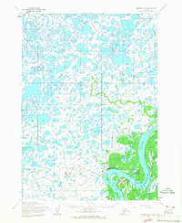 1954 Bethel D-81965 Print · USGSThe Kuskokwim Delta region comes into focus during the mid-fifties, centered on the growing aviation and river hub of Bethel. Trace the development of infrastructure like the Bethel Airforce Station and maritime features including Steamboat Slough.4 unique versions available
 - 1954 Map of Bethel C-8, 1965 Print
 1954 Bethel C-81965 Print · USGSThe Kuskokwim Delta in the mid-fifties is captured here as a labyrinth of tidewaters and tundra settlements. Trace the river life and seasonal travel routes near Napakiak, Oscarville, and the long Winter Trail.2 unique versions available
 - 1980 Map of Bethel
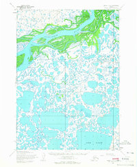
 1980 Bethel1980 Print · USGSThe Kuskokwim Delta and its riverbank villages are shown here in the early eighties as they relied on the water for transport and trade. Researchers can trace the layout of settlements like Bethel and Kwethluk or explore the wilderness around Chikuminuk Lake and Shining Dome.4 unique versions available
End of results
Showing maps 1-4 of 4
Top cities near Bethel
Frequently asked questions
- What are the different types of historical maps available for Bethel?
- What is the oldest map of Bethel?
- Where can I purchase historical maps of Bethel for my home or office?
- Where can I download high-res historical maps of Bethel?
- Are there historical topographic maps available for Bethel?
- Is there historical aerial imagery available for Bethel?
- Where are historical maps of Bethel sourced from?