Old Maps of Bethel, Alaska for Hiking & Exploration
Hike through history with 8 historic maps of Bethel. Explore old trails, ghost towns, and forgotten backroads — perfect for outdoor adventurers and local explorers.
- Rediscover forgotten places: Map out old mining camps, roads, and footpaths that no longer exist on modern maps.
- Layer with modern tools: Combine with LiDAR or satellite views to plan hikes through historical terrain.
- Made for exploration: Popular among hikers, overlanders, and local history lovers.
Use these maps to find adventure and explore the hidden past of Bethel.
Bethel, AK maps
(8)- 1950 Map of Bethel
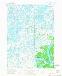
 1950 Bethel1950 Print · USGSThe Kuskokwim River region in the mid-twentieth century reveals a landscape of remote riverside villages and emerging aviation hubs. Researchers can trace traditional routes like the Winter Trail and locate family-named peaks such as Fisher Dome and Gemuk Mtn.3 unique versions available
 - 1954 Map of Bethel D-8, 1965 Print
 1954 Bethel D-81965 Print · USGSThe Kuskokwim Delta region comes into focus during the mid-fifties, centered on the growing aviation and river hub of Bethel. Trace the development of infrastructure like the Bethel Airforce Station and maritime features including Steamboat Slough.4 unique versions available
 - 1954 Map of Bethel C-8, 1965 Print
 1954 Bethel C-81965 Print · USGSThe Kuskokwim Delta in the mid-fifties is captured here as a labyrinth of tidewaters and tundra settlements. Trace the river life and seasonal travel routes near Napakiak, Oscarville, and the long Winter Trail.2 unique versions available
 - 1980 Map of Bethel
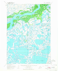
 1980 Bethel1980 Print · USGSThe Kuskokwim Delta and its riverbank villages are shown here in the early eighties as they relied on the water for transport and trade. Researchers can trace the layout of settlements like Bethel and Kwethluk or explore the wilderness around Chikuminuk Lake and Shining Dome.4 unique versions available
 - 2017 Map of Bethel D-8 SE, 2017 Print
 2017 Bethel D-8 SE2017 Print · USGSThe river town of Bethel stands at the heart of the Kuskokwim Delta in the late 2010s. Researchers can trace the modern town site near Arthur Dall Lake or follow the intricate waterways of Church Slough and Steamboat Slough.
 - 2017 Map of Bethel C-8 NW, 2017 Print
 2017 Bethel C-8 NW2017 Print · USGSNear the banks of the Kuskokwim River in the late 2010s, this area shows a village landscape shaped by water and tundra. Genealogists and researchers can trace the local layout of Napakiak, the Napakiak Airport, and local routes like Lagoon Road.
 - 2017 Map of Bethel D-8 SW, 2017 Print
 2017 Bethel D-8 SW2017 Print · USGSThe outskirts of Bethel in the late 2010s are captured here as residential expansion meets the tundra. Researchers can trace the layout of Bethel Airport and local thoroughfares like the Chief Eddie Hoffman Highway and Noel Polty Boulevard.
 - 2017 Map of Bethel C-8 NE, 2017 Print
 2017 Bethel C-8 NE2017 Print · USGSLife along the river comes into focus in this late twenty-tens survey of the Kuskokwim delta. You can trace the proximity of riverfront communities like Oscarville and Napaskiak and the critical infrastructure of the Napaskiak Airport.
End of results
Showing maps 1-8 of 8
Top cities near Bethel
Frequently asked questions
- What are the different types of historical maps available for Bethel?
- What is the oldest map of Bethel?
- Where can I purchase historical maps of Bethel for my home or office?
- Where can I download high-res historical maps of Bethel?
- Are there historical topographic maps available for Bethel?
- Is there historical aerial imagery available for Bethel?
- Where are historical maps of Bethel sourced from?